


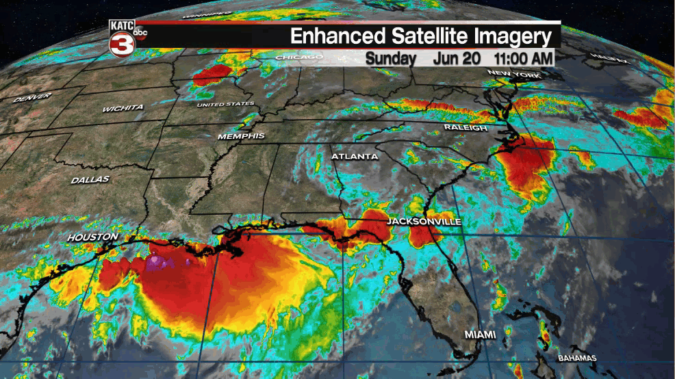
An active pattern of lingering deep tropical moisture and some instability aloft will keep a good chance of scattered showers and storms in the forecast for Acadiana as the new week begins.
Sunday we had seen most of the more concentrated storms lingering offshore which helped to rob some of the energy for scattered storms across our area today, but tomorrow through Tuesday may not be the case.

Scattered showers and storms will become likely for Monday as a weakening frontal boundary drops southward toward Acadiana, and could lead to extended storm chance Monday night into Tuesday.

Rain chances Monday into Tuesday will be pushing the 60-70% range...and as always with typical summer thunderstorms, there will be some locally heavy downpours of a couple of inches in the slower moving storms.
A significant flood threat is not anticipated.
Moving farther into next week it does appear that our atmospheric moisture levels should decrease slightly which should translate to rain chances getting closer to 30-40% toward the end of the week.
Looking at the long range GFS projections, the model over the last few of days has been insisting on a tropical wave or disturbance heading for the Gulf of Mexico the last day or two of June and toward the first days of July with Sunday's 12z solution today showing an organized tropical system...again!

For now no worries as we're talking about the 9-13 day forecast period, and we all know how drastically that could change, as we watched our "Claudette" event unfold.
Speaking of Tropical Depression Claudette, the system continues to produce heavy rains into the Carolinas and is expected to regain "storm" strength prior to departing the East Coast Monday
Elsewhere in the tropics, it's quiet...but keeping an eye on a weak tropical wave in the mid-tropical Atlantic as that's the wave the GFS model is keying in on (along with moisture pooling near Central America) 10 days down the road.
See the KATC 10 Day Forecast for the latest.
Finally on an astronomical note: the summer solstice arrives Sunday night at 10:31 pm CDT...and to be technical, Monday is the first full day of summer!
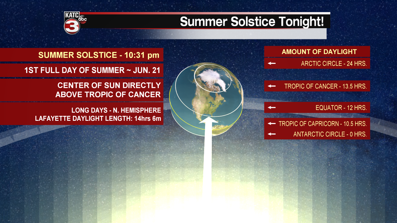
Our longest daylight hours in Acadiana will remain near 14 hrs and 6 min through Thursday with our latest sunset times at 8:13 pm Monday through Friday of this week. Enjoy!
------------------------------------------------------------
Stay in touch with us anytime, anywhere.
To reach the newsroom or report a typo/correction, click HERE.
Sign up for newsletters emailed to your inbox. Select from these options: Breaking News, Evening News Headlines, Latest COVID-19 Headlines, Morning News Headlines, Special Offers
