


The threat of rain mixed with some sleet and freezing rain for Acadiana will end by mid-late morning Sunday as the coldest Arctic air of the season, and stout northerly winds follow plowing through Acadiana tonight.

Fortunately Acadiana will not see a significant ice storm, however that does not preclude the chance of some frozen precipitation this morning.
Power Doppler 3 and surrounding radars this morning were indicating rain mixed with some sleet. and a light freezing rain farther to the north,
So far temperatures have been marginal for freezing rain from the I-10 corridor on southward and where temperatures were just above freezing while temperature near in Acadiana's northern parishes were hovering right near or slightly below freezing from near Opelousas in St Landry Parish and our northern parishes of Allen, Evangeline and Avoyelles northward.
For the next several hours precipitation will continue to fall with more cold rain for our southern parishes, rain mixed with freezing rain and some sleet along the I-10 parishes, and farther north mostly freezing rain and some sleet mixed in.

Frozen accumulations look negligible for our southern/coastal parishes while toward the I-10 corridor/parishes as it may take several hours for some icy patches on grass and a light glaze on trees but roadways shouldn't see too much in the way of icing as temperatures are expected to hover just above freezing before rising into the mid-upper 30s later today.
Meanwhile, toward the northern parishes of Acadiana, where temperatures are closer to 32°, a wintry glaze on trees/roof tops may be more likely along with some slick spots on bridges and overpasses.
As of 7am, DOTD was not reporting any road or bridge closures in Acadiana.
We are continuing to monitor trends and check with KATC our social media pages for the very latest updates.
The significant precipitation will end later this morning for Acadiana with temperatures hovering mostly near the low-mid 30s for most of the day, but then the very cold air will begin to move into the region as temperatures fall below 32° by this evening.
As it gets colder and brisk northerly winds kick in tonight, there might be an isolated snow flurry or two across the area but there won't be enough moisture for any accumulation but areas of standing water from the soaking rains could lead to some icy patches in spots.
Interestingly enough, the the GRAF Model is also picking up on the possibility of lake effect snows developing this evening across the Toledo Band Reservoir!
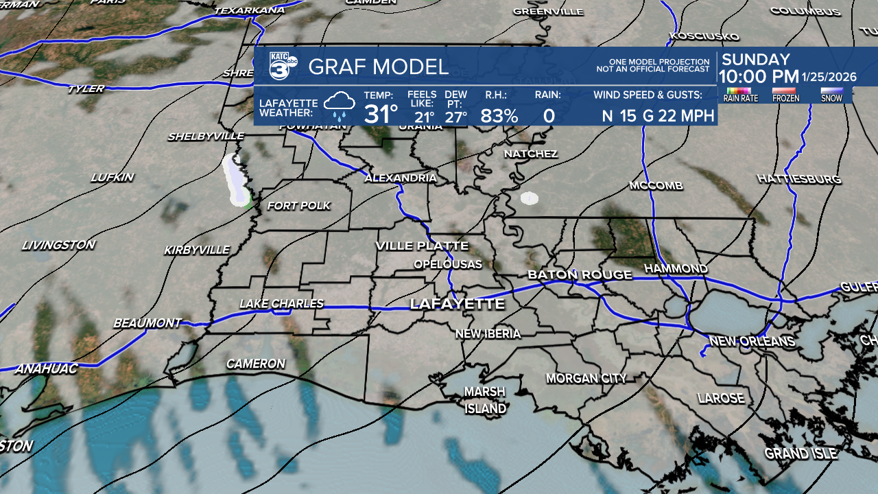
South of the reservoir near the Sabine River there may be a decent chances of some localized snow!
Arctic Express Arrives Tonight:
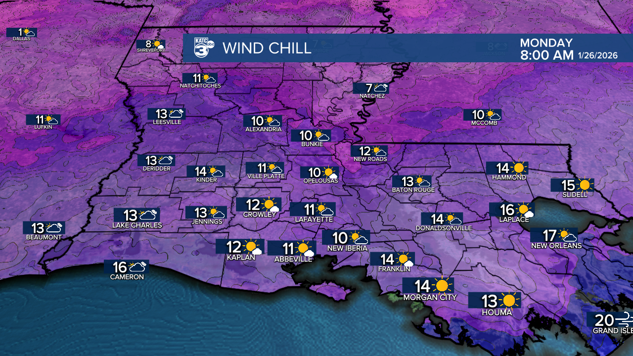
Prepare for very cold conditions with temperatures dropping into the lower 20s accompanied by brutal wind chills into the low to mid-teens and perhaps as low as single digits for the northern parishes come Monday morning.

Temperatures are expected to drop into the upper teens Monday night into Tuesday morning.
Acadiana may see temperatures climb above freezing for 3-5 hours at the most Monday afternoon...otherwise, it's expected to be subfreezing pretty much from Sunday evening through Tuesday midday...please prepare accordingly!
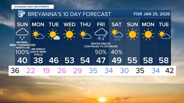
The KATC 10 Day Forecast remains cold and below normal for the rest of this month and into the first days of February at least...and with the cold air nearby, our next precipitation maker, depending on the timing, may bring the chance of of some precipitation Friday or into Saturday, but timing and amount of moisture remains questionable, but a period of some frozen precipitation may be possible...something to watch but not be concerned about at this time.
Stay with KATC for the latest on this winter weather system.
