


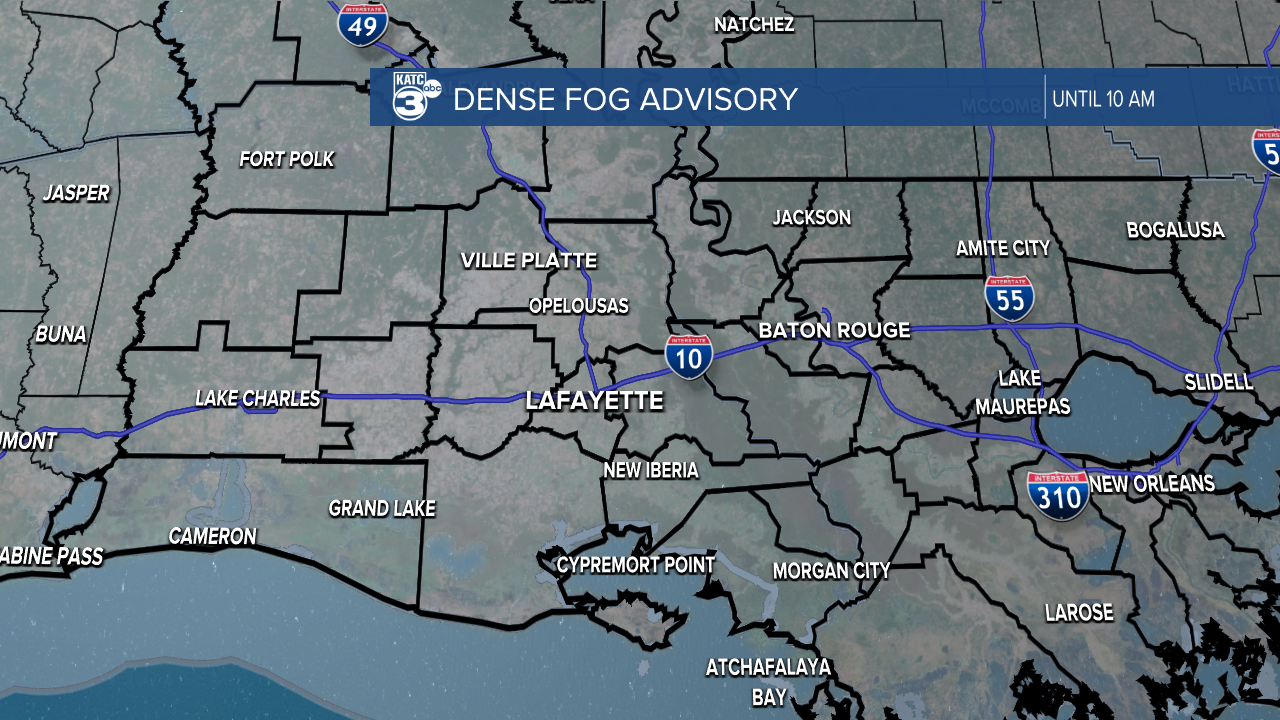
A Dense Fog Advisory has been issued for the entire state of Louisiana as thick fog, once again, will make for a tricky Wednesday morning commute.
Visibility in most areas has dipped below a mile and we'll likely see visibility remain an issue into the mid morning hours.
Please give yourself extra time to get to work and don't get into a rush on those roadways.
The fog comes as no surprise given the amount of moisture that has been pumped into the atmosphere from a steady breeze from the south.
As the moisture has grown so have those temperatures with highs in the 70s pushing close to record levels once again.
Once the fog breaks up we'll get patches of sunshine mixed in with the clouds, and this pattern is set to continue again on Thursday.

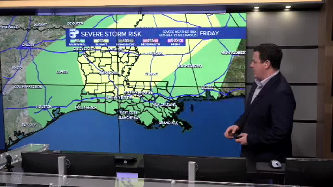
A storm system is expected to swing through the area on Friday and given the abundance of moisture in the area there's the potential for some isolated pockets of severe weather.
Super-cell development will be possible with strong winds and the potential for some hail Friday afternoon into the overnight hours.
Regardless of storm development Acadiana is looking at a steady round of shower activity that will last into the first half of the day on Saturday.
Rain totals don't look overly impressive and flooding won't be a major concern with most areas only picking up an inch or two over the course of a couple of days.

Temperatures will drop by the end of the weekend and we'll see highs in the 50s and lows in the 30s to end the weekend and kick off the work week.
