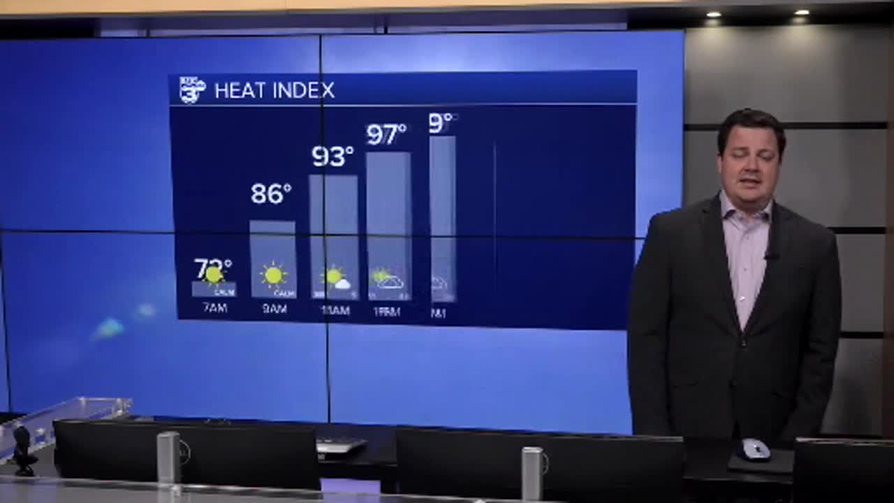


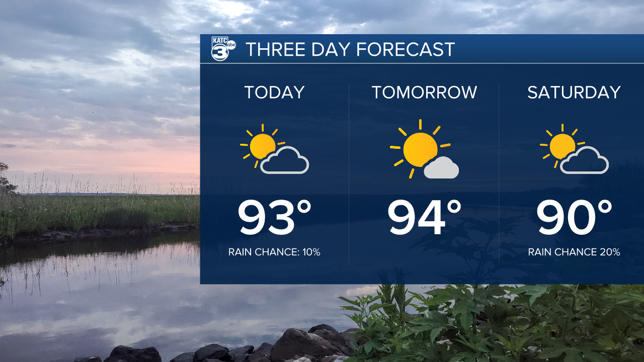
After some showers made their way through the area on Wednesday we will be back to hot and dry weather to wrap up the week.
Highs the next few days will sit in the low to mid 90s with rain chances staying isolated at best.
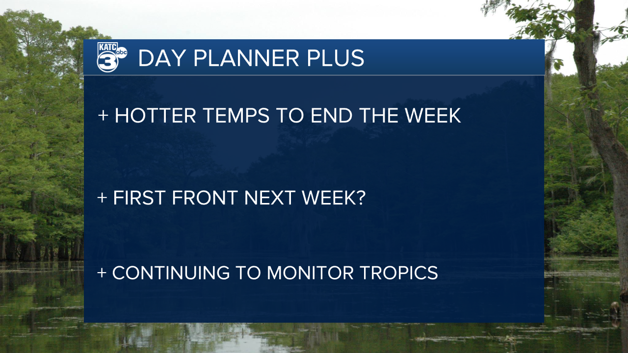
A slow increase in moisture headed into the weekend could open up the door for a few more showers on Sunday as a front dips down into the area.
Dry air moves into the region to start next week and by Tuesday morning we could see temperatures down in the mid 60s.
A secondary front may be lining up behind the first one to freshen things up by late next week, but that's an eternity in the weather world so we won't hype ourselves up too much.
A tropical wave continues to drift further west and models seem to be keen on bringing it closer to the Caribbean and east coast.
Still a long way away but we may need to pay a little closer attention to the storm than originally hoped, especially if you have interests in the Caribbean or the east coast.
Conditions won't be favorable in the Gulf with the frontal passage so still doubt this is a system that could impact us directly.
