


While Acadiana will see temperatures moderate this week, another front will be on the way for the area this weekend.
In the near term, look for another pleasant night/morning for the area with lows close to the upper 50s by daybreak Tuesday.

Plenty of sunshine remains in the forecast this week with highs pushing the upper 80s while overnight lows moderate a bit as a return flow from the Gulf becomes established by Friday into the weekend.

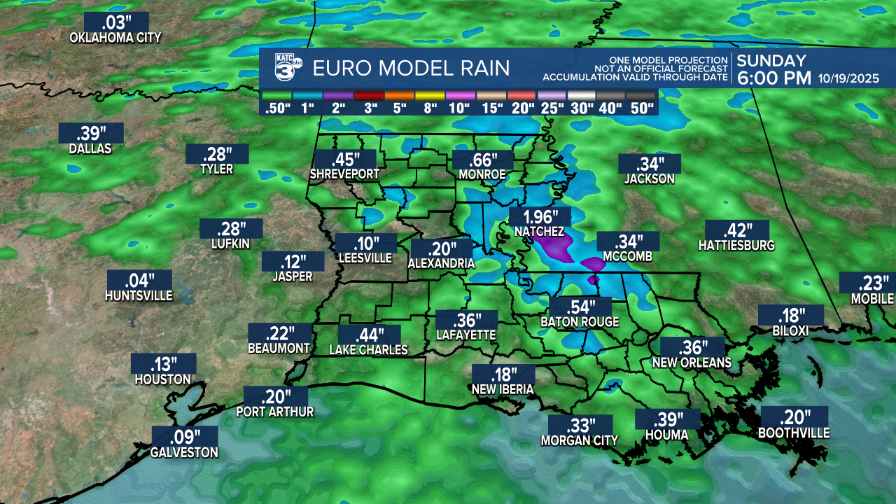
A few spotty showers may be possible Saturday with a better chance of showers and possibly a few storms early Sunday ahead of our next front.

While some showers can be expected this weekend, do not look for a whole lot of rainfall...perhaps enough to settle the dust for a day or two at best as drought conditions are expected to worsen over the next week plus.
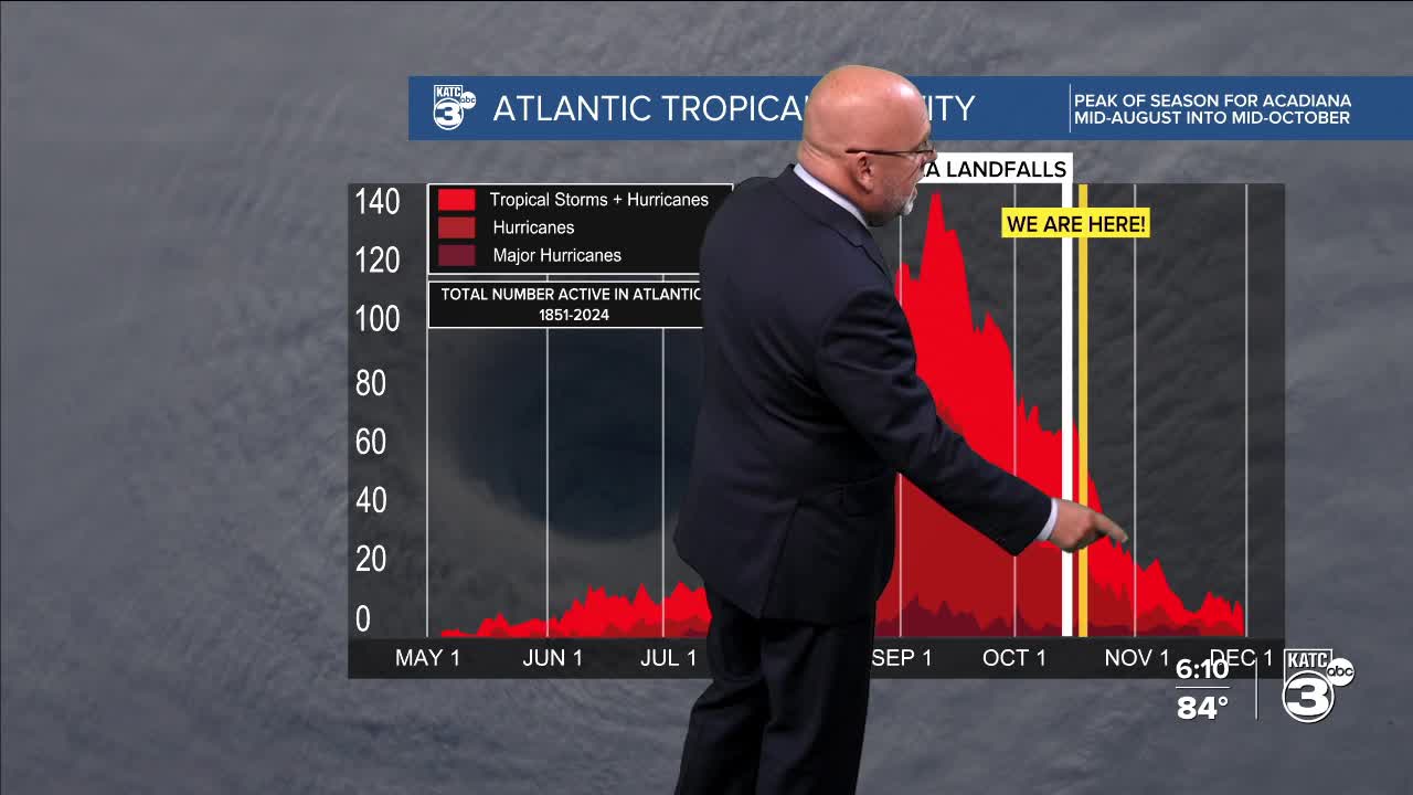
Another front may appear by mid-next week insuring the tropics are pretty much shut down for Acadiana and Louisiana this year!
See the KATC 10 Day Forecast for the latest.
The Atlantic tropics are still alive however in the open Atlantic, and perhaps with a new system emerging down the road, but any threats to the Northern Gulf into November are all but non-existent.

Latest on the tropics below:
