


Tropical Depression 2 has formed in the Eastern Gulf...expected to drift westward to the Louisiana Coast and have some impacts in Acadiana later this week .
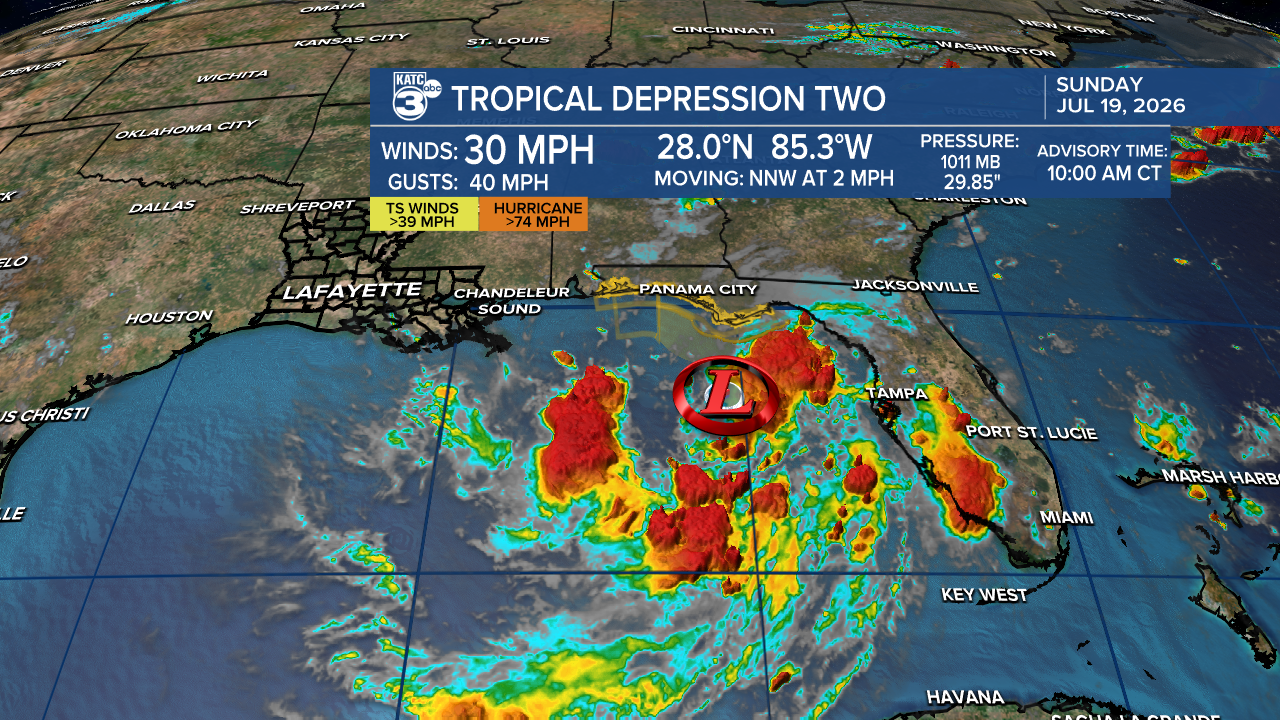
TD #2 is expected to become Tropical Storm Bertha and move slowly westward impacting portions of Southern Louisiana Wednesday through Friday with mostly gusty winds...how high those winds will be is yet to be determined.
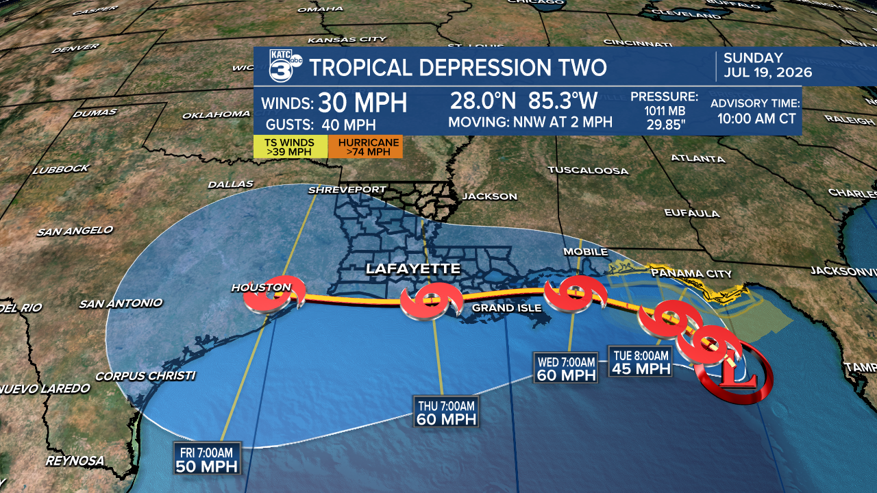
Upper level conditions are expected to be more hostile for a tropical system later in the week as high pressure to our north induces wind shear and keeps the storm running east to west.
So the bulk of the system and biggest rains may stay mostly in the Gulf, and the storm may weaken is it travels across Louisiana waters and heads to Texas Friday.
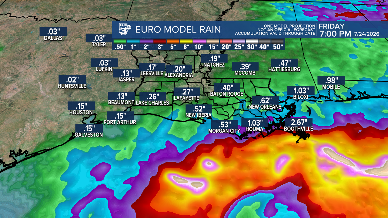
But because of the slow movement of the system we'll still have to watch for wrap around rain squalls that could be possible here come Thursday and Friday.
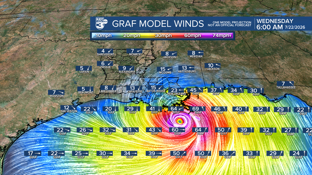
GRAF Model Track here is a little south of the NHC track, nonetheless tropical storm conditions for Louisiana Coastal Parishes perhaps as far north as the I-10 corridor should now be expected mid-late this week.
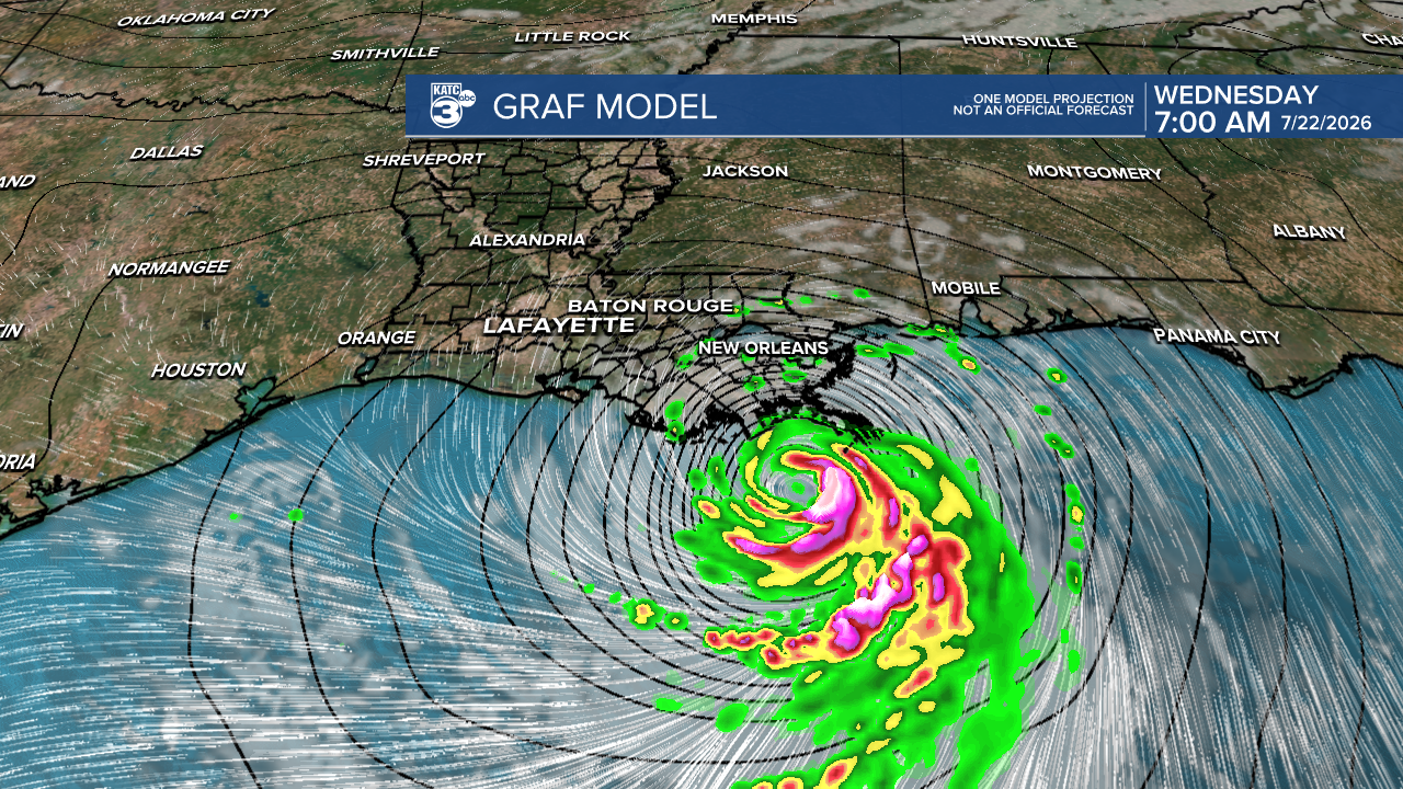
Right now it looks like primarily a wind event for Acadiana, but there could be some surge and tropical rain issues developing later this week, but the overnight Euro Model is not that high on big rains here.
Currently Tropical Storm Watches has been issued for Florida from Ochlockonee River to the Alabama border, but those watches will migrate westward when tropical storm conditions are expected within 48 hours...watches for Acadiana may not be issued until late tomorrow or early Tuesday.
Will have more later this afternoon. Stay with KATC for the latest.
