


Current Conditions
Acadiana begins the week on a cool note after a cold front passed through with some overnight rains and we are waking up with temperatures in the lower 50s and a few pockets of light fog possibly this Monday morning. Any lingering fog would be expected to clear quickly after sunrise as drier air and better conditions move in. Clouds continue thinning out through the morning, allowing sunshine to make a welcome return after several gray December days. Tuesday however, is looking to be our best day, before the week does a little flip.


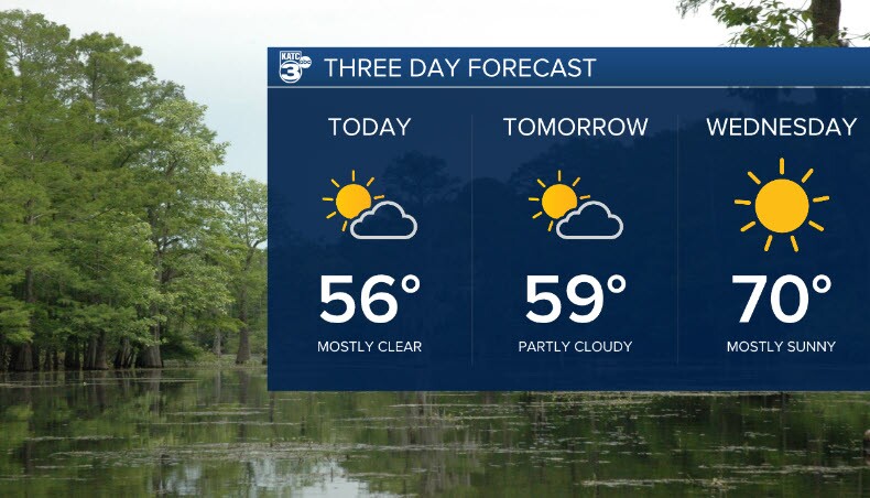
24-Hour Forecast
Skies become mostly clear through the afternoon with highs climbing into the mid-50s to near 60. Today remains dry with no rain expected, and winds will stay light as high pressure settles overhead. Monday night brings another cool drop into the 30s, so be mindful of plants and pets outside, but the pipes will be fine. The region begins a gradual warming trend Tuesday and Wednesday.
No SPC severe weather risks or WPC rainfall hazards are highlighted for the next 24 hours as conditions remain quiet and stable.

Next Three Days
Tuesday: Mostly clear to partly cloudy with highs in the upper 50s.
Wednesday: A more noticeable warm up arrives with highs in the lower 70s under mostly sunny skies with a possible few sprinkles as our warm front makes it way through.
Thursday: Mild and pleasant with highs near the upper 60s and continued sunshine.
Next Weather Maker
The next system approaches late this weekend into early next week. Increasing cloud cover Sunday hints at the change on the way, followed by scattered showers Monday and Tuesday. Rain chances rise into the 40–50% range. This system may bring cooler air back into the region behind it. A bit of a classic Louisiana weather roller coaster as far as temperatures this week.

