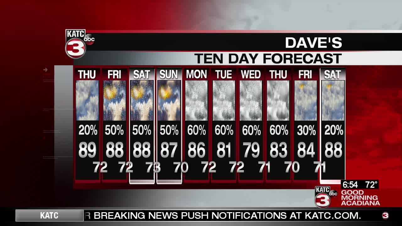
A stationary front that has been draped over central Louisiana, will drift slowly northward today. This should allow morning cloudiness and fog to break up a bit this afternoon. Expect temperatures to soar to near 90 degrees with heat index values in the lower 90s. We'll see a slight chance for a shower or storm with moisture still lingering in the area. Clouds will return overnight as a ridge of high pressure slides over the eastern Gulf of Mexico. The deep southerly flow will keep it warm and muggy with lows in the lower 70s.
Friday, expect party cloudy skies. With moist flow in place and some daytime heating, showers and thunderstorms will be a bit more likely by the afternoon. This pattern is expected to amplify this weekend as a trough digs in the west. This should keep the warm, tropical flow in place into early next week. Expect partly to mostly cloudy skies for the weekend, with afternoon showers and thunderstorms likely. Highs over the weekend will remain in the upper 80s.
Early next week, even more moisture will flow into the area. Clouds, showers, and thunderstorms will remain likely. Highs will be in the mid 80s with lows near 70.
------------------------------------------------------------
Stay in touch with us anytime, anywhere.
To reach the newsroom or report a typo/correction, click HERE.
Download our free app for Apple, Android, Roku and Amazon devices.
Sign up for newsletters emailed to your inbox. Select from these options: Breaking News, Evening News Headlines, Latest COVID-19 Headlines, Morning News Headlines, Special Offers
