


Despite, officially, being in the back half of September the overall weather pattern is one that looks and feels a little more like summer.
The heat has continued mostly uninterrupted and even the afternoon showers have been popping back into the forecast.
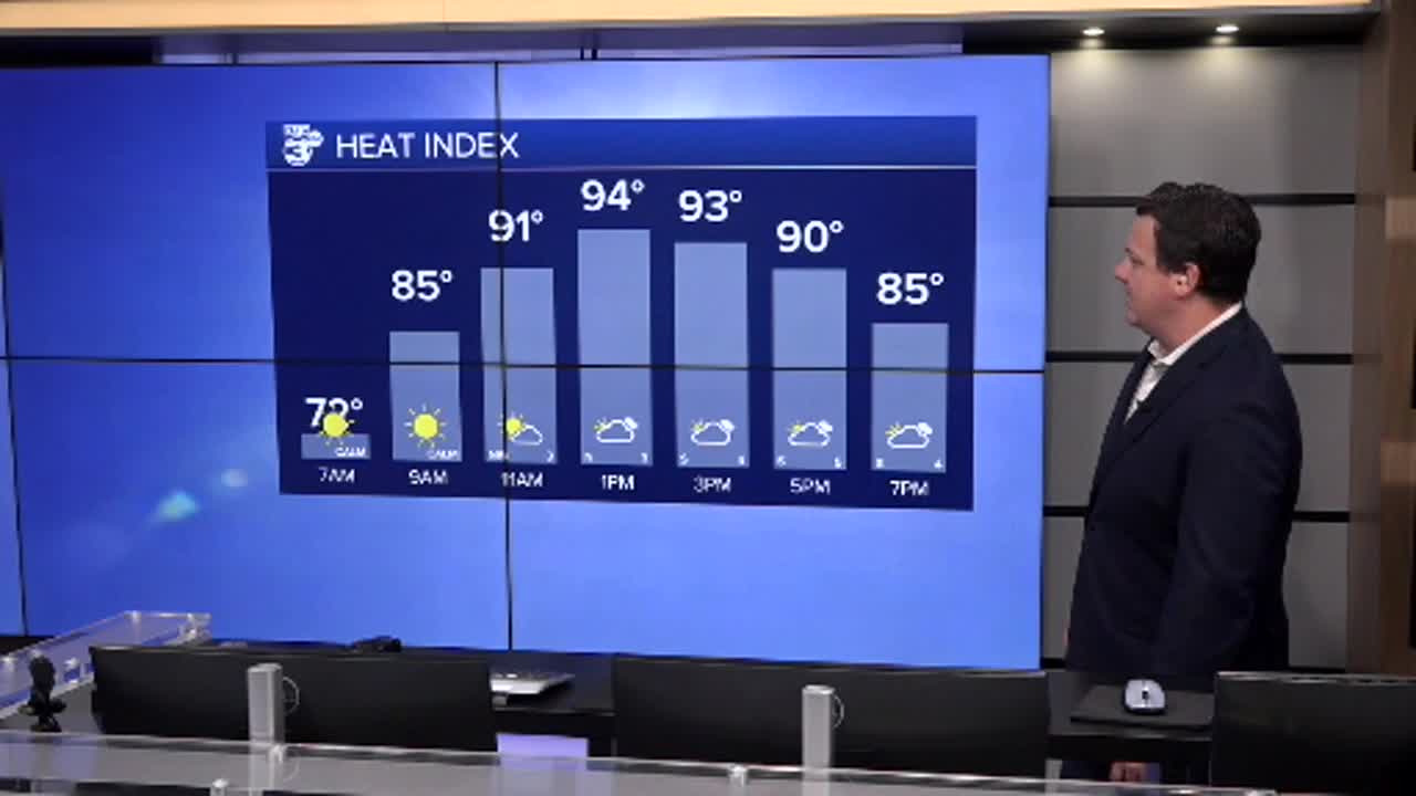
Wednesday looks like it will be a little more of the same as temperatures once again get back into the low 90s.
A few spotty showers will arrive in the afternoon and with little to no breeze it will feel very still out there today.

Shower chances will diminish for the latter half of the work week but highs will remain above average.
The mornings haven't been too bad with lows in the low 70s but maybe a little stickier than some would like for mid September.
We're still eyeing a weak front early next week that could spark a few showers but won't cool us down too much.
Long range models are hinting at our next decent front arriving late September/early October but predicting anything out that far is a fool's game.
The Atlantic Basin has produced it's next tropical system after a remarkably quiet period took us through the peak of the season with the development of Tropical Depression 7.
This will eventually become Gabrielle and will remain out in the Atlantic.
