


It was a loud, active night Sunday as a robust front came racing through the region in the early morning hours of Monday.
While the showers have cleared the area and the clouds following close behind, we'll still be dealing with the fall out from this system for the next several days.
Winds have dramatically picked up and will be blowing at a high pace today out of the north between 20-25 mph with gusts pushing 35 mph through the day.
A Wind Advisory has been issued along with a Red Flag Warning as that north wind is expected to dramatically drop our humidity.
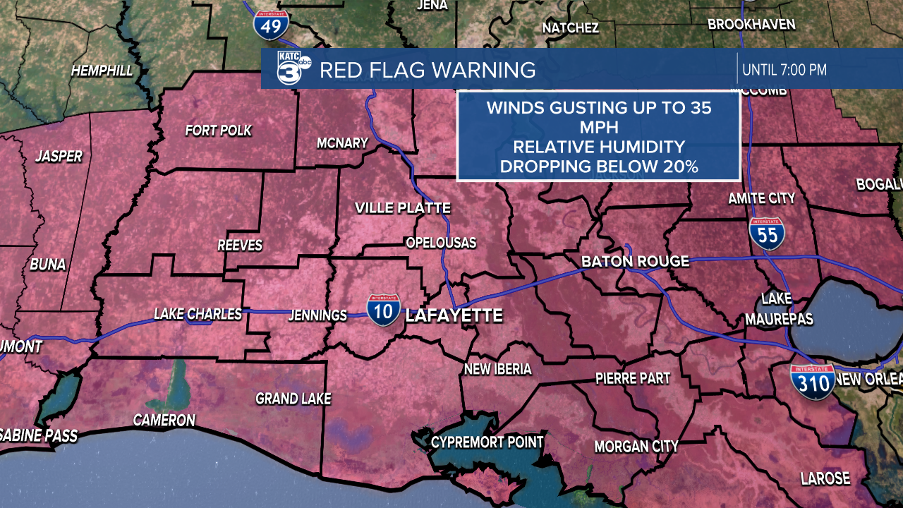
Given these conditions the fire danger will be elevated today, any blaze can spread easily given the dry air, high winds, and dry vegetation.
Even factoring last night's rain we've been very dry in Acadiana and, while helpful, last night's rain won't do much overall.
These winds are going to drive in some much colder temperatures, highs on Monday are expected to stay in the 50s with lows dropping down into the 30s.
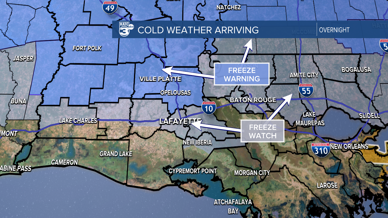
A Freeze Watch has been issued for areas along the I-10 corridor and to about New Iberia, while a Freeze Warning has been issued for areas north of Highway 190 for Monday night.
This will largely depend on the wind, if it stays elevated going into the overnight we'll have a harder time getting temperatures down to freezing.
If it calms, however, then frost will be possible by Tuesday morning.
This comes at a rough time for gardeners as there's a lot of new, sensitive growth so be mindful of new buds on cold susceptible plants.
Temperatures will stay cool going into the middle of the week before warming to normal, the rest of the week looks quiet and sunny.
