


Acadiana will close out the work week the same way it started with warm, muggy conditions and increasing winds.
A gray start to the day will give way to sunshine by the mid morning hours and we'll remain partly cloudy through the remainder of the day.
Winds have increased slightly and will be a little gustier than the last few days, they will remain out of the south keeping that moisture locked firmly in place.

Saturday will get off to a similar start but as the day progresses winds will pick up along with cloud cover, and by late Saturday a front will bring in a round of showers and storms.
Rain will be ongoing in north Louisiana for the first half of the day before slowly dipping down into Acadiana by the late evening.
Heavy showers won't pick up until after dinner time Saturday but once they get going they'll last through the night into Sunday.
A few of the thunderstorms could be on the severe side with damaging winds the main issue.
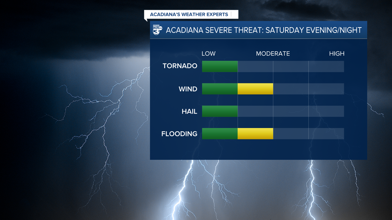
There's a chance for some localized flash flooding as the rains pick up, but the flood threat looks higher in the northern parts of Acadiana with the focal point really being more in CenLa.
Acadiana will pick up an inch or two overall of rain before the storms come to an end, which won't put a major dent in drought conditions but could help keep it fro expanding.
We'll get a quick break from stormy weather for Monday and Tuesday but another storm system is expected to move through on Wednesday.
This one looks a little more robust and will likely produce a few stronger storms as it moves through the region.
