


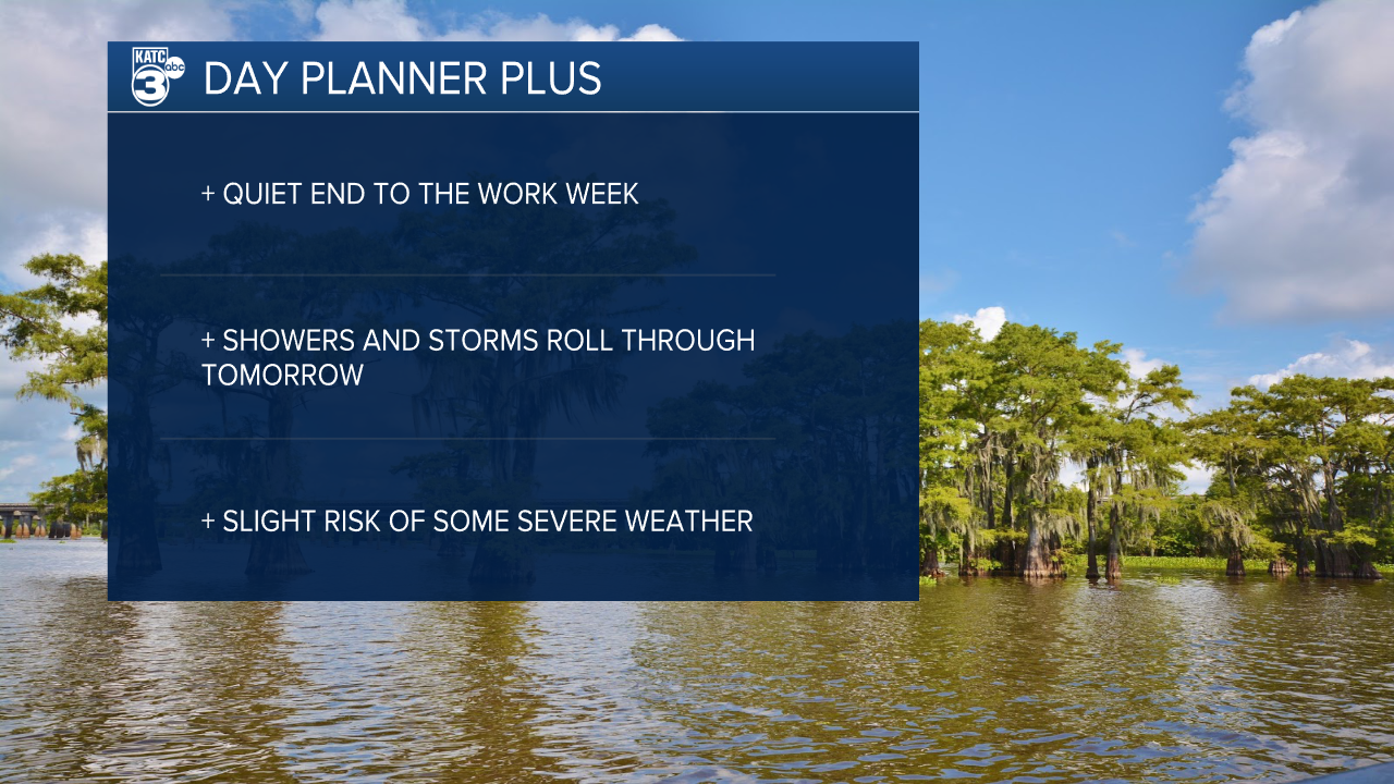
There's not much to talk about for Friday's forecast.
A chilly morning will give way to a warm afternoon with highs sitting in the low 80s and skies remaining mostly clear.
Winds will start to turn from the south a little more this afternoon and moisture will begin to move into the area.
This won't have a real impact on Friday's forecast but will prime the atmosphere for showers and thunderstorms that are expected to arrive Saturday morning.

Clouds will build through the night and the first line of showers and storms will move through Saturday morning.
The rain on Saturday won't be continuous but it will arrive in a series of waves moving through the area all day Saturday and into Sunday.
Acadiana seems to be on the hook for 2-4" of rain with a few hot spots hitting closer to 5-6".
This will open the door for a little localized flooding, particularly on low lying roadways, but because we'll get gaps for water to drain out we won't have a widespread flood event.
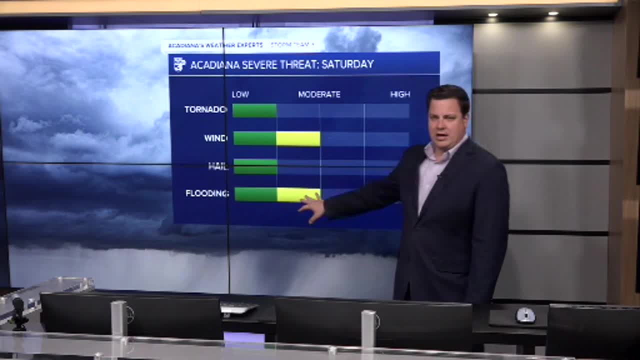
We will need to be mindful of the potential of some severe weather Saturday afternoon with isolated tornadoes and gusty winds the primary threat.
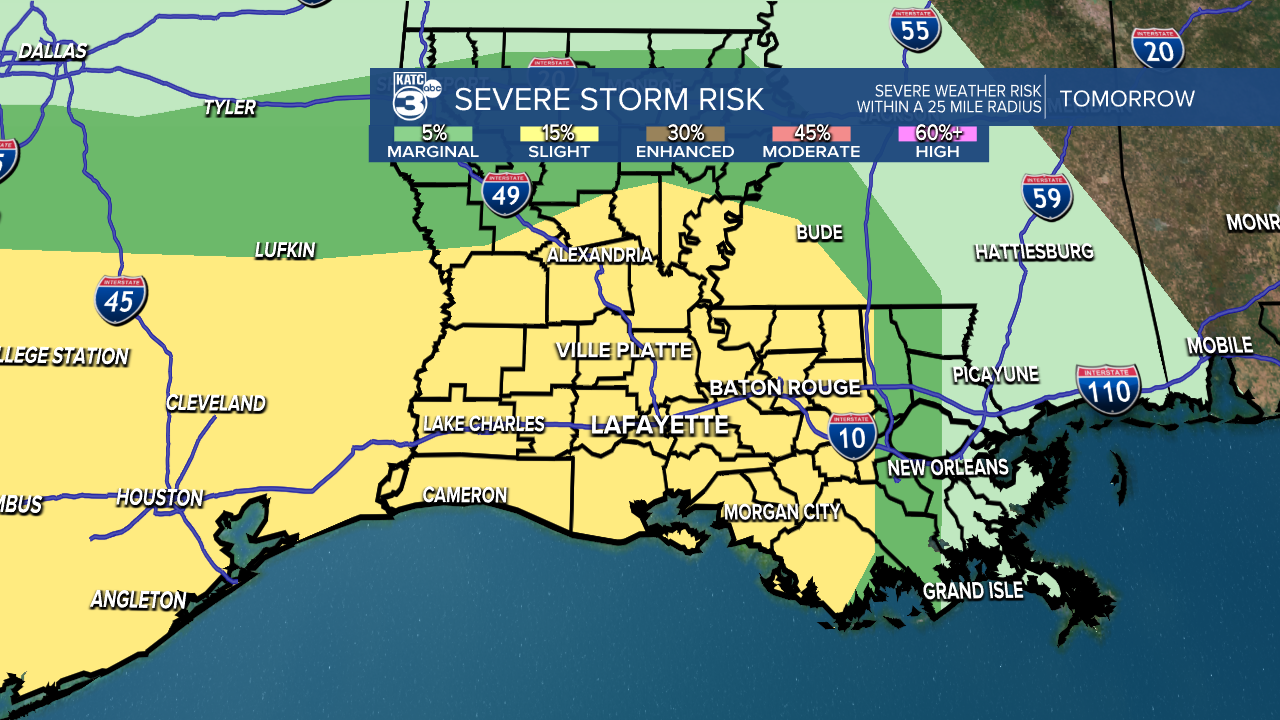
The severe threat is largely going to be dictated by the early morning showers which may eat up enough of the energy to limit the storms potential.
If we get some decent showers and clouds linger into the afternoon it may limit the ability for storms to flare up, still it will be a good idea to keep an eye on the radar.
Clouds will finally start to break Sunday afternoon and we'll slowly clear out by the start of the work week.
Warmer temperatures will hold on into the first half of the week but another front won't bring much rain but it will bring back some of the coolest temperatures of the season.
