We've seen a few showers and storms around Acadiana, but the weather ramps up tonight through early Sunday with a Pacific cold front moving in. The storm outlook still shows a marginal (1/5) risk for the majority of Acadiana, with a slight (2/5) risk for areas north of Highway 190.

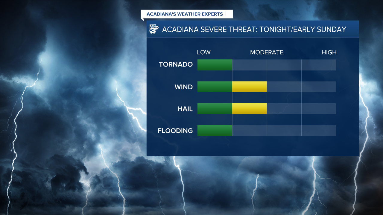
HAZARDS: As the line of storms develops, we may have damaging winds and large hail, with a lower chance of isolated tornadoes if storms turn severe.
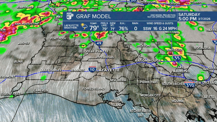
STORM TIMELINE: Isolated to scattered showers and storms continue into the evening. However, the main line is set to roll in around 9-10 PM for western parishes, including Allen and Jeff Davis. Lafayette should see storms around midnight, pushing out of St. Mary Parish before 4 AM. The intensity of the storms should weaken south of I-10, but timing may vary by an hour or so.
After a brief break, lingering showers and storms return Sunday afternoon before we finally see things clear up.
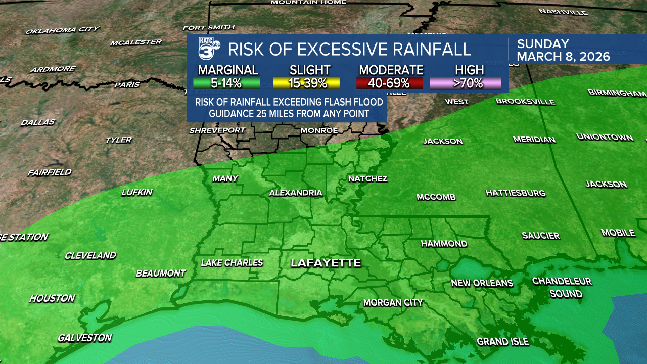
RAINFALL TOTALS: There’s a marginal (1/4) risk for flash flooding across Acadiana, with Central Louisiana facing a higher (2/4) risk.
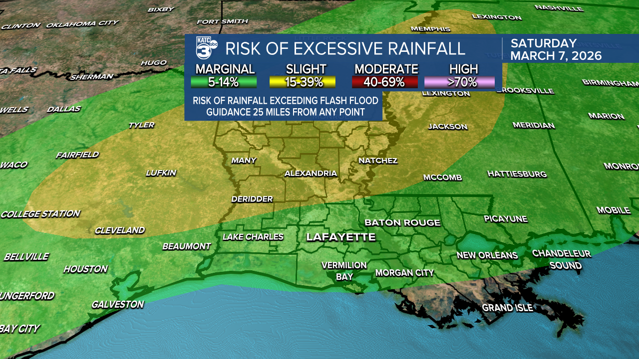
We’re expecting rainfall totals between half an inch and 3", with some spots possibly seeing more due to training thunderstorms.

NEXT WEEK STORM OUTLOOK: Drier conditions are on the horizon late Sunday afternoon, with rain chances dropping to 10%-20% on Monday and Tuesday. Another round of storms—along with a low-end severe weather risk—returns on Wednesday, especially for parts of CENLA, which is under a slight (2/5) risk.

Stay alert tonight, especially since storms will be arriving after dark. Make sure you have multiple ways to get watches and warnings. I’ll keep you updated throughout the night!
Follow Meteorologist Breyanna Lewis for further updates.
See the KATC 10 Day Forecast for the latest.
