


Showers and some strong, possibly severe thunderstorms are in the forecast for Acadiana Friday into Saturday morning before a cold front sweeps through the area.
In the near term, look for scattered on and off showers overnight into Friday morning as warmer and more humid air continues to get shuttle into the region courtesy of breeze southerly winds, which should also keep any fog at bay.
Rain chances overnight will be in the 70-80% range, but activity will be scattered in nature.
It will be quite mild overnight with lows in the upper 60s to lower 70s while highs reach the near record upper 70s to near 80° in a few spots again Friday.
Friday will bring more storm dynamics in play allowing for more scattered shower and thunderstorm activity into the midday and afternoon hours, and there may be enough atmospheric dynamics in place to produce a few isolated severe storms.
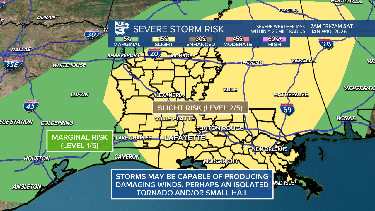
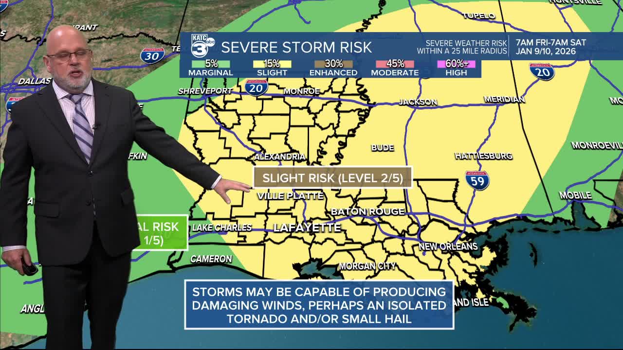
The Storm Prediction Center has upgraded all of Acadiana for a slight risk (level 2/5) for severe storms Friday through 7am Saturday morning, and it may last a little longer than that for our southeastern parishes, perhaps until midday there.
The severe weather threat might lessen substantially after midnight Friday night, if the severe weather dynamics advance more rapidly eastward ahead of the front, as our latest models are indicating as of this Thursday afternoon.
The primary severe threat for any severe storms would be for cells that could contain damaging winds, but an isolated tornado and/or some hail may be possible in the region.
Showers and storms may continue into the early evening hours Friday, but thereafter, there could be a slight lull in activity as we will await the cold front that will produce more thunderstorm forcing during the predawn hours Saturday, ending from west to east Saturday.

We do expect, a line of strong showers and storms with gusty winds to advance through the area ahead of our next cold front from the predawn hours through much of Saturday morning.
Rain chances Friday into Friday night will be in the 80% range but it any activity will not last long.
Rain chances with the front will increase to near 100%.
Activity looks to linger into Saturday (near 60% or better) primarily for the morning hours.
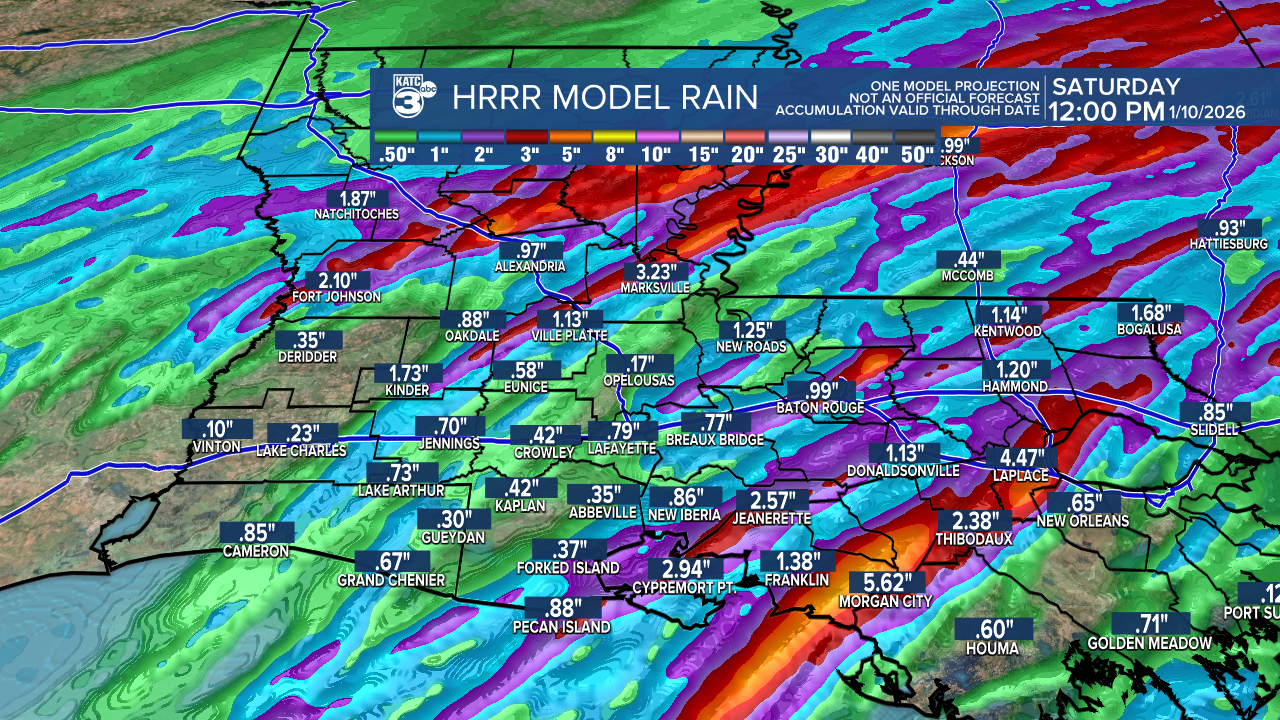
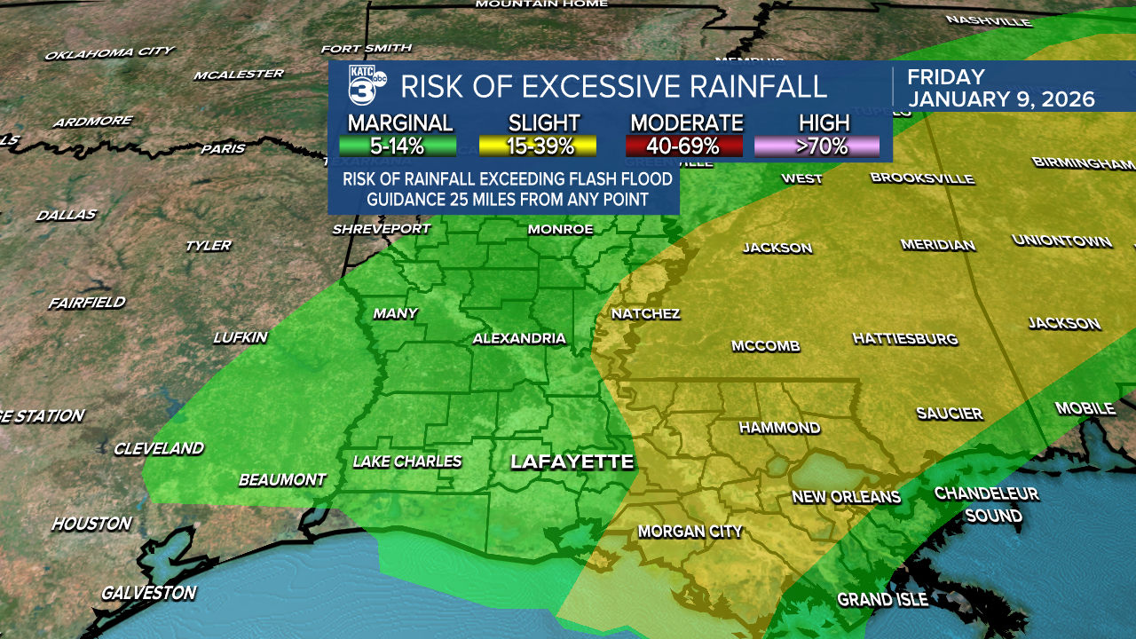
Rain totals will generally be between 1/2-1" for most, but isolated hots spots of 2-4" or more may be possible wherever storms cross over the same areas.
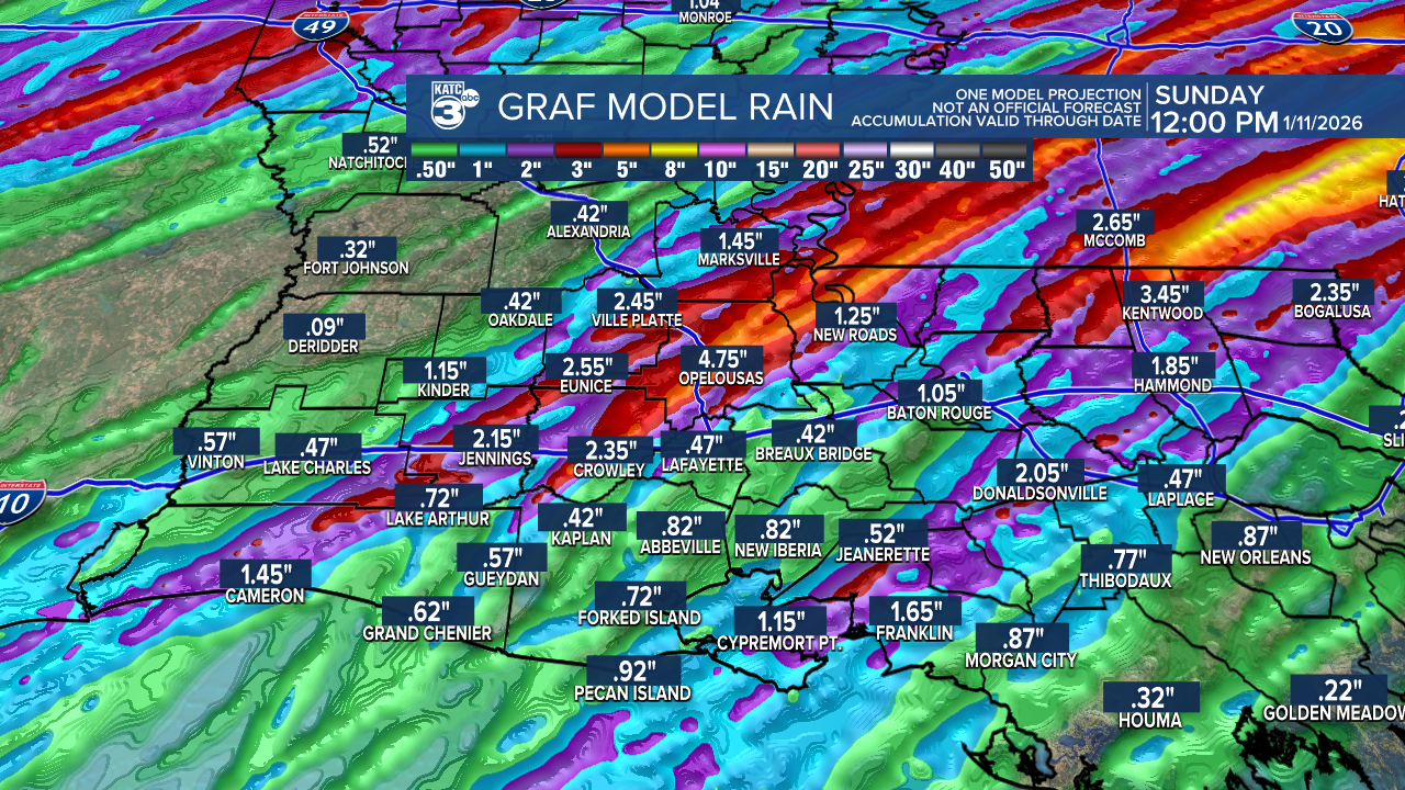
This would be most likely over our eastern parishes of Acadiana into Eastern Louisiana and Mississipi where a Flood Watch and the risk of excessive rainfall will be higher.
Chilly temperatures and periods of light rain or drizzle may continue into the afternoon and evening Saturday as temperatures drop through the 50s and head for the 40s.
Sunday looks to be dry and cool with lingering high clouds thanks to the sub-tropical jet overhead.
Next week looks seasonably cool, with some sun through Tuesday, with a more unsettled and colder "winter" pattern looking to take shape from the mid-week period into the following weekend...stay tuned for changes to this part of the forecast.
In the meantime, here's the latest KATC 10 Day Forecast.
