


Showers and thunderstorms will return to the Acadiana area by Wednesday afternoon as tropical moisture surges in from the east accompanied by a weak inverted trough of low pressure.

This feature will be similar to a hybrid tropical wave (wave and storms moving from east to west)...and there could be a few strong cells capable of producing strong and gusty winds accompanied by localized torrential downpours.
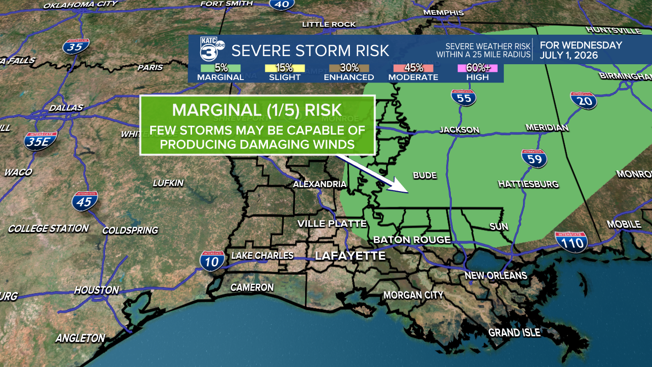
The Storm Prediction Center has areas mainly east of most of Acadiana hatched in for a marginal risk of an isolated severe storm into Mississippi, so a pulse severe cell might be possible perhaps west of the outlook area too, depending on how it plays out tomorrow, with the possibility of wet microbursts the primary focus .
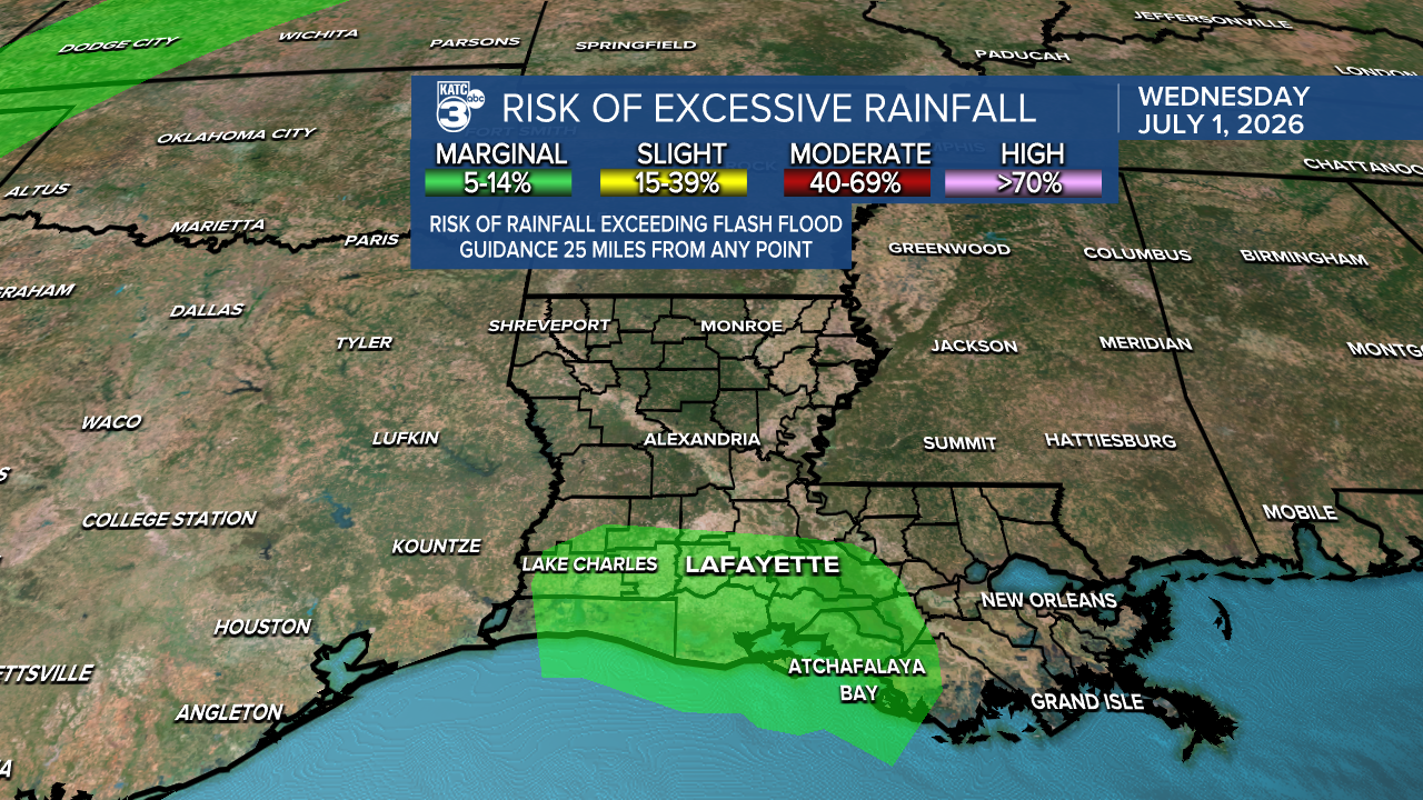
In addition, the Weather Prediction Center has thrown a little marginal risk outlook area for excessive rainfall for Acadiana, as a few storms might produce a couple of inches of rain over a short period of time, which could impede remediation in flooded areas over the last week plus.

Models are showing typical rain accumulations associated with a scattered storm pattern across our area, with some areas not receiving much at all, to a few localized areas that could catch a 2-3"+ in an hour or two.

Above is the 2 day total per the GRAF Model:

And here is the HRRR model that carries us only through 1pm Thursday:
Rain chances Wednesday will elevate to 70% by the latter part of the afternoon ending during the early evening hours.
Tropical moisture will likely stay around through early next week translating to another healthy round of tropical showers and storms Thursday.

Rain chances will be in the likely category Thursday and then move into the slightly lower, "scattered" category Friday and Saturday.
There could be another uptick in the chance of storms Sunday and Monday before high pressure advances back into the Gulf, shifting the best chance of scattered storms north of our area...however, there may still be the risk of a few isolated afternoon storms toward the mid-latter part of next week.
Storms or not, temperatures will still manage to reach the upper 80s to lower 90s in the days ahead while steamy overnight lows in the mid-upper 70s should continue.
See the KATC 10 Day Forecast and Power Doppler 3 page for the latest.
Meanwhile in the tropics, we're back to no suspect areas for the next week as the disturbance the National Hurricane Center had been tracking now has a 0% chance development.

The weak area of low pressure was located along a frontal boundary off the SE U.S. coast today has had limited thunderstorm activity associated with it.

In addition, its proximity to dry air is expected to prevent development of this system as it drifts southward and then westward later this week.
