


A tropical disturbance in the Bay of Campeche will continue to be monitored this week for possible tropical development. A very disorganized area of cloudiness and rain, associated with a trough of low pressure will continue to stay stationary off the coast of Mexico.
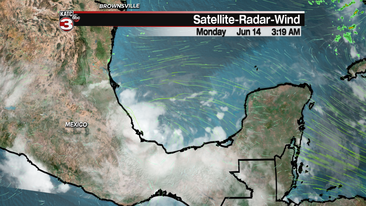
Over the next few days conditions will become more favorable for this to develop into a tropical depression as the system drifts northward. This could bring additional rains and rough seas to the western Gulf of Mexico this week, and along the northern Gulf Coast by week's end. The National Hurricane Center puts a 50% chance for development over the next five days.

Overnight, showers and storms passed through the region. We're still seeing rains over the northern Gulf of Mexico this morning. Skies will start out partly cloudy this morning, with temperatures reaching the lower 90s by early this afternoon. Clouds and scattered showers and thunderstorms will develop with the daytime heating. Expect highs to reach the lower 90s with heat index values around 102. Afternoon storms will drop temperatures back into the 80s later today.

Overnight, skies will become fair. Warm and muggy conditions are likely with lows in the mid to upper 70s. Afternoon storms are possible again on Tuesday with highs in the lower 90s. Rain chances will drop off a bit for the mid week with highs in the low 90s for Wednesday and Thursday. Rain chances will again go up toward the Father's Day Weekend if the tropical disturbance moves in our direction. Temperatures over the weekend should hover in the upper 80s because of increased cloud cover and rain.
