

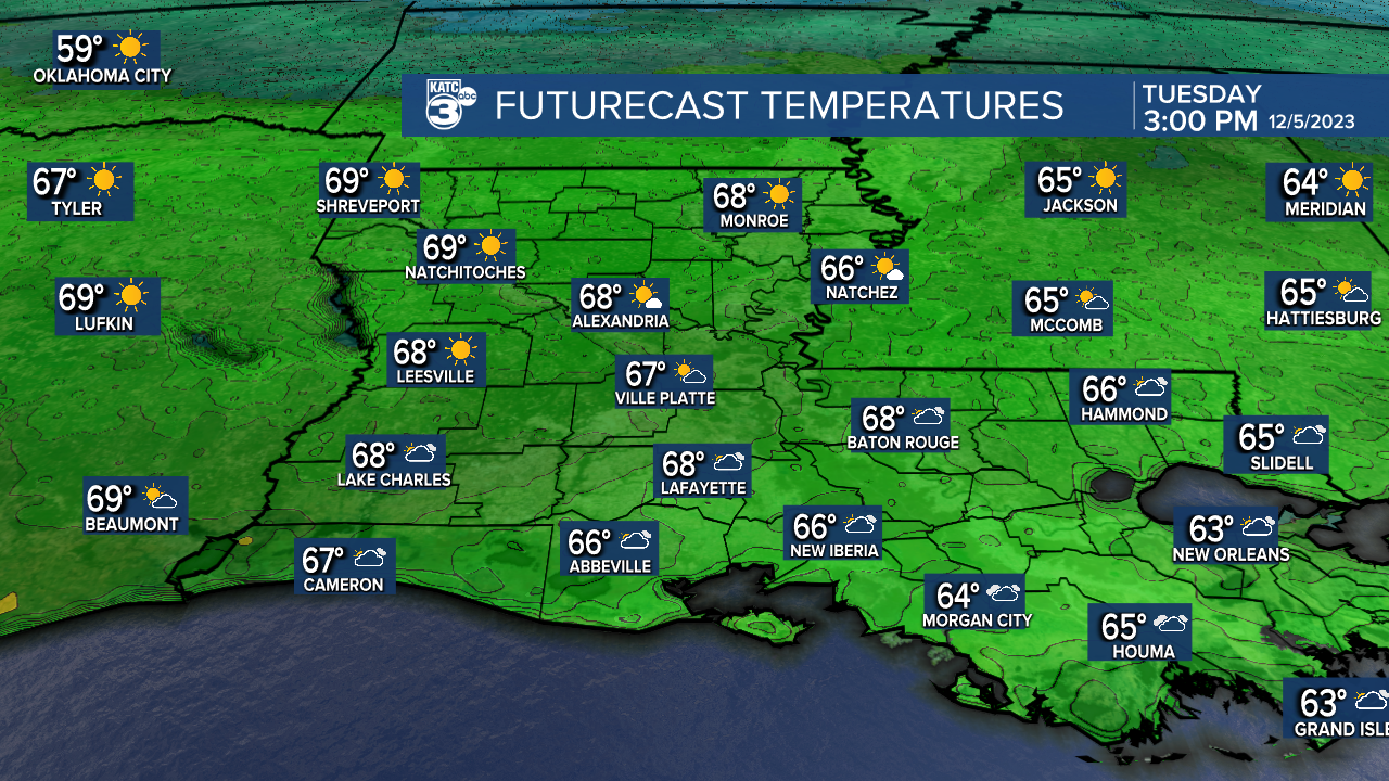
Another pretty day is in store for Acadiana as high pressure remains in control. Northerly breezes will be light and temperatures will climb into the mid to upper 60s. Some high, thin cloudiness will dim the sunlight somewhat, but still a very nice day.
Overnight a cool front will push through the region, reinforcing the dry and cool air. Expect lows to drop into the lower 40s under mostly fair skies. Sunshine is planned for Wednesday, but temperatures will be a few degrees cooler. Expect highs in the upper 50s north, and lower 60s south.
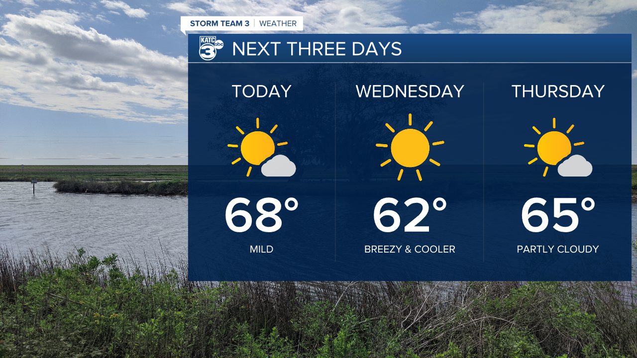
Thursday, high pressure will be exiting to the east allowing more of a southerly flow. Expect temperatures to climb back into the mid 60s under partly cloudy skies. By Friday, low pressure will be developing over Texas pulling in more Gulf moisture. Temperatures will be mild with highs in the 70s under mostly cloudy skies.

As the low pulls northeastward toward the mid Mississippi Valley, it will strengthen. Windy conditions are expected Saturday as the cold front approaches. Expect showers and thunderstorms along the front Saturday pushing eastward Saturday night. There is a chance for some severe weather, although the greatest risk looks to be north of our area.

By Sunday, skies will start clearing. It'll be blustery with highs only in the mid to upper 50s. Sunny skies return Monday and temperatures will remain below normal for the early part of next week.
