


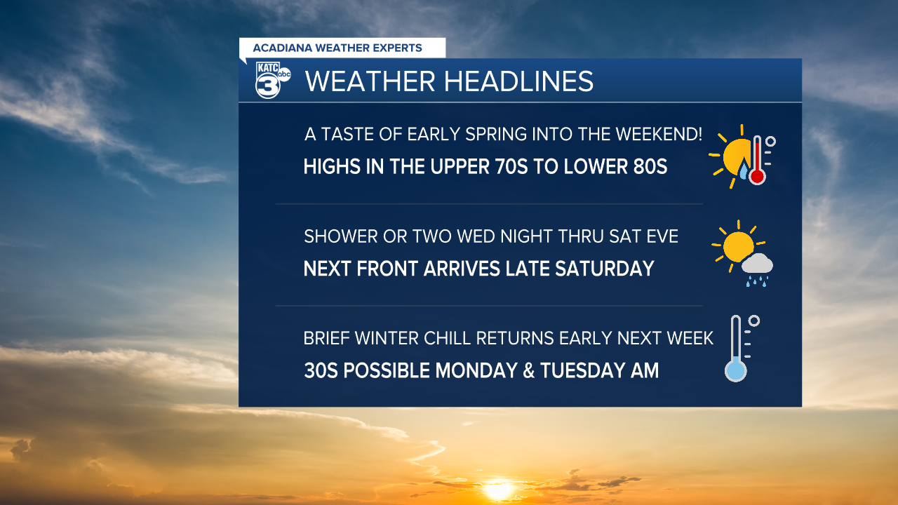
Acadiana will see breezy and warmer conditions with highs pushing the lower 80s into the weekend, but a brief winter chill will return Sunday into early next week.
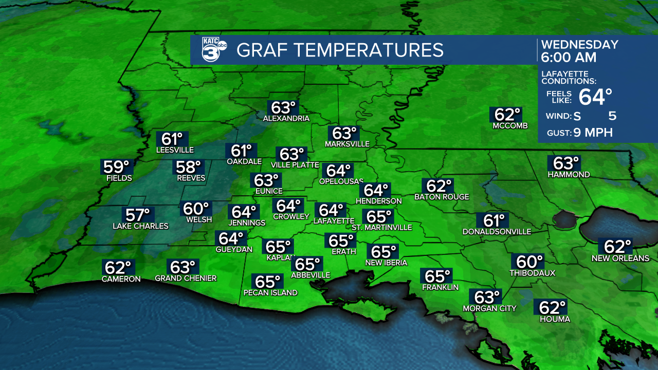
In the near term, look for breezy and mild conditions overnight through Wednesday morning with lows in the lower 60s.
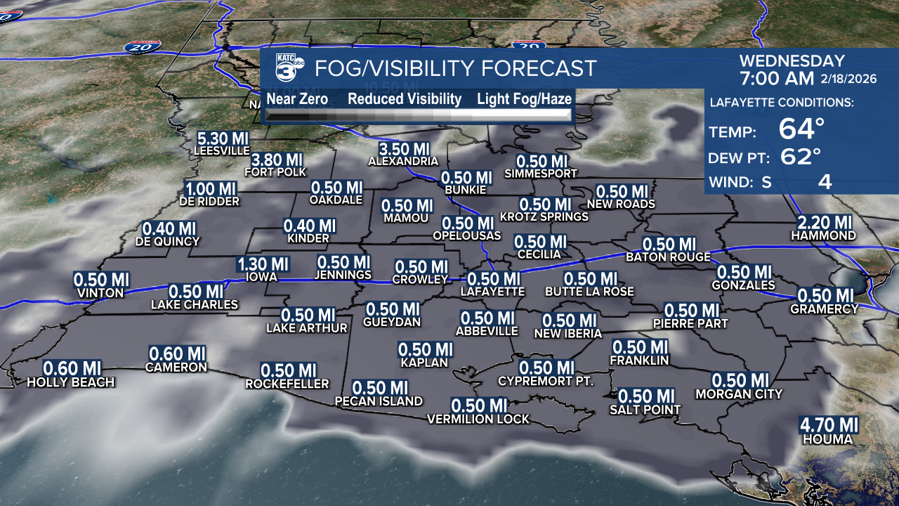
Areas of fog may develop right near daybreak just as winds die down for a few hours...those winds will maintain a low cloud deck otherwise overnight.
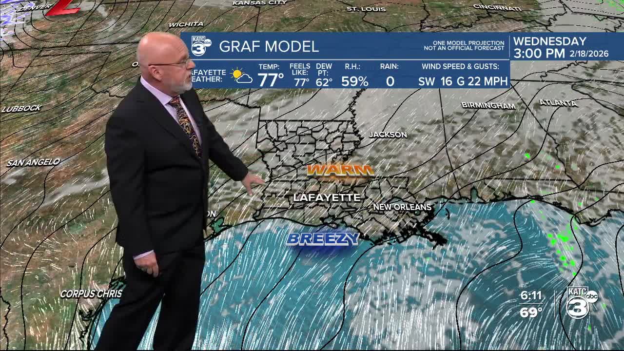
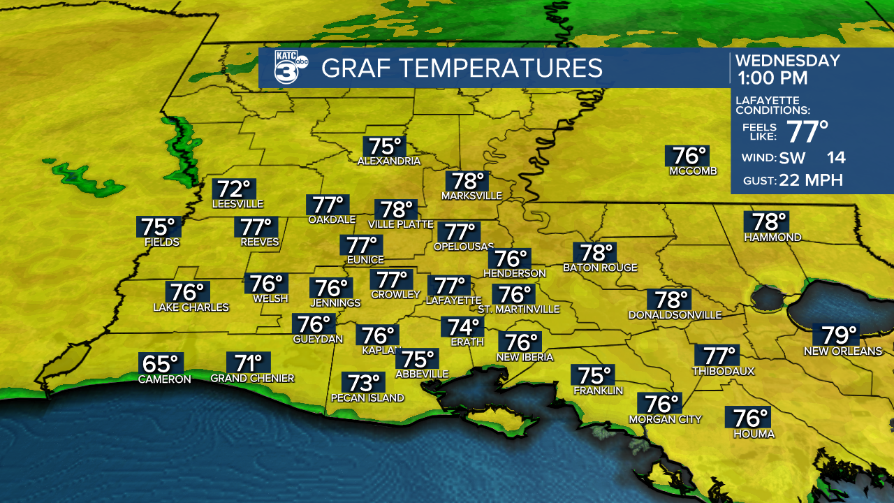
Look for another mostly cloudy day Wednesday with increasing southwesterly winds near 12-20 mph with a few higher gusts likely.

A few more intervals of sun are expected Wednesday afternoon as temperatures push into the mid-upper 70s.
Wednesday night will bring more mild temperatures, and with a "humidifcation" of the lower atmosphere, more fog, perhaps accompanied by misty drizzle, will be possible.
The same pattern is anticipated for Thursday with high temperatures nearing the 80° mark...more sun is expected for the afternoon hours.

A few showers will be possible Friday into Saturday with highs still ranging near the lower 80s...but a front could bring a few more showers (30-40%) when it arrives later Saturday into Saturday evening.
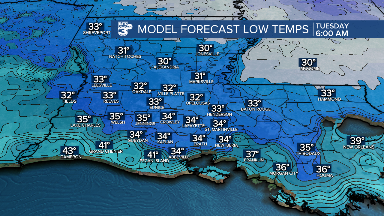
The next cold front will usher in more winter-like temperatures for a few days Sunday through Tuesday with highs cooling into the upper 50s to lower 60s, while morning lows early next week dip into the mid-upper 30s...a light frost will be possible in portions of Acadiana primarily Tuesday morning.
The winter chill early next week will be brief, with spring-like temperatures returning later in the week.
See the KATC 10 Day Forecast for the latest.
