


Acadiana will enter the weekend with spring-like temperatures in the 70s Saturday, but exit the weekend with windy, winter-like temperatures and wind chills Sunday.
In the near term, as warm and moist air moves northward out of the Gulf into Louisiana overnight, we can continue to expect mostly cloudy skies with fog likely developing along with the risk of spotty light showers and/or occasional patchy drizzle/mist.

Chance of enough moisture to wet the ground will be near 20-30%.
The onset of the fog could be earlier than usual tonight, with visibility dropping from south to north prior to midnight in many locations.
A Dense Fog Advisory could be issued by the National Weather Service later this Friday evening.
It will be milder but damp tonight with temperatures holding in the upper 50s...some 10-15° above normal.
The fog and clouds should be very slow to burn off Saturday, with some intervals of sun possibly developing during the mid-late afternoon.

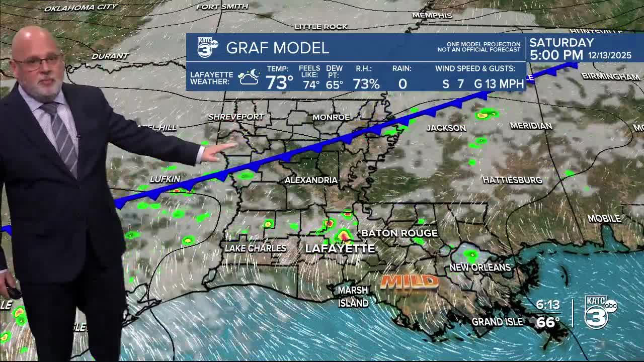
Temperatures will be balmy for the time of the year with highs in the mid-upper 70s Saturday.
A few isolated showers will be possible Saturday, but our best rain chances should develop later into Saturday night, and mostly likely after midnight as the strongest front of the season comes crashing through.
There should be near a 70% chance of showers and perhaps a few embedded thunderstorms for Saturday night with activity tapering toward daybreak Sunday. No severe weather nor significant rainfall is expected, but a few spots could catch up to 1/4".
It will turn windy and much colder Sunday with temperatures falling and holding in the mid-40s, with wind chills dropping into the 30s. Clouds should clear out for Sunday afternoon.

The coldest air arrives Sunday night into Monday morning with temperatures dropping into the mid-upper 20s accompanied by wind chills in the upper teens to lower 20s by Monday morning.
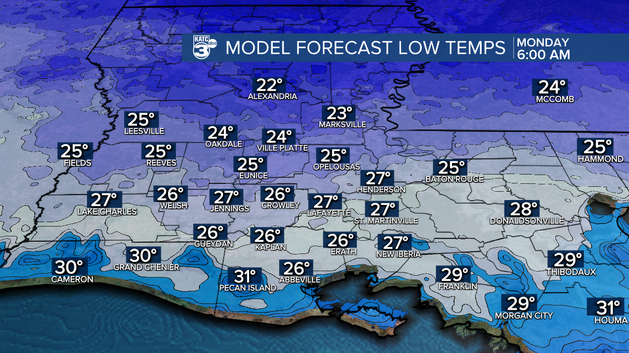
Portions of Acadiana may see sub-freezing temperatures for 6-12 hours from south to north respectively) Sunday night into Monday morning.
And per the NWS: "As it stands now in the forecast conditions will likely meet/exceed Cold Weather Advisory criteria".

This will be our first freeze where the pets, plants and exposed pipes will require some protection.
Sunny and cold weather will continue Monday with highs in the upper 40s with another freeze Monday night into Tuesday morning.

Thereafter, milder temperatures with limited rain chances are expected for the rest of next week and very likely into the weekend.
And it continues to appear that milder than normal conditions, with highs remaining in the 70s, could continue into much of Christmas Week.
See the KATC 10 Day Forecast for the latest. and follow me on Facebook for additional updates this weekend.
