


Despite a weak frontal system arriving to Acadiana by Friday morning, spring will be in full swing into the weekend into the following week.
In the near term, breezy southerly winds will diminish below their afternoon levels tonight, but will keep clouds and hold our temperatures closer to the quite mild mid-60s.
Thursday will be another mostly cloudy, breezy and even warmer day.
Highs will top out in the mid-upper 70s Thursday, with a few more intervals of afternoon sun, along with a very slight chance of a passing shower or sprinkle at 10%.

It will be on the rather breezy side again Thursday, but wind gusts will be closer to 20-25 mph versus gusts near 30 mph Wednesday.
A weakening frontal boundary will approach the area Thursday night into Friday morning likely to be accompanied by some very light shower activity at best, and perhaps some fog.
Today models are far less bullish for any significant rain with this frontal system, which will technically be more of a brief wind shift line.
We'll still top out in the mid-upper 70s to near 80° Friday with more sunshine likely for the afternoon.
The rest of the 10 Day Forecast looks like spring will continue to be in full swing with daily highs near 80° from this weekend to next weekend...rain chances however, may come back into play toward the end of next week and/or the following weekend.
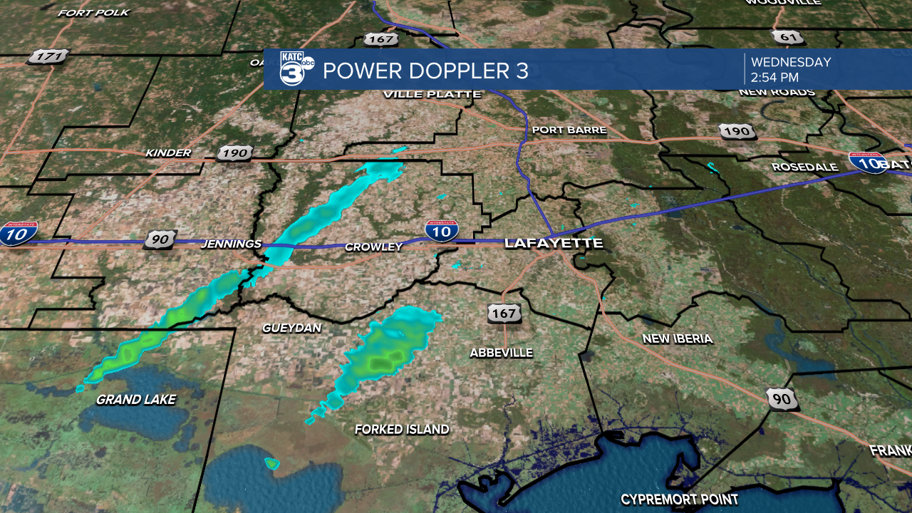
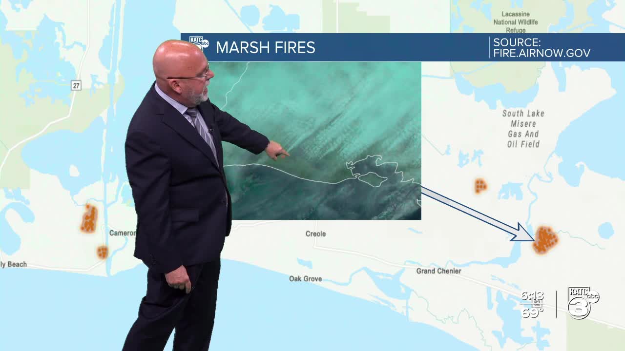
Power Doppler 3 was smoking this afternoon...actually none of what you may have seen on the radar was rain, it was smoke from a couple of decent size marsh fires and where there is some other burning going.

This time of year there is a lot of burning, prescribed or otherwise in the marsh which incidentally is not in the current areas for burn bans.
