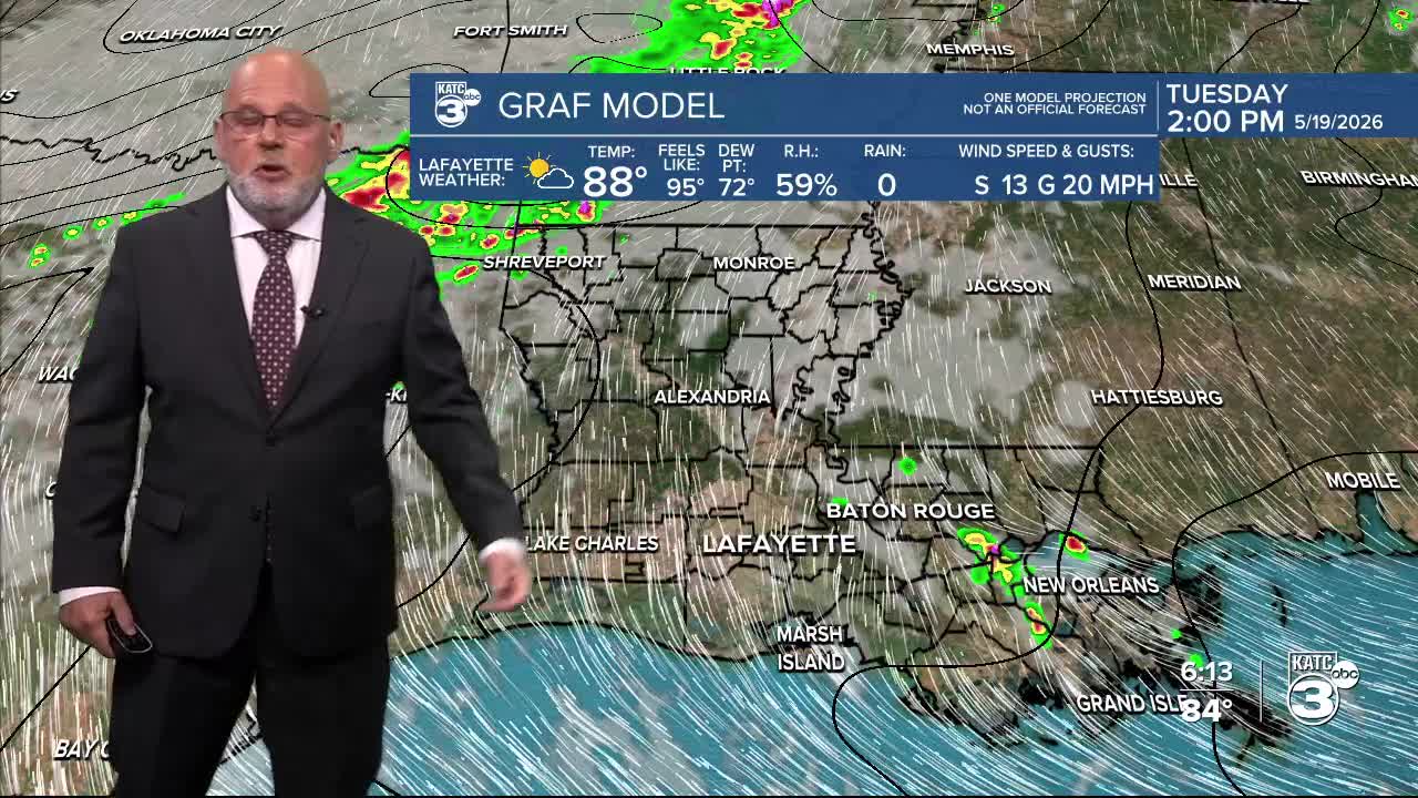


After a relatively quiet, warm and humid Tuesday, an extended period of high rain chances and the daily threat of locally heavy rains will develop for Acadiana starting Wednesday, and will likely continue through the last week of the month.
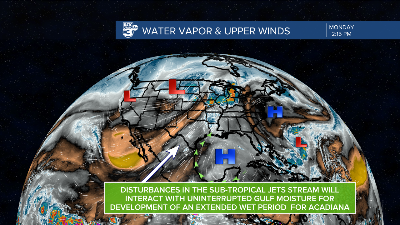
A series of disturbances riding with the sub-tropical jet-stream will interact with a nearly endless supply of Gulf moisture to produce a very good chance of scattered showers and thunderstorms on any given day starting Wednesday and continuing through the next 10-14 days.

No one particular day (or night for that matter) looks like a washout, but there will be a 70-80% chance of some showers and/or thunderstorms through the holiday weekend.
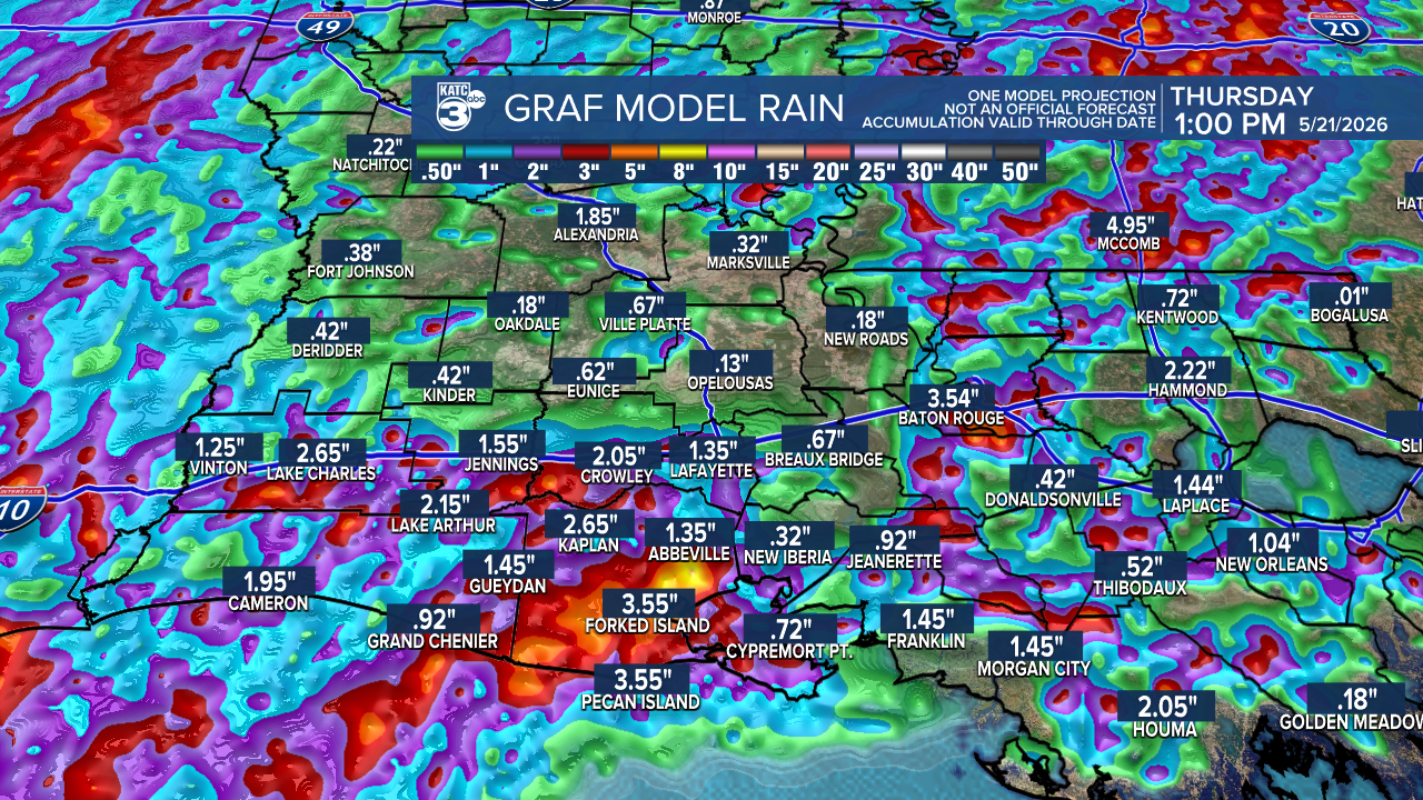
In general, rainfall totals over the next 7 days looks to be in the 2-4" range, isolated spots may see double or more compared with the Weather Prediction Center's forecast below.

The latest Euro model indicates much the same for the next 7 days...with much higher rain totals, perhaps over 10" west into Eastern Texas.

Going through the next 10 days the Euro rightly indicates that some areas may see more than 10-15" of rain somewhere between Texas and Louisiana...and there will be more rain days beyond the next 10.

For now, the severe weather risk looks low or marginal at best on any given day into the weekend, but the main concern will be the rain totals and more importantly rain rates.
Some days areas will see 1/4-1/2" and other days, several inches will be possible, and that may come in just an hour or two, which could lead to localized flooding.
So with each passing day into the weekend and beyond, there will be increasing odds for flood watches and/or warnings for the Acadiana area and region.
After Tuesday's highs in the upper 80s, expect daily highs to get closer to the low-mid 80s...and perhaps some days in the upper 70s, while lows at night/morning hours stay in the humid lower 70s.
Lafayette has already received 8.88" of rain month to date, with the additional rainfall expected over the next couple of weeks it will likely push May 2026 into the top 10 wettest on record.

See the KATC 10 Day Forecast for the latest rain chances and Power Doppler 3.
