


Soaking rains of at least 1-4" and the threat of a few severe storms are expected for portions of Acadiana this weekend.
Acadiana remains on track for rounds of showers and storms Saturday morning through Saturday night ending Sunday morning.
New Thursday afternoon, the Storm Prediction Center had increased the potential for severe storms for western portions of Acadiana to a slight risk (level 2/5), for the possibility of storms that could produce damaging winds, isolated tornadoes and hail Saturday into Saturday night.

The model upper air profiles suggest that the highest risk of an isolated tornado may occur Saturday morning/afternoon for SW LA and Saturday evening/night farther east into Acadiana, but the amount of dynamics in play and after dark remains questionable. We'll watch the trends.

Expect several rounds of on and off showers and storms beginning Saturday morning through the afternoon (80-90%), with widespread activity Saturday night (near 100%), tapering from west to east (near 80% early) Sunday morning.

In addition, the Weather Prediction Center has most of Acadiana hatched in for a slight risk (level 2/4) of excessive rainfall.

Rainfall amounts will likely be in the 1-4" range for most of the area, with isolated amounts of 5-6" possible over a roughly 24-30 hour period.

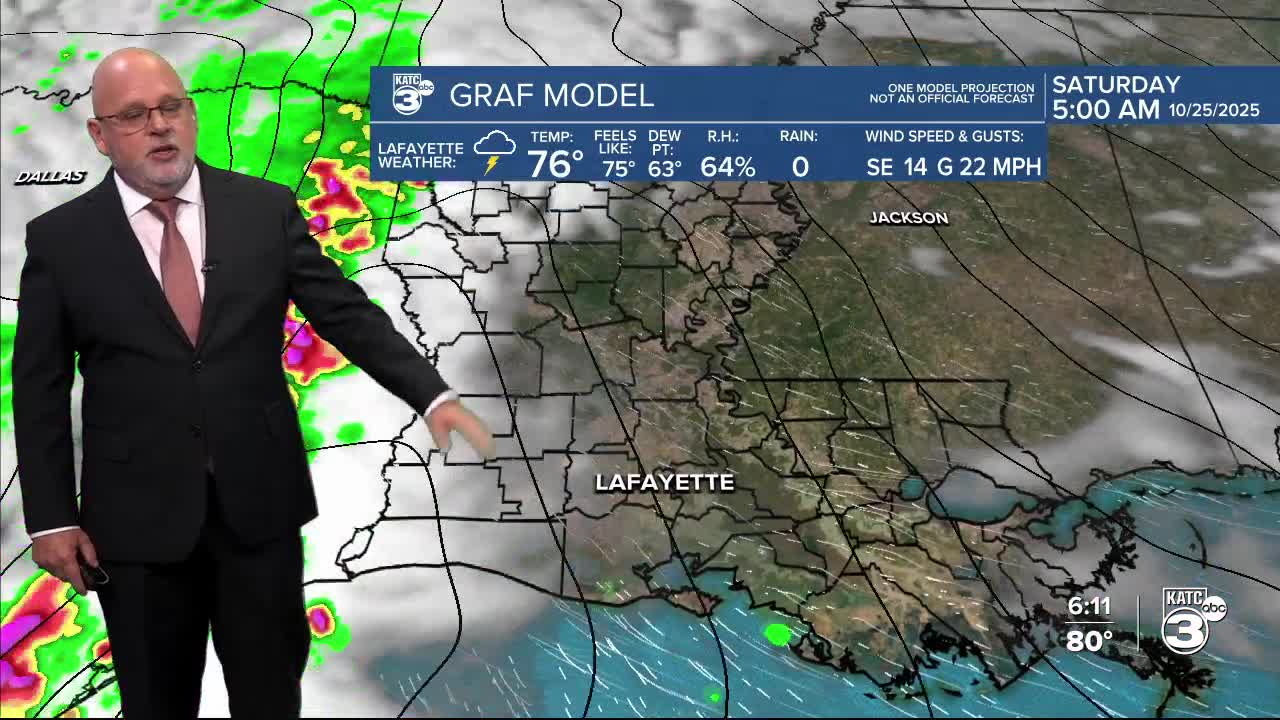
Per usual and on par for 2025, model guidance remains suspect at times (with less available upper air data to feed the models) with the GRAF swinging from 2-6" this morning to the 1-4" isolated more, shown in this afternoon's model run.
The Euro model appears to be more reasonable at this time unless the GRAF is on to a new trend.
If trends worsen, a Flood Watch may be required by the National Weather Service for portions of the Acadiana area.
Even though our parched soil will likely gladly take on most of the rain, rainfall rates could get into the 2-3" per hour range in isolated spots, which could lead to some localized street flooding at times.
Drier weather should return to the area Sunday afternoon, with generally fair and seasonable conditions expected into early next week.
The coolest air of the season should follow with a mid-week front ushering lows into the 40s and highs in the 60s for the latter part of next week and including Halloween.
See the KATC 10 Day Forecast for the latest.
Meanwhile in the tropics, Tropical Storm Melissa is expected to intensify to a hurricane by Saturday and a major category 3 then 4 hurricane, Sunday into early next week.

Melissa will continue to be a very slow-mover likely to produce more than 2 feet of rain over portions of Jamaica, Haiti and possibly portions of Eastern Cuba.

In addition, portions of Jamaica could experience hurricane force winds for 3 to 4 days...making this storm a potentially catastrophic event for the island.
