A good chance of scattered showers and some strong thunderstorms is in the forecast for Acadiana Friday, with rain chances not ending until drier air arrives late Saturday.
The frontal system looks to get hung up over Acadiana through Saturday keeping the chance of showers and thunderstorms at least through Saturday morning...but drier air should start to filter in Saturday night into Sunday resulting in a better feeling finish to our Labor Day weekend holiday.
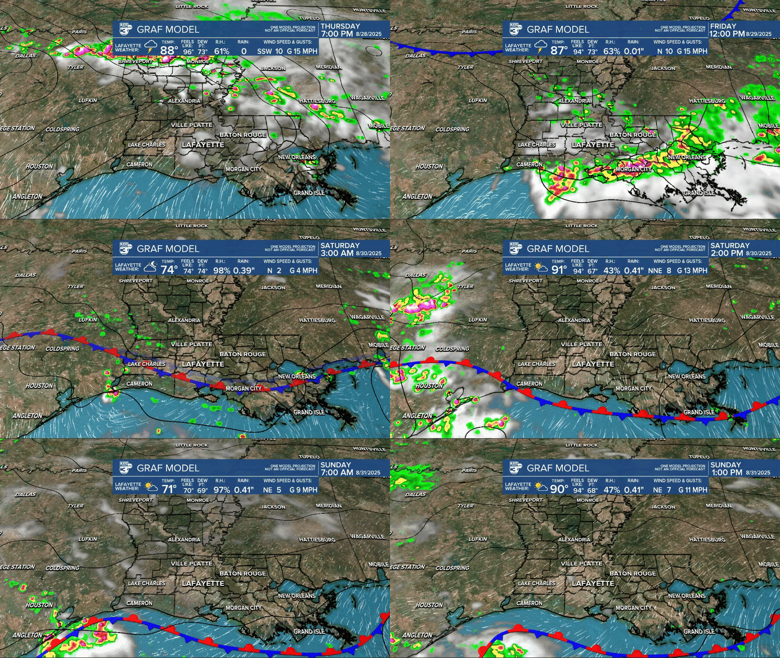
Hopefully, it will quiet down for Saturday evening and the Louisiana Ragin’ Cajuns Football game...but no promises when there's a wagging front in our area...tailgating may be wet at times.
In addition to the more widespread coverage of storms Friday, the Storm Prediction Center has our area hatched in for a marginal risk of a few isolated storms that could be capable of producing damaging wind gusts (meaning there could be a few severe thunderstorm warnings in the area).

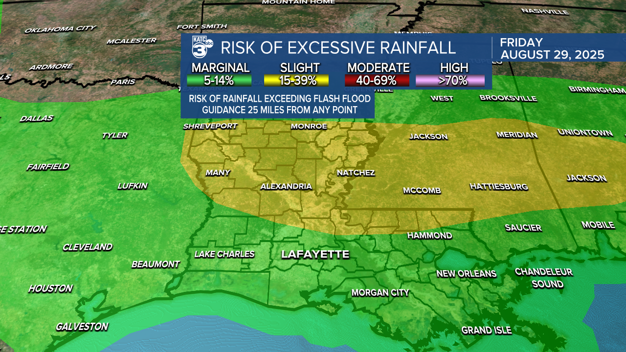
Meanwhile, the Weather Prediction Center has the area hatched in for a marginal risk of excessive rainfall, with that risk higher into the central and northern part of the state.
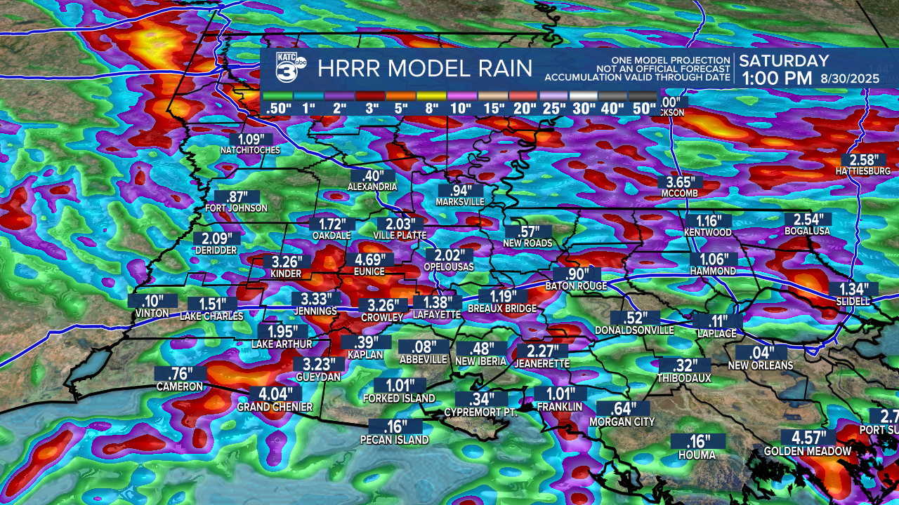
Our rainfall guidance is going for generally 1-2" in many spots, while isolated areas may see up to 3-5" in a few spots with rainfall rates of 2-3"/hr which may cause localized street flooding.

Please note that the GRAF rainfall total is valid through 1pm Sunday while the HRRR model takes us only through 1pm Saturday.
Skies should become partly cloudy with drier air in place Sunday into Labor Day with daytime highs closer to the upper 80s while overnight lows (and dew points) improve into the lower 70s...and perhaps a few upper 60s in our northern parishes for Monday and Tuesday mornings.
Much of next week looks quiet and early September-like, with another potential front arriving later in the week or the following Saturday.
See the KATC 10 Day Forecast for the latest.
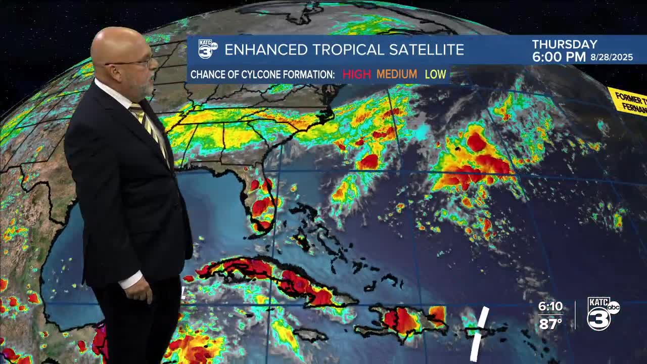
Meanwhile, the tropics are quiet for the last week of August with the NHC introducing a new area outlook in the far Eastern Atlantic associated with a wave coming off the African Coast this weekend.
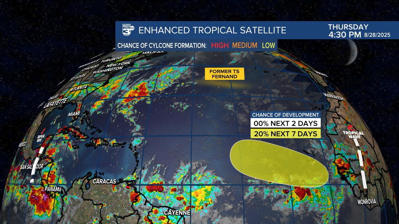
For now no worries for the Gulf for at least the next week to 10 days.
I'd be on the lookout for the possibility of more a homegrown system, perhaps in the Western Caribbean/Southern Gulf sometime mid-September, but that forecast is barely above a guess, as the long-range models have been showing deeper tropical moisture looming at that time, but it's too far out for any certainty at all.

