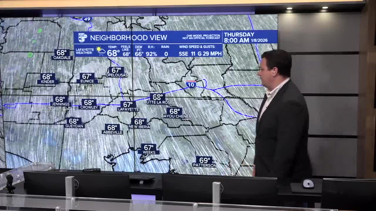


Rain will make its return to Acadiana on Thursday with some fast, moving streamer showers pushing across the area on Thursday afternoon.
Skies will remain mostly cloudy, and while it won't be a washout by any means, it won't be surprising to run into a few rounds of rain through the day.
Thursday's showers will have minimal impact, and won't help out much with temperatures which again will be flirting with record levels in the afternoon.
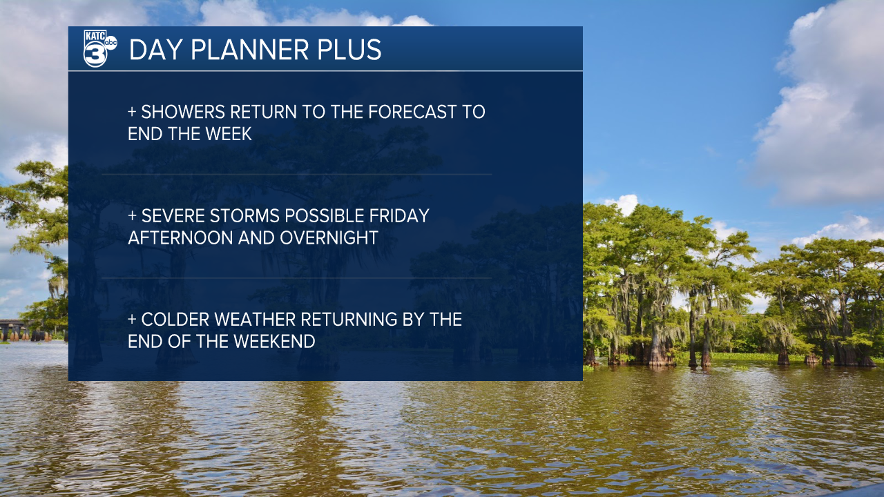
Despite an increase in shower activity on Friday temperatures will stay elevated until the weekend.
The heavier rain is expected to move through on Friday as a robust front will slowly move through the area starting in the afternoon and dragging on until Saturday morning.
There's enough moisture and instability to fuel some strong thunderstorms, particularly in the northern parts of Acadiana and we'll have to keep an eye out for severe weather.
Wind and a few isolated tornadoes would be the biggest issue, but a few pockets of hail can't be ruled out.
Severe weather potential will be dictated by the type of rain we see during the day, slow monotonous rain that lasts through the afternoon and evening could limit instability and severe weather chances.
If the showers are more isolated, however, that would likely mean an increased risk in severe weather Friday night.

The severe threat will taper off through the night on Friday, but showers will continue to linger into Saturday morning.
A soggy start to the weekend will eventually give way to a mostly cloudy one with sunshine struggling to break through until Sunday.
Temperatures will cool behind the front and we'll see a return of near frost conditions by early next week.
