


It can't be like this forever.
It probably feels like it though and when Tuesday's showers fire back up I'm sure you'll wonder if there will ever be a 24 hour period again without rain.
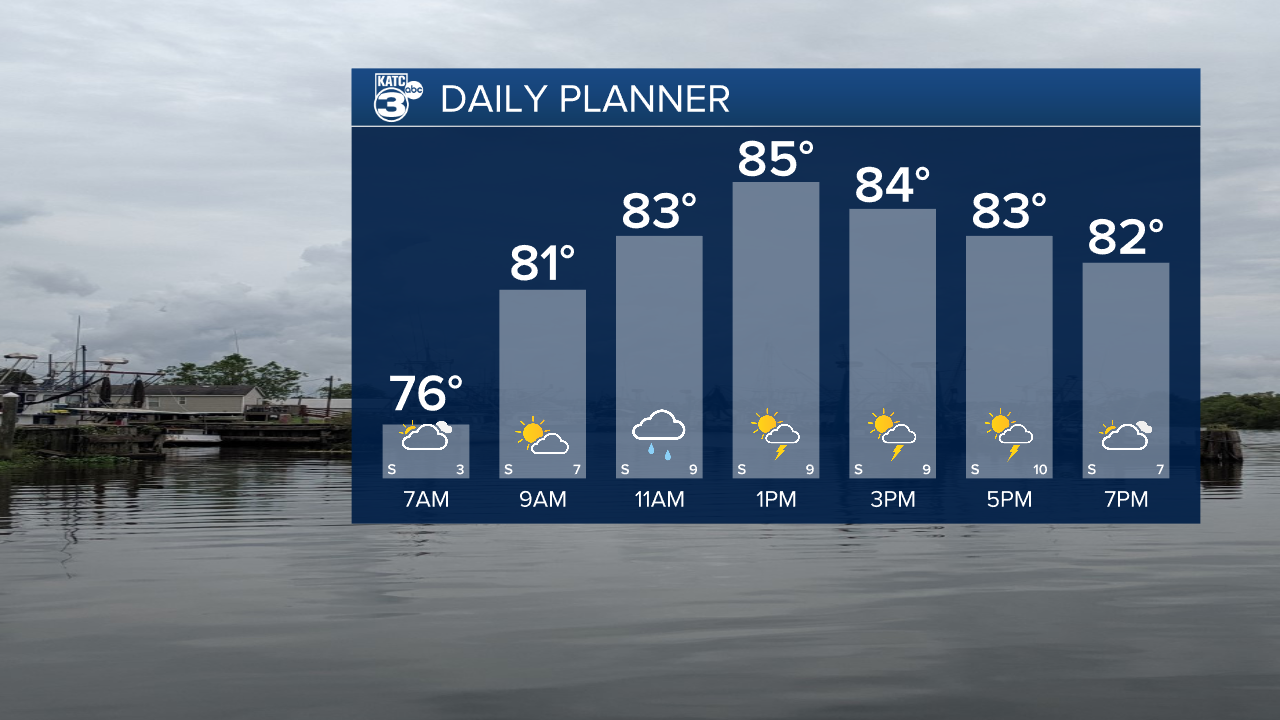
The pattern remains mostly unchanged from last week and for folks in Acadiana that means another round of showers and storms pushing through the area on Tuesday.
Similar to the last week this means periods of heavy rain and frequent lightning which could lead to localized pockets of flash flooding.
If you're looking for a silver lining then it's with the temperatures which will be slightly subdued as a result of the rain and clouds with highs in the mid to upper 80s.
Rain chances will likely stay at or above 50% for the next few days but it does look like there's some ridging that's trying to build into the area.
This could help limit rain chances a little more towards the end of the week and the weekend, although it wouldn't banish rain completely.
Showers will be a little more isolated and random, however, as they'll be driven more by daytime heating without the upper level support they've enjoyed the last week.
Temperatures, of course, would increase with highs pushing into the low 90s by the weekend.
