


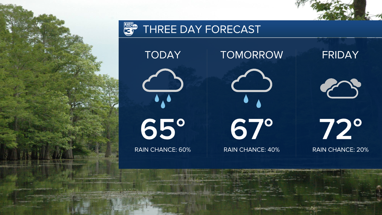
Let's quickly start with today's forecast before we dig into the weekend.
Getting lost in the excitement of the long range forecast is the fact we've got a round of showers moving through the region Wednesday.
Clouds will build through the course of the day with rain picking up in the afternoon hours and continuing on and off through the evening.
Rain totals may push an inch in some areas but mostly this will just be run of the mill rain.
Clouds will linger through the rest of the week with a few spotty showers out there on Thursday.
Alright the discussion everyone has been waiting for and that's the latest on this weekend's forecast.
Uncertainty still remains aplenty as models continue to shift around, including a fairly substantial shift in the EURO Wednesday morning.
We'll start getting into the range of our higher resolution models on Thursday which will allow us to start to iron out some of the finer details.
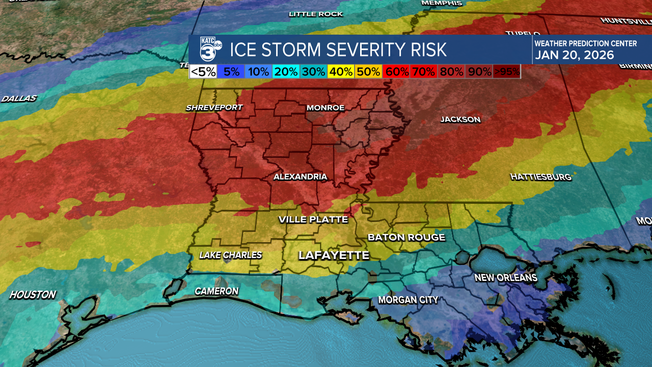
What remains unchanged is the possibility of a major, disruptive ice storm that will likely cripple parts of the deep south.
We're certain that the coldest air of the season will move into Acadiana, and there's a chance some places may spend a full 24 hours plus below freezing.
The rest of it remains a challenge.
So acknowledging that we live in the precarious realm of the unknown let's dive in to what models are trying to tell us and how much stock we put into them.
Showers look to get going on Saturday and will likely last through a majority of the day, but the key question is what will the temperatures be doing.
Temperatures will fall through the day on Saturday and look like they'll stay above freezing along the I-10 corridor until late Saturday evening when they'll dip down to freezing and below.
At this point showers that are on going will transition to freezing rain.
This would make travel difficult in parts of Acadiana, particularly areas north of Highway 190.
Areas along and south of I-10 may be able to avoid some of the more major impacts, although some freezing along bridges and overpasses will be possible.
It should be noted that the EURO held firm on this solution through the majority of the day Tuesday, but shifted the freezing rain much further north and delayed the onset of freezing until Sunday.
This is a massive shift and would pull all of Acadiana out of any kinds of impacts and keep the frozen stuff confined to the I-20 corridor.
The question now is this the beginning of a trend or is this an outlier?
Shorter, higher-resolution models will start to roll out on Thursday and Friday and we'll get a better sense of what we're looking at here locally as far as impacts go.
In the meantime I would prepare to avoid travel to north Louisiana over the weekend and early next week and make sure the pipes are wrapped and the plants and pets are brought in.
