
The chance of showers and thunderstorms will increase for Acadiana mid-week with the risk of scattered, primarily daytime showers and storms to stay through the July 4th Weekend.
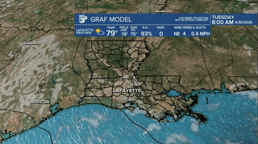
Before the higher rain chances return, Tuesday will be another hot and humid day with temperatures topping out in the low-mid 90s accompanied by heat indices in the 100-105° range...those heat index values could go higher near bodies of water (and in/near lingering flood waters (to the north)).
There could be an isolated pop-shower or thundershower in the Acadiana area Tuesday (20% or less) with the best chance of seeing a few cells in Lower St Martin and St Mary Parishes (or farther east).
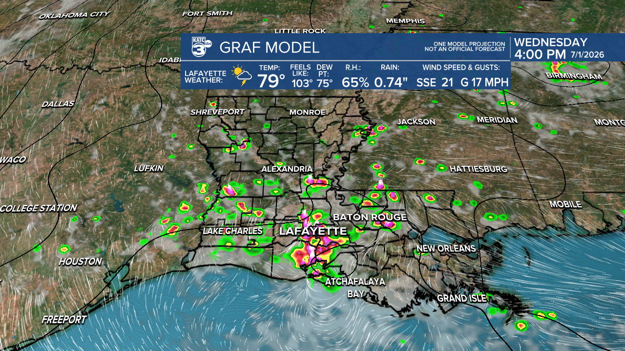
High pressure in the Eastern Gulf will weaken Tuesday and eventually allow for an inverted trough, similar to a tropical wave, with tropical moisture accompanying this feature, and then surging into our area from the east Wednesday.
A good chance of tropical showers and storms, some accompanied by strong and gusty winds and localized torrential downpours are expected Wednesday, with chance of getting wet near 70%.
Scattered, primarily daytime showers and storms will stay with us (40-60%) through the holiday weekend into early next week.
The forecast will keep at least a 30% chance of typical scattered activity into next weekend.
See the KATC 10 Day Forecast and Power Doppler 3 page for the latest.
Meanwhile in the tropics, the National Hurricane Center is maintaining very low odds of a system to develop off the SE U.S. Coast over the next day or two before conditions become too hostile for any chance of development.

The feature and its moisture is expected to drift southward and then westward before dissipating mid-week.
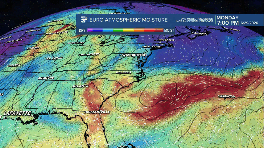
Notice the increase in tropical moisture across Louisiana by Wednesday...an inverted trough/weak tropical wave is therefore expected to enhance rain chances locally Wednesday/Thursday with residual tropical moisture keeping the chance of mainly scattered, daytime showers and storms through the 4th of July weekend.
