


Showers will return to Acadiana as our next surge of tropical moisture pushes into the area Tuesday.
The rain will follow the same pattern it's had for most of the summer with widely scattered showers and storms arriving in the afternoon with brief periods of decent downpours.
Rumbles of thunder and flashes of lightning will be likely but we're not expecting much if any severe weather.
Highs will still be able to get to the low 90s before the rain arrives so expect summer heat to continue.

There's not much variation in the weather pattern for the rest of the week, with only slightly lower rain chances for the back half of the week and weekend.
Temperatures will hover around average which this time of year feels like roughly the surface of the sun.
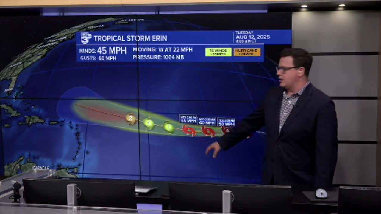
In the tropics we've seen the formation of Tropical Storm Erin in the far east Atlantic.
This storm is expected to become a powerful hurricane in the next week or so but the current belief is that this storm will curve up and into the Atlantic.
Some westward trends with the models indicates folks along the east coast should still monitor the storm closely, but as of now doesn't look like a threat to the Gulf communities.
