


Cloudy skies continuing across Acadiana on Tuesday and winds will be picking up ahead of our next storm system on Wednesday.
Today's forecast will largely be a continuation of what we got on Monday as a warm, moist air mass continues to hang across the region.
Temperatures once again will sit about ten degrees above normal and a steady breeze will continue through the remainder of the day.

Little will change going into Wednesday with a front not moving through until later in the evening.
Winds will increase slightly tomorrow but will remain from the south and we'll still see plenty of cloud cover during the day.
As moisture levels will be high there will be plenty of instability for storms to latch on to and as the front pushes through I would expect a line of strong, potentially severe storms.
All modes will be possible along the line with damaging winds the primary concern, but a threat of both some hail and spin up tornadoes can't be ruled out.
One thing to watch for during the afternoon will be isolated cells developing ahead of the front, if we see any discreet cells developing away from the front they could carry a higher tornado risk and will need to be monitored.
The cloudiness should help limit the number of these isolated supercells but with a little bit of afternoon sunshine we may see them starting to pop up.
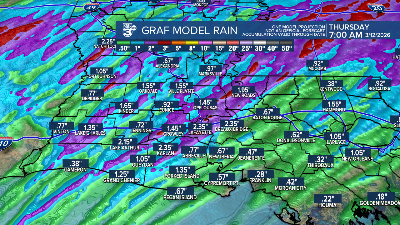
Heavy showers will be likely along the front with most of Acadiana picking up another inch or two of rain, but we may see some isolated areas picking up closer to three inches.
Flooding isn't a major concern but as the showers are coming down we may see a little pooling on some of the roadways.
Much cooler air is expected to filter in behind the system and temperatures will drop down into the 50s with a steady north wind Thursday morning, and we'll remain cool for the rest of the week.
