


Stormy conditions are on the way to Acadiana beginning as early as the late afternoon, and most likely into the evening hours Wednesday.

A storm system advancing through Texas this evening is expected to bring breezy and warm conditions to Acadiana through midday Wednesday.

Scattered showers and storms are expected to develop across the area during the latter part of the afternoon, with more widespread activity into the evening hours.
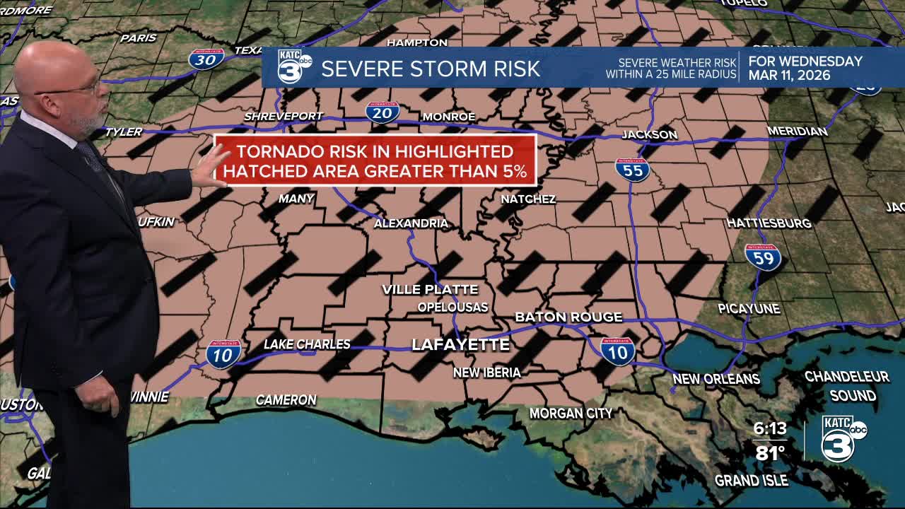
The Storm Prediction Center upgraded most of Acadiana to a slight risk (level 2 out of 5) for storms that could produce "all modes" of severe threats.

The primary threat for Acadiana will be damaging winds, but a few isolated tornadoes, perhaps up to EF1 strength, and hail are also possible.

Prime-time for storms in our area are expected to be between 6-8 pm through midnight to 1 am Thursday, give or take a couple of hours.

Initially storms developing in the afternoon/early evening may exhibit some discrete activity (loner cells), which can cause brief tornadic spin-ups...with the primary line of storms coming later in the evening that could produce a few more spin-ups, damaging winds and some hail.
A "Tornado Watch" for portions, if not all of Acadiana may be required Wednesday afternoon into the evening hours.

Rainfall with this system, per most model data, is suggesting up to 1-2" for portions of Acadiana...isolated hotspots could potentially receive up to 3-4".

Some localized flooding might be possible, especially for the saturated northern Acadiana parishes where 4-7" of rain fell this weekend.

This will be a dynamic wind system as well, with gusts in the 25-35 mph range preceding and accompanying the storms, and the possibility of north-northeasterly gusts near 40-45 mph per our guidance, may be quite possible as the storms pass through any given location.

Storms will end and skies will clear Thursday, along with breezy and significantly cooler conditions for the area to finish the week.
Temperatures will moderate this weekend, but another front is expected to arrive with much less fanfare Sunday night, bringing a spring chill to the area (and possibly one morning in the upper 30s!) next week.
See the KATC 10 Day Forecast and our Power Doppler 3 page for the latest.
