

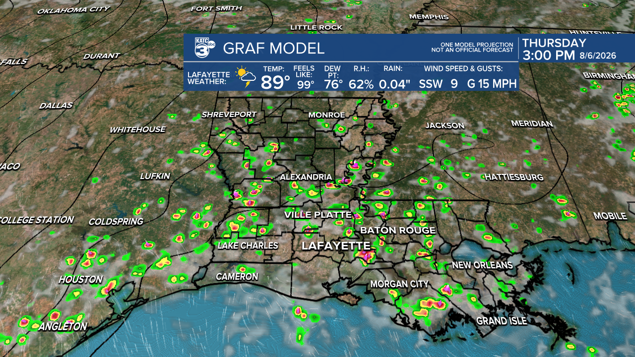


More scattered showers and thunderstorms remain in the forecast for Acadiana Thursday holding temperatures down, while there is more encouraging news regarding this hurricane season.
Expect any activity across the area to dissipate this evening with activity firing up again Thursday...chances of getting wet are set to be near 50-60% Thursday but should drop some Friday into the weekend.

Highs will be closer to the upper 80s to near 90° across the area Thursday but get back into the low-mid 90s Friday into the weekend as rain chances ease.

Rainfall totals mostly will vary from a trace to 1/4" of an inch, but isolated hot spots of 2-3" will be possible as upper level steering remains weak, meaning the storms will be slow to move.

Rain chances should increase again early next week with a drier and hotter pattern returning for the latter part of the week.
See the KATC 10 Day Forecast for the latest.
Meanwhile, the tropics remain quiet and the hurricane forecast update issued today remains encouraging:
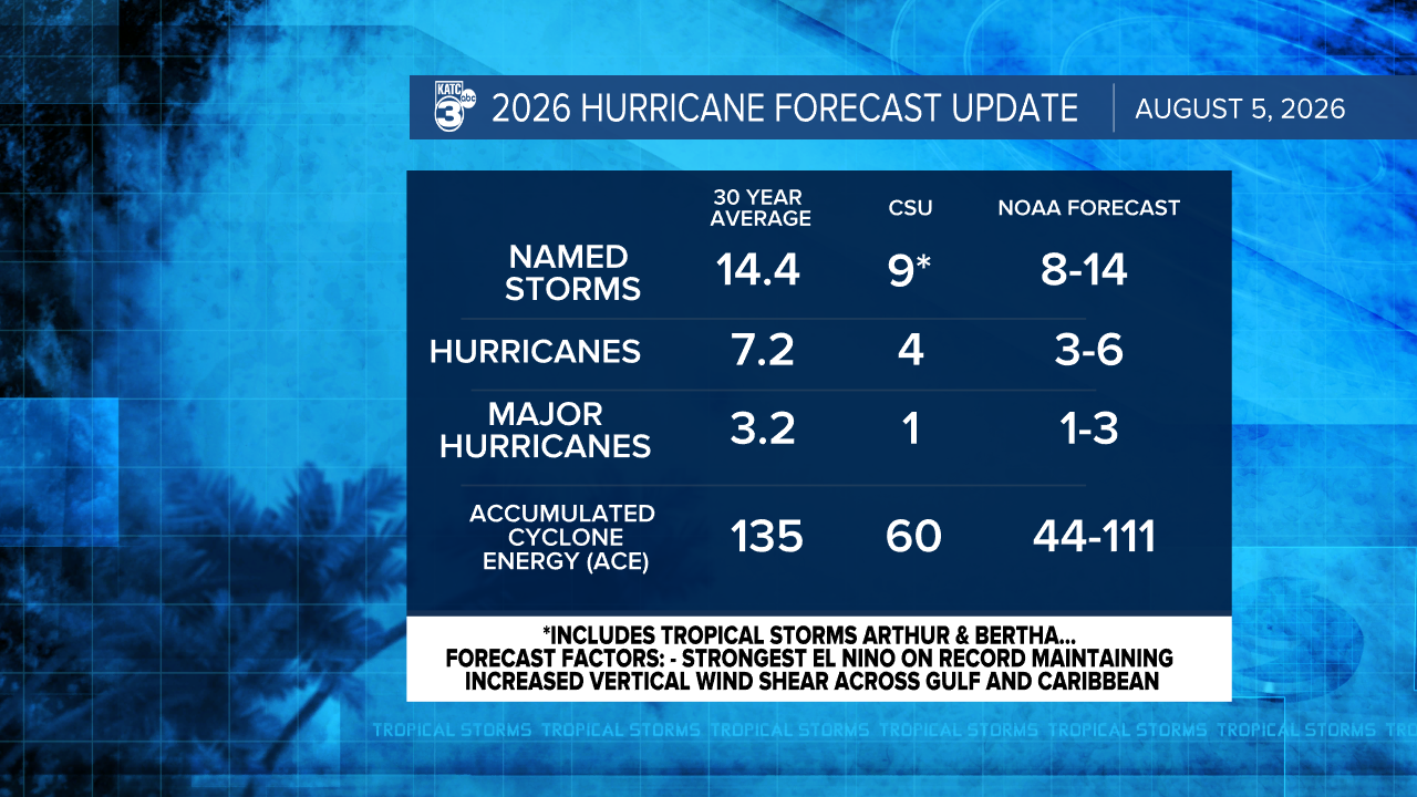
Colorado State's 2026 Atlantic Hurricane Forecast updated today is maintaining that there will be roughly a handful or tropical systems this year as El Niño, the main forecast factor and tropical inhibitor) is currently at the strongest level on record and it won't peak until December!

The El Niño pattern of anomalously warm water in the Equatorial Eastern Pacific is expected to continue to create more storminess in the Pacific Basin while sending robust atmospheric shear into the development zones in the Atlantic from the Gulf through the Caribbean and into the Main Development Region in the Atlantic.

9 named storms are expected (including Arthur and Bertha) 3-4 becoming hurricanes and perhaps one major storm. Given we are two tropical storms down, that means perhaps just 7 more named systems to go...and that may be generous.
In addition, surface water temperature anomalies in the Atlantic development region are below normal.
All good news, but what could go wrong?
Even in relatively quiet seasons there have been U.S., Gulf and Louisiana hurricane strikes...if timing is just right when shear is temporarily lower and/or a storm develops near the Southeast U.S. and/or northern half of the Gulf...usually born of a decaying stationary frontal trough and/or persistent weak upper disturbances.
It only takes one storm at your location to make it a bad year for storms, and we all should prepare equally for every season, busy forecast or not.
But given the data and the science, we all have to like what we're seeing at this time.
Of note: since this El Niño is going to be one for the record books it will influence larger scale weather patterns worldwide, and it will be an interesting experiment on what its manifestations may be...but they will be impactful.
For us in Southern Louisiana it all but insures a cloudy, wet, potentially stormy winter into early spring, and perhaps a slightly better than normal chance of frozen precipitation, mainly ice not as much snow...but something to watch into this winter.
