


After a fairly stormy Thursday, the weather pattern that includes afternoon storms, will continue through the weekend. A ridge of high pressure over the Atlantic will keep a southerly flow at the lower levels, keeping the moisture in place. In the upper levels, a ridge that kept things pretty stable early in the week, has broken down. Therefore, lift from daytime heating won't be inhibited, and storms are fairly likely to develop every day.
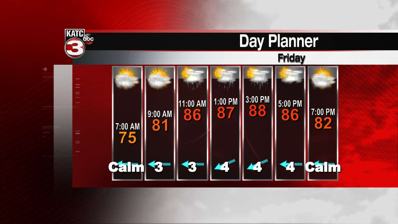
Most of the action will be in the offshore waters and along the coast up until sunrise. Those storms will dissipate, and most of Acadiana will be quiet during the early morning hours. But by midday, scattered storms will develop again and move inland. Most of the storms will continue through the afternoon, and dissipate once the sun goes down.
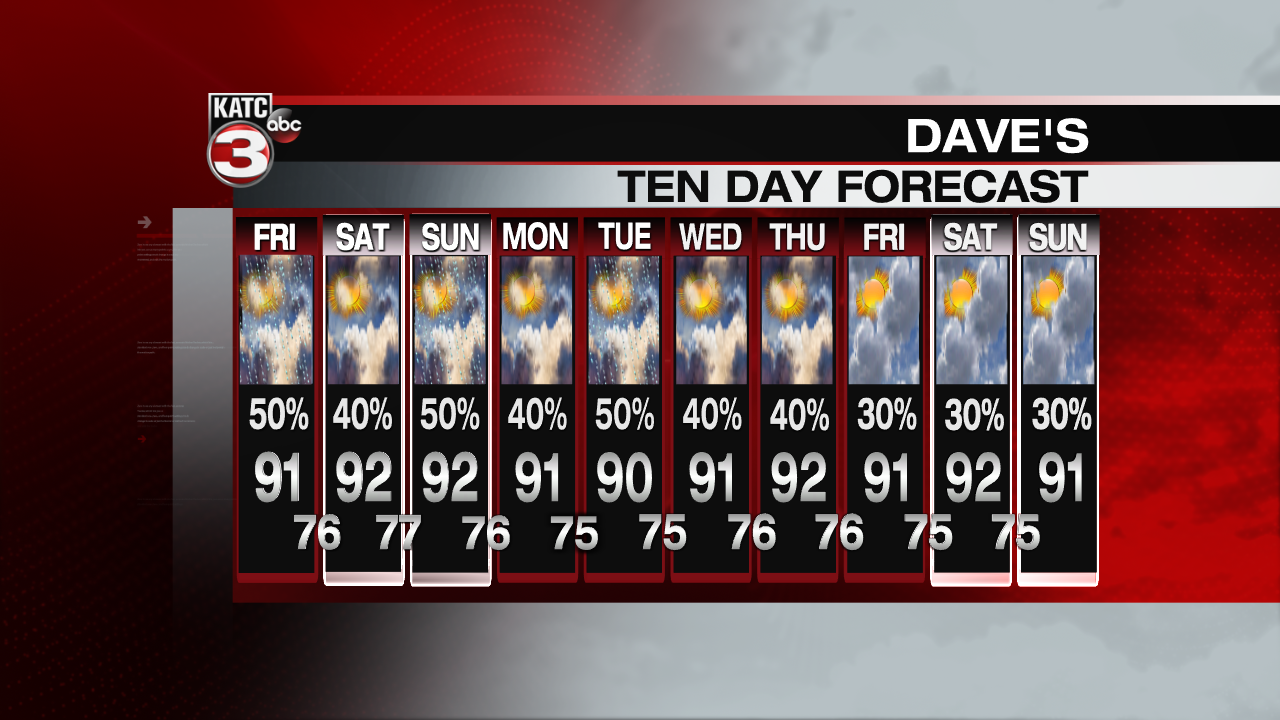
Because there's so much moisture in the atmosphere, and storms are expected to move slowly, significant rainfall totals can be expected if one of these storms pops up over your area. Some of the storms Thursday dropped nearly two inches of rain. Temperatures over the weekend will hold around 90 during the day. Expect mid to upper 70s at night.
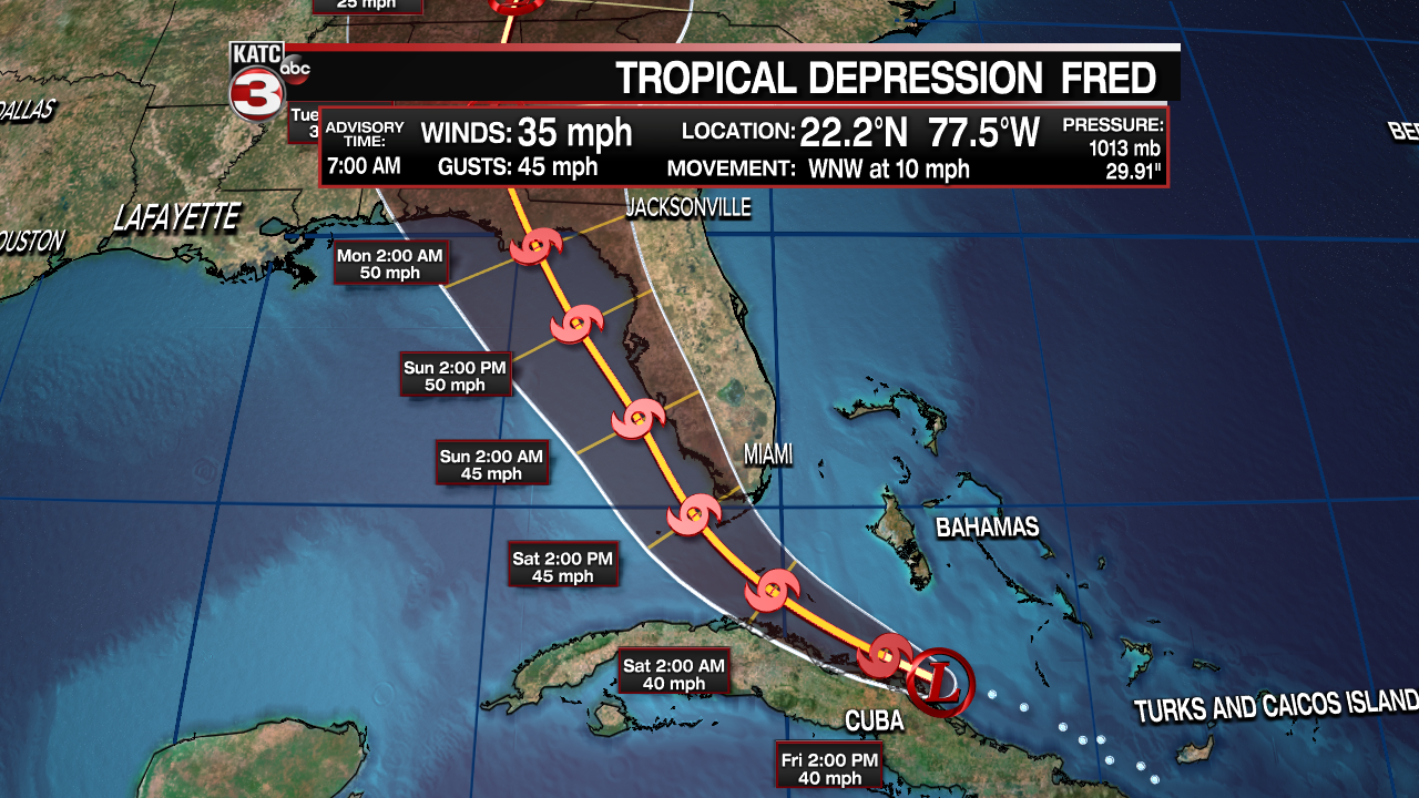
Tropical Depression Fred isn't looking much better this morning. After interacting with land Wednesday and Thursday, wind shear has been the system's enemy over the past few hours. The center is also quite close to the Cuban coastline. As Fred drifts toward the northwest, into the Gulf waters, some strengthening is possible. The NHC forecast still goes for a landfall near Apalachicola, but only a weak tropical storm is expected with peak winds of 50mph. Most of the intensity models keep it as a depression. Heavier rains can be expected on the eastern side of the system, with minimal impacts to the Acadiana area.
Another disturbance (95L) in the Atlantic Ocean has a promising future as it moves westward. The National Hurricane Center nearly certain that a tropical depression or tropical storm will form over the next couple of days.
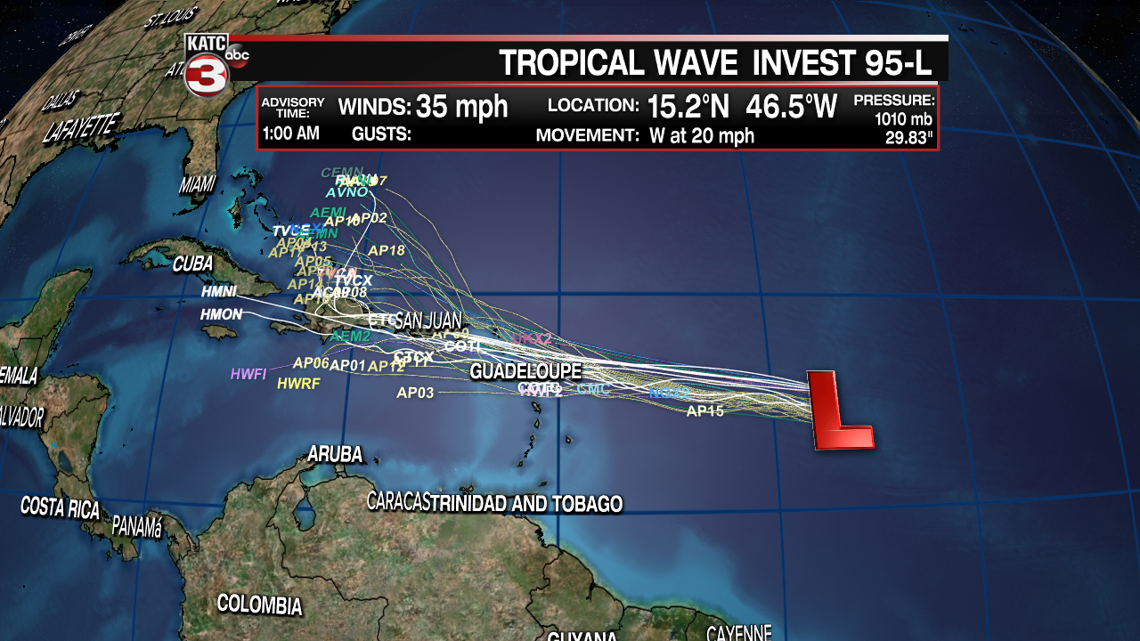
Models generally continue 95L on a westward drift toward the northern Leeward Islands and the Virgin Islands late this weekend. Several models indicate this will become a hurricane between three and five days. The disturbance should round the ridge of high pressure over the Atlantic, and a possible turn toward The Bahamas and the east coast of the United States is possible. Tropical Storm or Hurricane "Grace" will probably be a big weather focus next week.
