


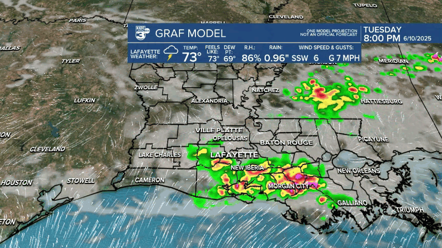
An unsettled pattern with better than normal chances of daytime showers and thunderstorms will likely continue for Acadiana into the weekend.
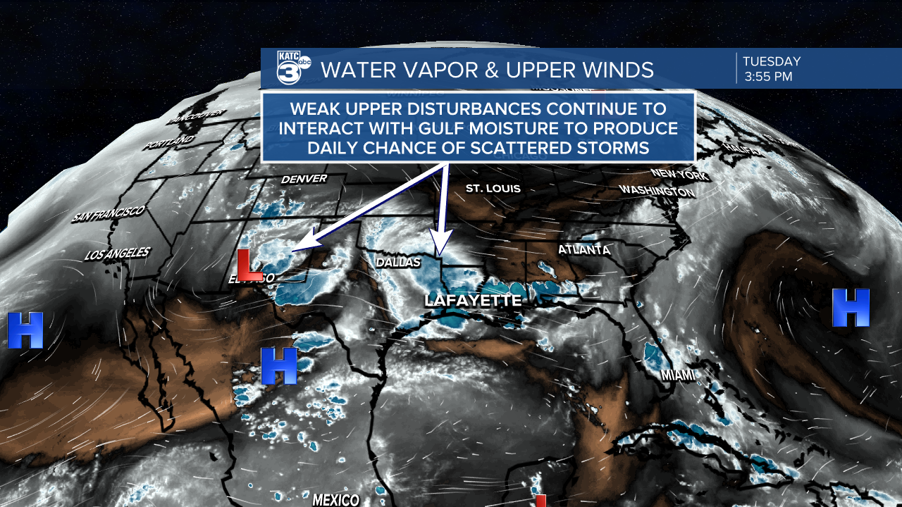
Deep tropical moisture feeding in from the Gulf of Mexico will continue to interact with weak "west to east" traveling upper disturbances for the next several days leading to a good chance of daytime showers and storms in the region in the days ahead.
The pattern remains extremely chaotic to forecast, with activity random in nature, leading variable conditions from town to town....typical for scattered June storms.
Rain chances will stay somewhere between 40-80% through the weekend, whereas normal this time of year should be in the 20-30% range.
A few hot spots could catch a few inches on any given day.
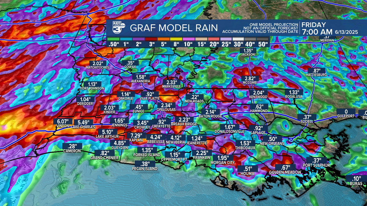
Most areas will see 1-3" between now and Friday, with 3 day rain totals in a few spots up to 3-6" or more.
Temperatures holding closer to the mid-upper 80s can be expected on the days where storms dominate, but on any given day can slip into the lower 90s if storms are tardy or materialize elsewhere...such as today (Tuesday).
Overall, there's little evidence of change in the pattern until a week down the road when high pressure aloft should exert a little more influence on reducing rain chances...and when that happens, it'll be consistently hotter for sure.
See the KATC 10 Day Forecast for the latest.
