

It's the summer that keeps delivering extreme heat. You need to go back pretty far to see when this heat wave got its start. June was the hottest June ever in Lafayette, and July looks to be on record pace too. But the heat really got going consistently in mid May when temperatures were approaching or exceeding 90 degrees on a regular basis. Believe it or not, the first 90 degree temperature was April 1st, and it was a record. This weekend, not only are daily record highs threatened, but some more unusual records too.

Today's high should be around 98. Close, but not good enough to break the record of 100 degrees set in 1960. Saturday's forecast high is 99, that should be good enough to break the record of 98 set in 2015. Sunday will be close again. Forecast high is 100, record is 101 set in 2015. Let's hope we don't break Monday's 124 year old record of 103 set in 1899! The forecast is 102, so we'll be close.

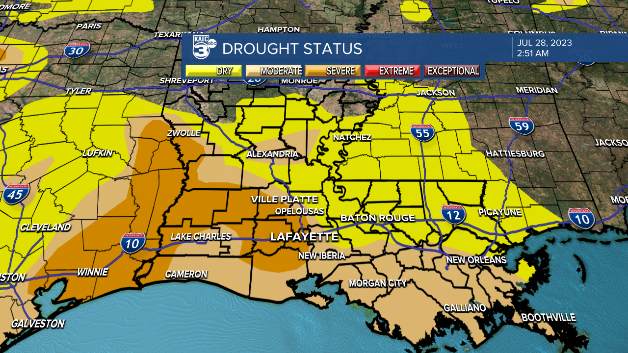
As mentioned in my article Thursday, back in August and September of 2000 we went seven consecutive days with 100 degrees or higher. Our Chief Meteorologist, Rob Perillo let me know that IS the longest stretch of 100 degree highs on record. I have 100+ temps forecast for Sunday through next Saturday. If we hit that mark, it'll be 7 in a row, just like 2000. Could we go eight? Let's hope not. The heat wave will continue into August, with little relief in site. I think the only thing that will save us from any above normal temperatures would be a good breakout of storms, and that doesn't look likely either. Much of Louisiana is in drought status, so any rain would be welcome.
Of course, let's hope big rains don't come from any tropical systems. Only one area looks interesting today, and it's over the eastern Atlantic. Models are forecasting tropical development, and the National Hurricane Center seems to be more confident something could spin up over the Atlantic over the next week or so. Fortunately nearly all of the models keep anything over the waters, well away from Acadiana. The waters are super heated everywhere, so anything that develops, should have a pretty good chance as long as upper level conditions are favorable. Prepare now when it's quiet!

