


Acadiana will stay on the chilly side through Saturday morning, but milder temperatures are expected Saturday afternoon ahead of a good chance of rain and a few thunderstorms late Saturday night into Sunday morning.

Lows overnight into Saturday morning will range generally in the low-mid 40s...some 5-8° milder than Friday morning.

Highs Saturday should push back into the lower 70s as clouds move in and thicken for the afternoon.
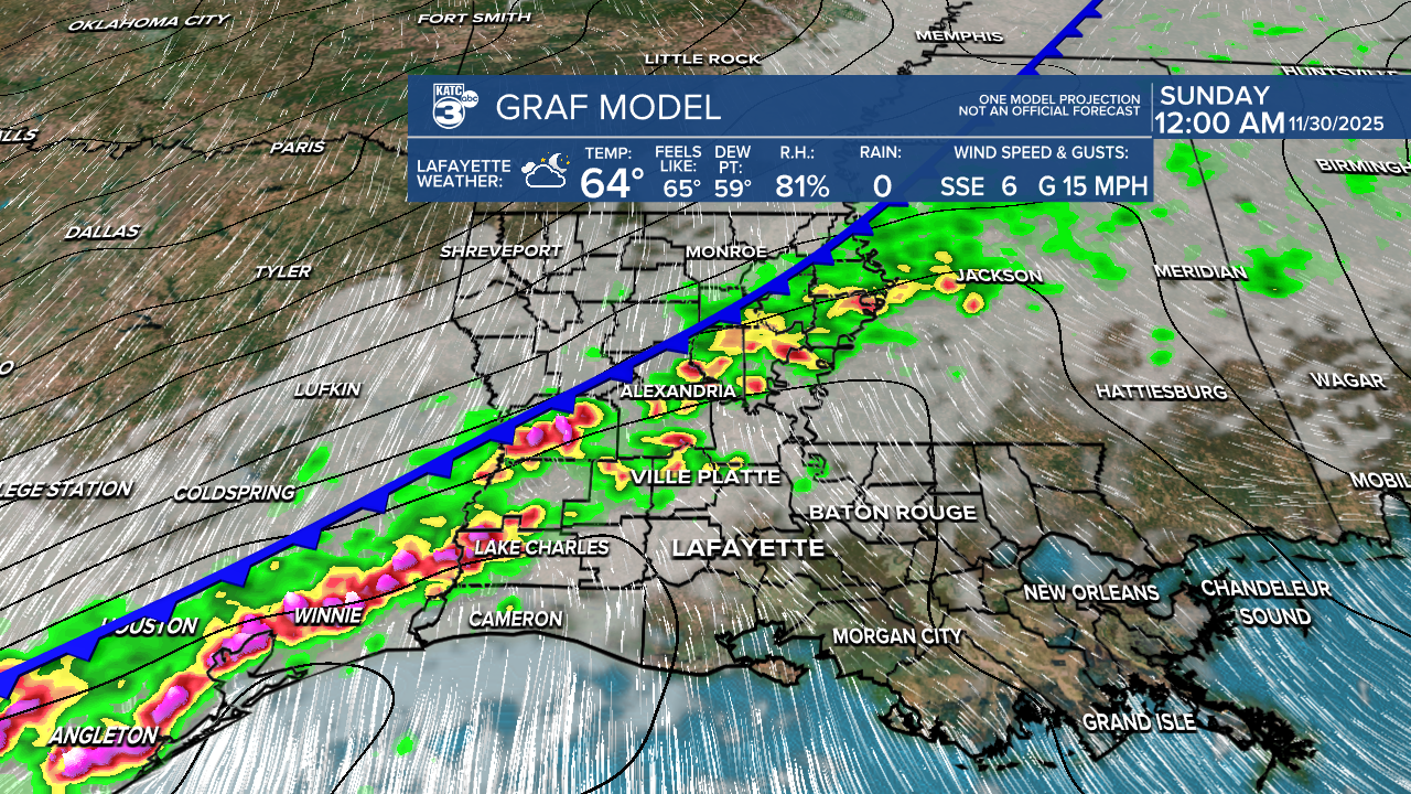
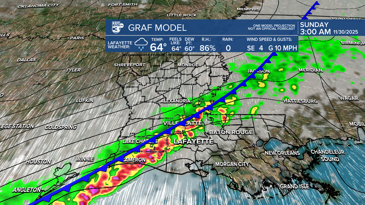
The next weather system for Acadiana will come in the form of a cold front, that should bring a 90% chance of rain and a few thunderstorms late Saturday night, and likely after midnight.
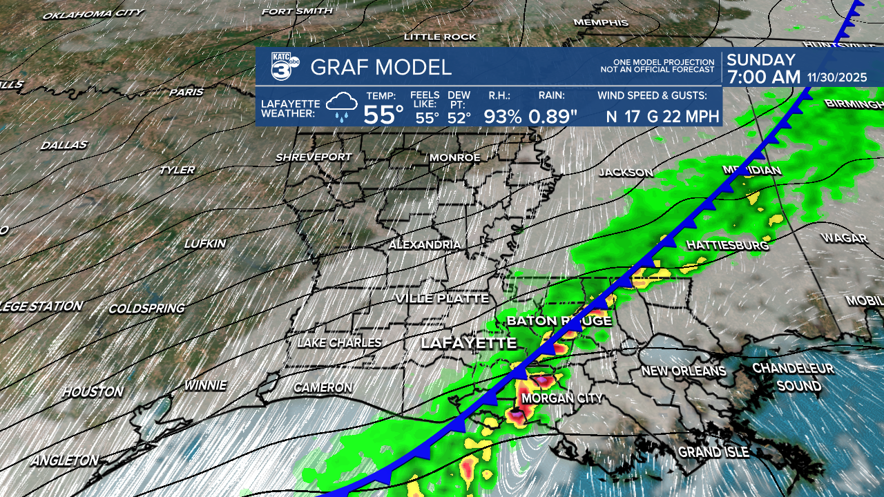
Rains should taper Sunday morning with lingering clouds and chilly highs in the 50s.
At this point, the system looks to have weakening upper dynamics over Acadiana, so the risk of any severe weather appears low...but is not zero.
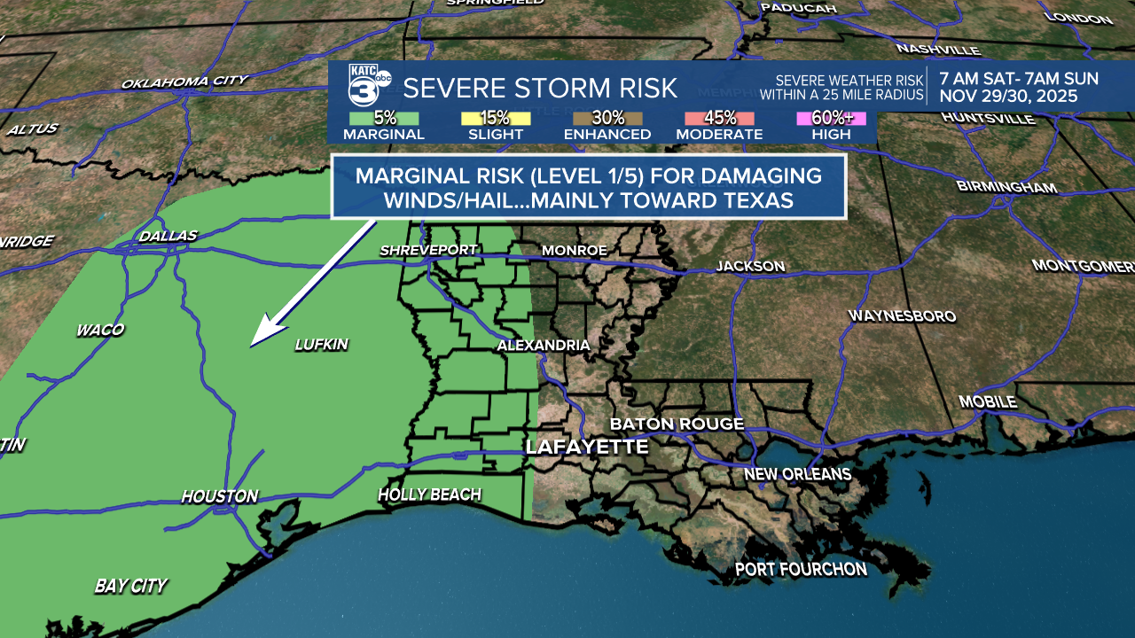
Per the Storm Prediction Center, portions of Southwestern/Western Louisiana are hatched in for a marginal (level 1/5) risk of a few severe storms Saturday night through daybreak Sunday, with the primary threats being isolated damaging and/or some small hail.

Rainfall-wise this quick moving system looks to bring roughly 1/2-1" of rain...probably more to the west...less to the east.
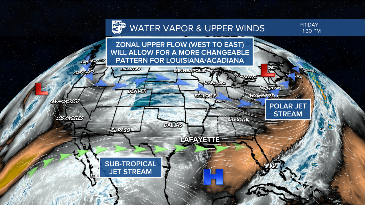
Thanks to a more zonal flow aloft, Acadiana will continue to see a rather changeable pattern through the first week of December.
More rainy weather systems are on the way for our area Monday into Monday night, and they'll be chilly rains with temperatures in the mid-upper 40/lower 50s.
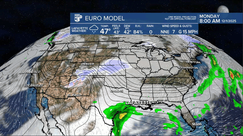
Monday's system should bring a good chance of a couple of inches of rain, but the details are yet to be ironed out.
Another system into Thursday/Friday which should give us a 7 day rain total closer to 2-4" per the Weather Prediction Center.

See the KATC 10 Day Forecast for the latest.
