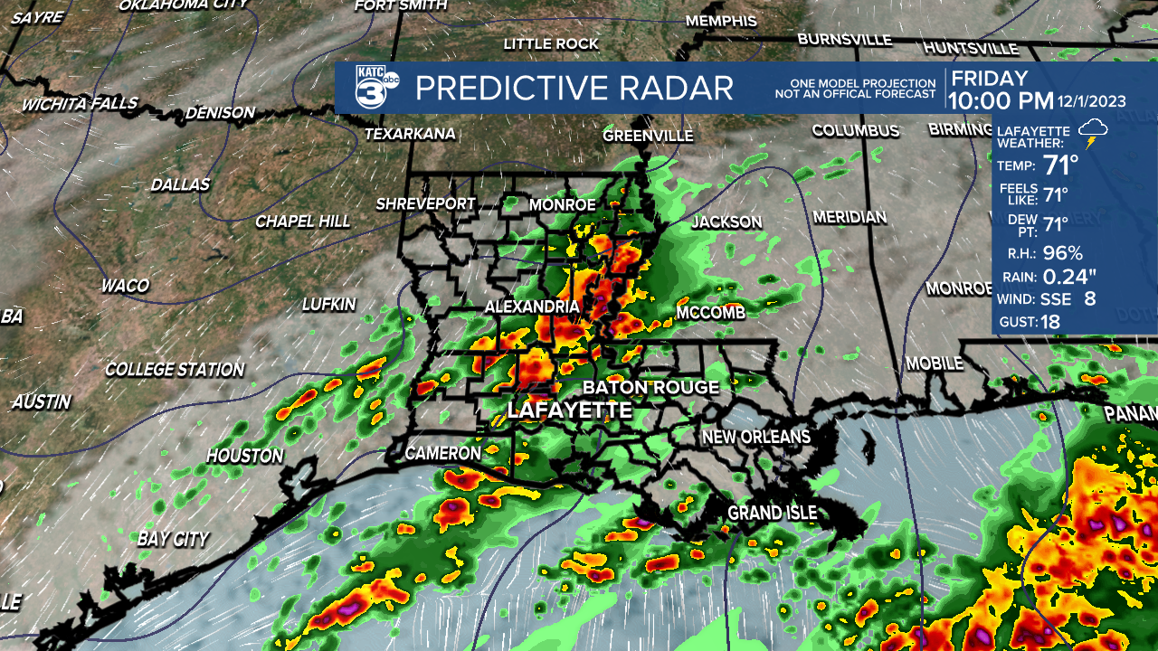
Heavy rains have continued overnight into early Friday. With lines of storms moving over the same areas, some flooding has occurred. Radar estimates are showing rain totals of over five inches in some areas, and official rain gauge reports are confirming at least 3-4 inches of rain hitting the ground. Rain will slowly push eastward this morning, but another round is likely to develop this afternoon.

A front is stalling to our west, and we're locked in to a warm and moist air mass. An upper low moving out of Texas is now riding northward toward the mid Mississippi Valley. As the low moves away, our chances of rain will drop off for a while today. Another piece of energy is rounding the base of a trough over the desert southwest. As that opens up and heads eastward, another round of rain will develop ahead of the front.

Again, some heavy rains could roll over the same places that have seen several inches of rain so far. Therefore the flood threat will continue. Models are showing an additional 2-4 inches of rain could fall.

Rain will linger into Saturday with showers likely at anytime during the day. Temperatures will remain on the warm and muggy side. A few showers may be on the heavy side, but models are showing the heaviest rainfall totals may end up over the Gulf of Mexico. By Sunday everything starts shifting eastward and rains will subside. Clouds will hang on Sunday before the front finally pushes through Monday helping to clear our skies and allow a few days of drying out. Temperatures over the weekend will remain in the 70s, while more seasonal temperatures are expected next week.


