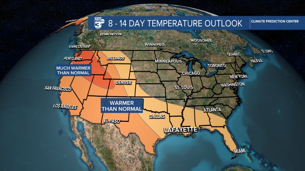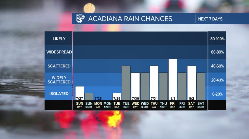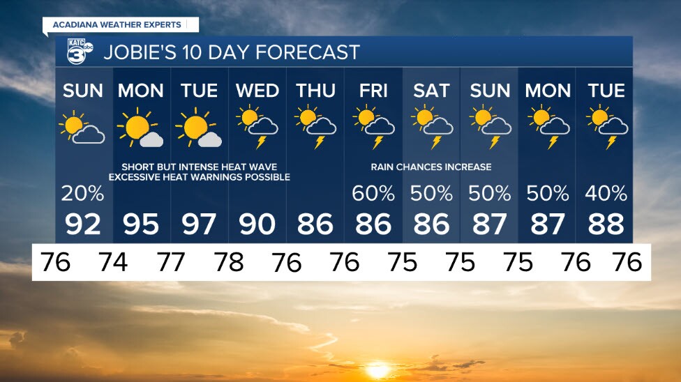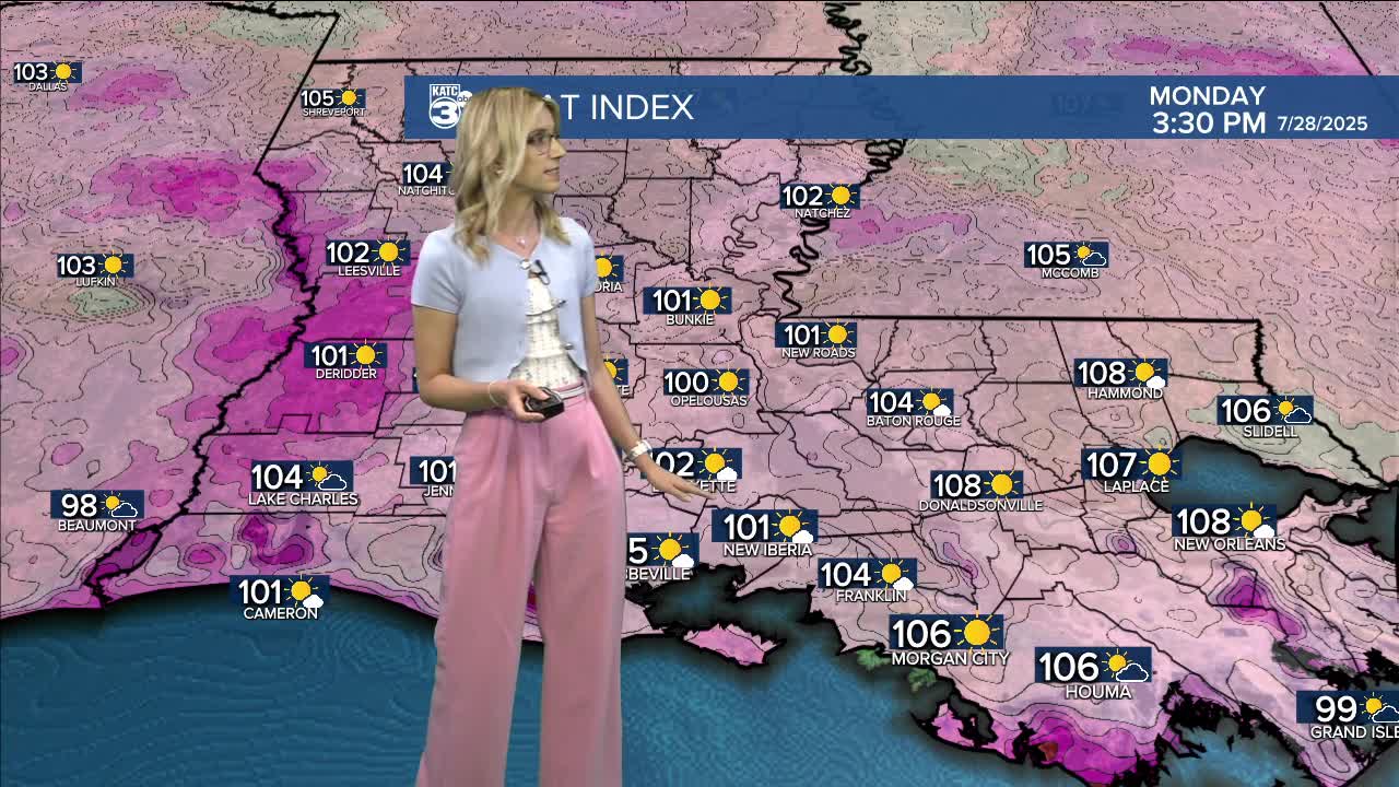


We have a heat wave making headlines as we look ahead to our work week on Monday. In the meantime, we have some lingering rain chances through the end of the weekend.
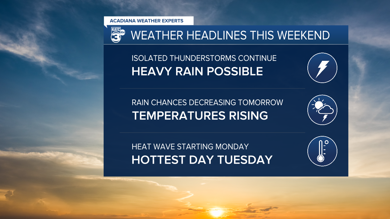
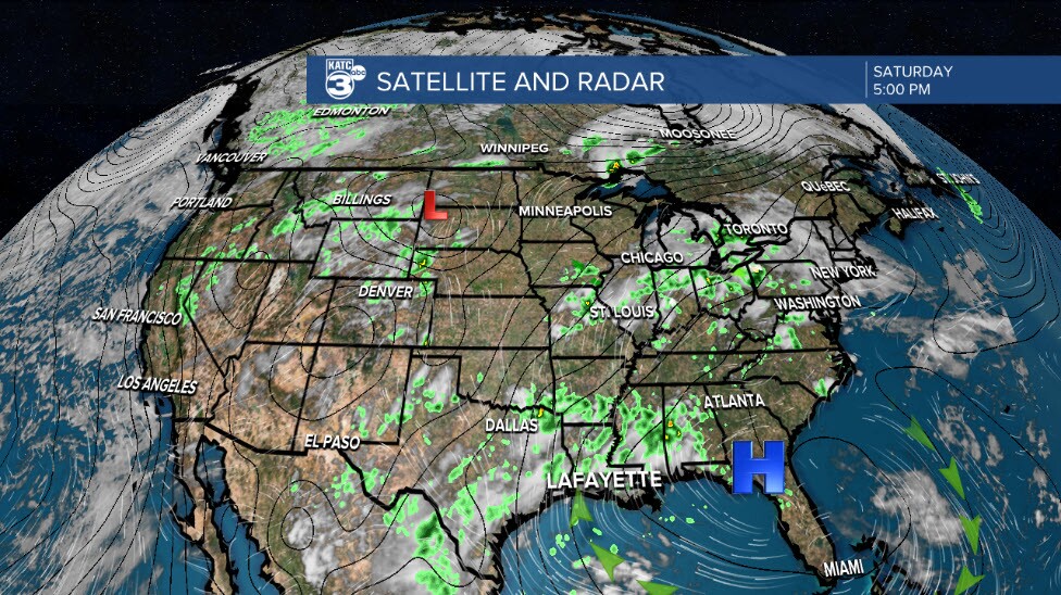
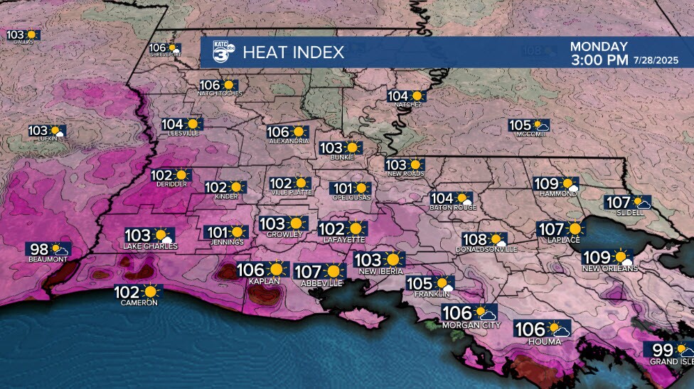
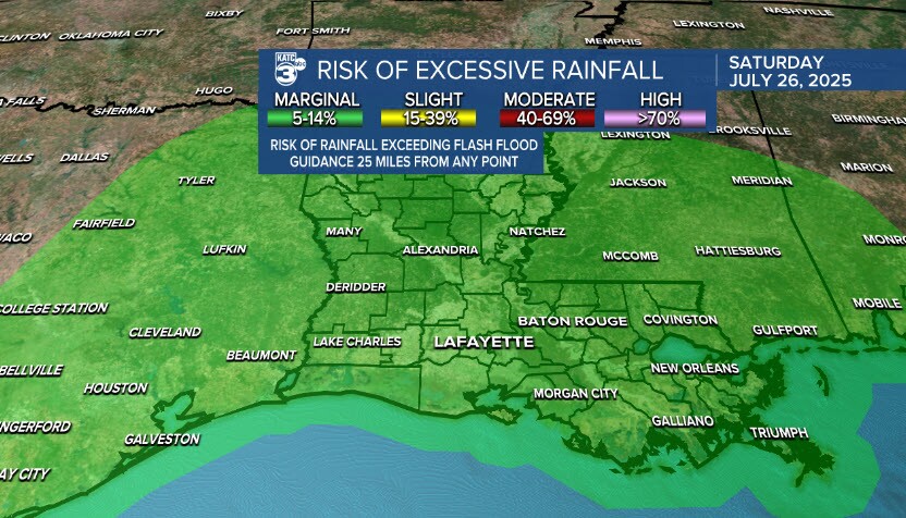
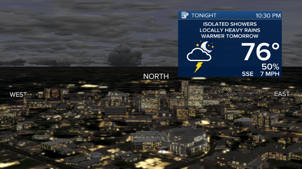
Although showers and thunderstorms are remaining isolated in nature, the air is so saturated that any storms that form and can get going are efficient rain producers. The Weather Prediction Center is keeping us in a Marginal Risk for Excessive Rainfall due to this. So make sure to be weather aware if it begins raining in your area and take any flash flood alerts seriously. Rain chances will begin to decrease tomorrow, and Monday even further as a high pressure system builds into Acadiana bringing lots of heat and high temperatures with it.
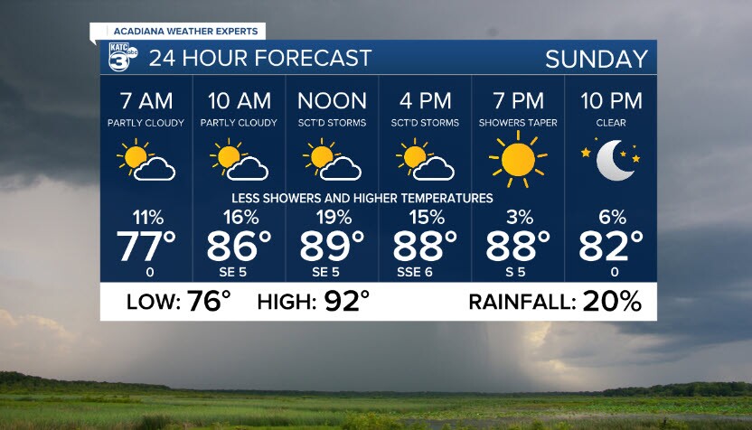
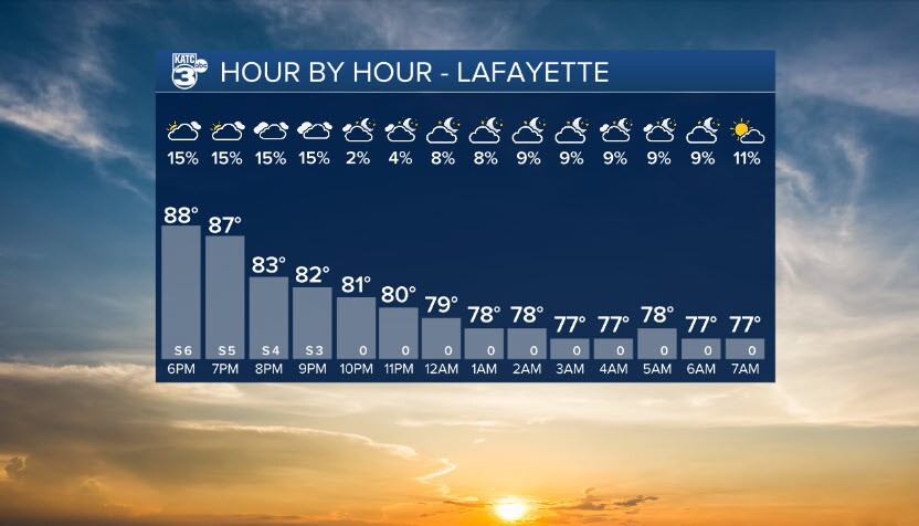
Your hour by hour forecast. Very typical Louisiana Saturday night with lows remaining in the mid to upper 70s and rain chances decreasing with the evening.
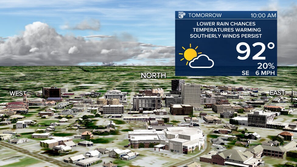
Tomorrow we will see weather similar to today, with the exception that we see rain chances decrease, allowing temperatures to become warmer as that high pressure builds over Louisiana.