


The chances of scattered showers and thunderstorms will increase again this week with highest chances and the risk of heaviest downpours returning by Wednesday and Thursday.

As of Sunday evening, per the National Weather Service, central and eastern portions of Acadiana remain under a Flood Watch through Monday evening, where best rain chances should develop by Monday afternoon.
Rain chances eased down to 40% Sunday but will ramp back up to near 60% for Monday and Tuesday, and then 80% Wednesday and Thursday with more active disturbances returning to the area.
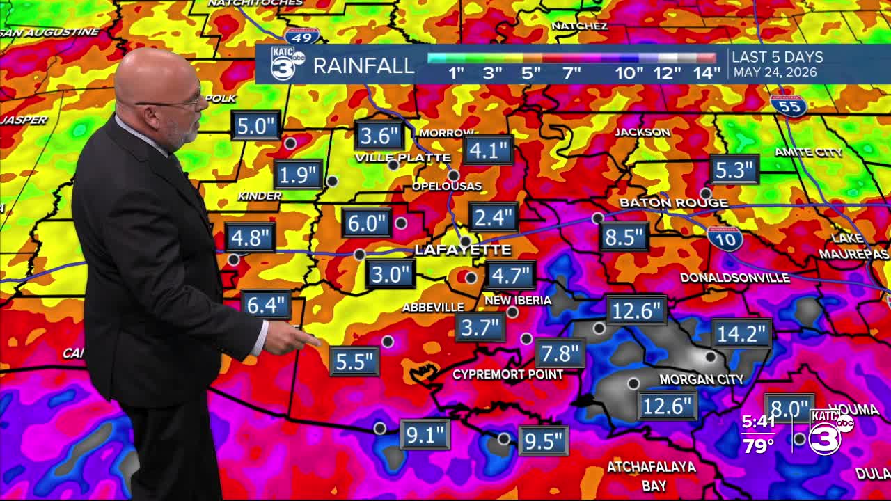
Rainfall over the last 5 days for Acadiana have ranged from 1-2" in few spots, with most having seen somewhere between 2-6", and there's been 8-12" plus for portions of Iberia, Lower St Martin and St Mary Parishes.

Thus, the flood watch continuing in these areas.
Rainfall through the next 48 hours looks to be heavier to the east where an additional 1-3" for most between central and eastern Acadiana with much lesser totals and lower rain chances west toward Lake Charles.
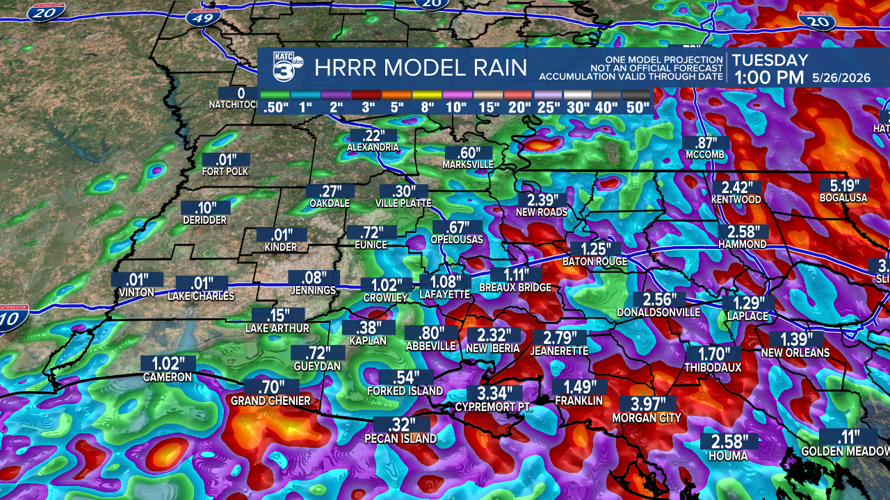
This risk of heaviest downpours Monday looks to be across Iberia, St Martin and St Mary parishes so some localized street flooding may be most possible.
Rain chances look to stay in the 50-60% range Tuesday with bigger rains and heavier storms likely to develop in a more energetic pattern Wednesday and Thursday.
Additional rainfall over the next 6-7 days will range from anywhere from 2-6" with isolated hotter spots likely, especially in the eastern half of Acadiana.

Rain chances look to begin to ease to a more "normal" pattern starting around next weekend, but may not be eliminated for the latter part of our 10 Day Forecast.
Temperatures over the wet days this week are expected to remain mostly in the lower-mid 80s for highs while night-time lows remain near the lower 70s.
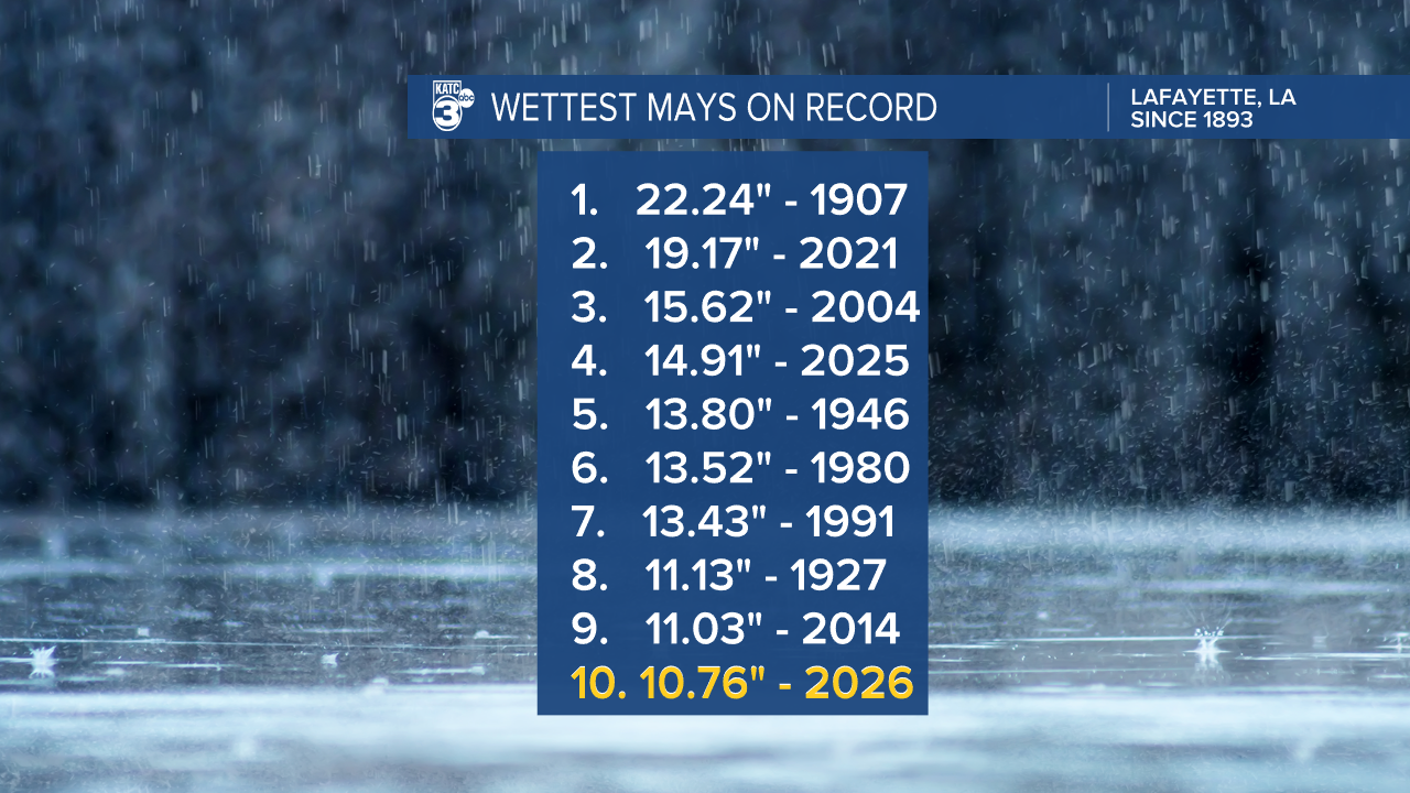
Climate Update: Lafayette has cracked the top 10 wettest Mays on record since 1893 with more slots to move up likely in the week ahead...
