


Rain chances will ease across Acadiana over the next few days allowing for our first real taste of summer-like heat and humidity this week.
In the near term, look for any isolated shower activity to dissipate early this evening and hopefully skies are clear enough during the early evening when bright Venus will be closely paired with Jupiter.
The satellite imagery late this afternoon does not look too promising, but if we miss it tonight there will be another opportunity tomorrow evening.

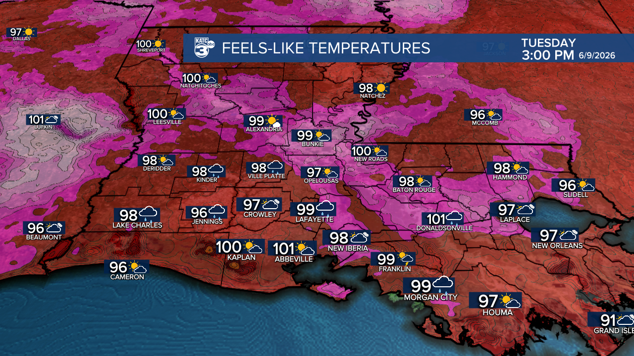
Temperatures will level off in the mid-70s Tuesday morning and rise to near 90° Tuesday afternoon. Heat index values will be near 96-101° Tuesday.
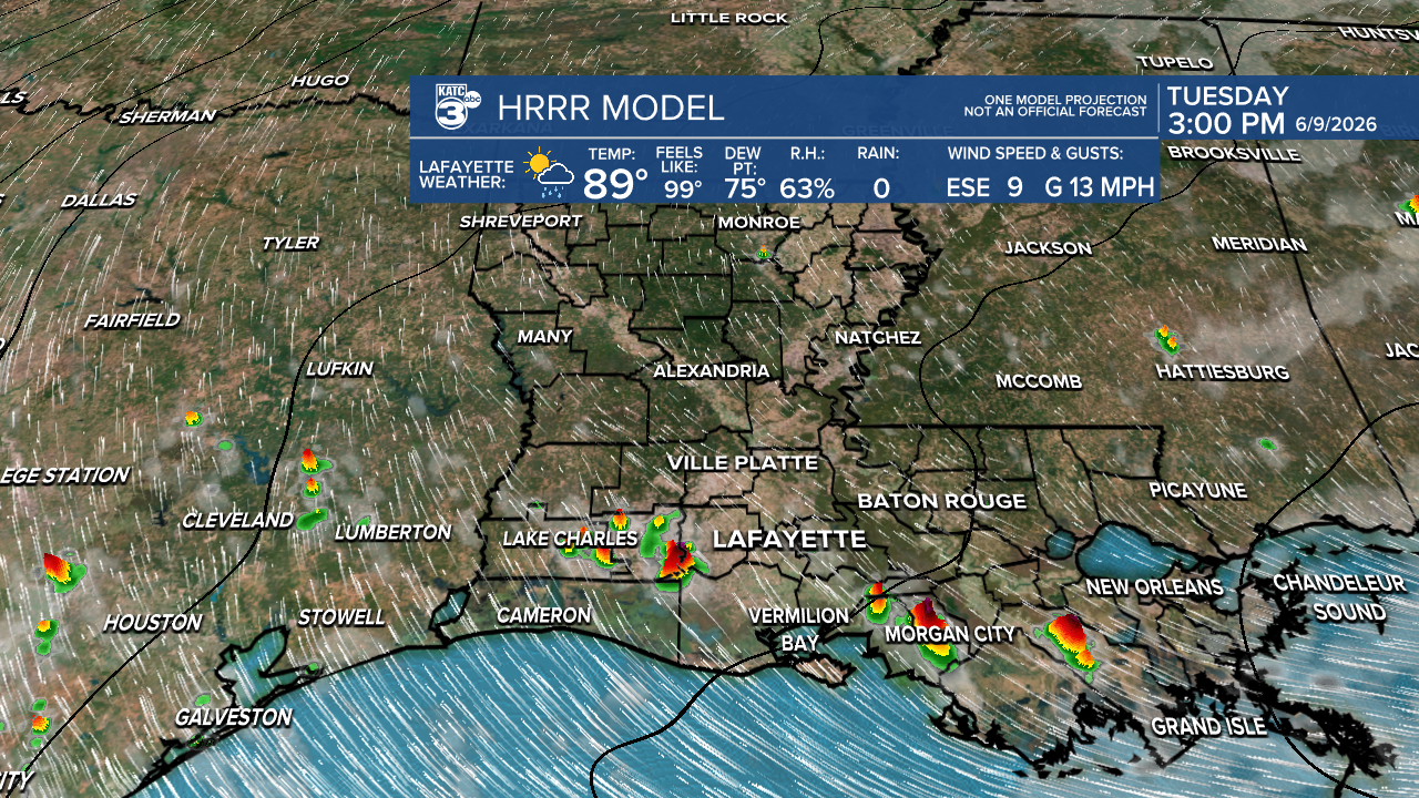
There will be a few more scattered showers and a few afternoon thunderstorms Tuesday with rain chances in the neighborhood of 40%.
Rain chances are expected to drop to 20% or less Wednesday and Thursday allowing for daytime highs to reach the lower 90s while heat indices rise over 100°.

Typical summer-like heat and humidity along with the chance of scattered afternoon showers and storms will continue through the weekend.
Deeper tropical moisture may enter the area early next week (see the tropical discussion below), allowing for increased rain chances at that point.
See the KATC 10 Day Forecast for the latest.
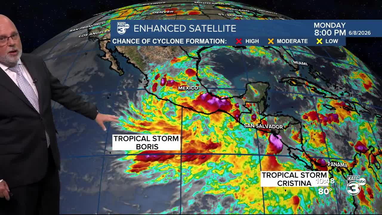
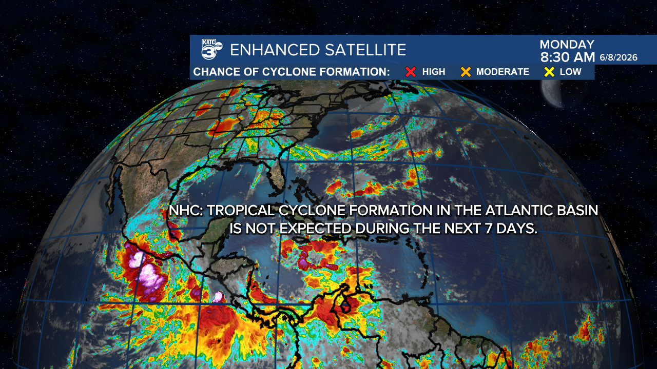
Meanwhile in the tropics, the Atlantic Basin remains quiet at this time, with the National Hurricane Center indicating that tropical cyclone activity is not expected in the next 7 days.
We are however watching a busy Eastern Pacific with two tropical storms near the Mexican Coast.
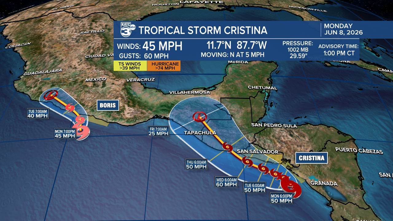
Newly formed Tropical Storm Cristina is the system we'll watch for Gulf interests as the system moves inland into portions of Central America and Mexico later this week.

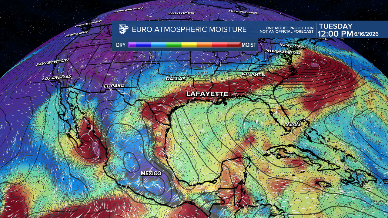
The remnant system/deep tropical moisture is expected by the Euro Model to emerge in the SW Gulf/Bay of Campeche around this weekend.
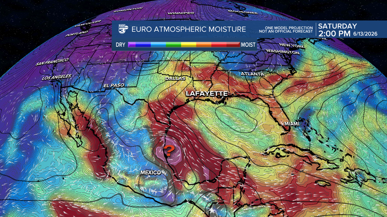
Whether there is any re-development or not remains to be seen, but we'll be watching the remnant system and in particular, the deep tropical moisture, as it progresses toward Mexico and perhaps Texas.

There remains the possibility of some of that deep tropical moisture reaching our neck of the woods in Louisiana in about a week's time...when chance of tropical rains could increase locally.
But for now, no local worries.
St Medard's Day!
Today is St Medard Day...local pronunciation: "Sam-ee-da"!
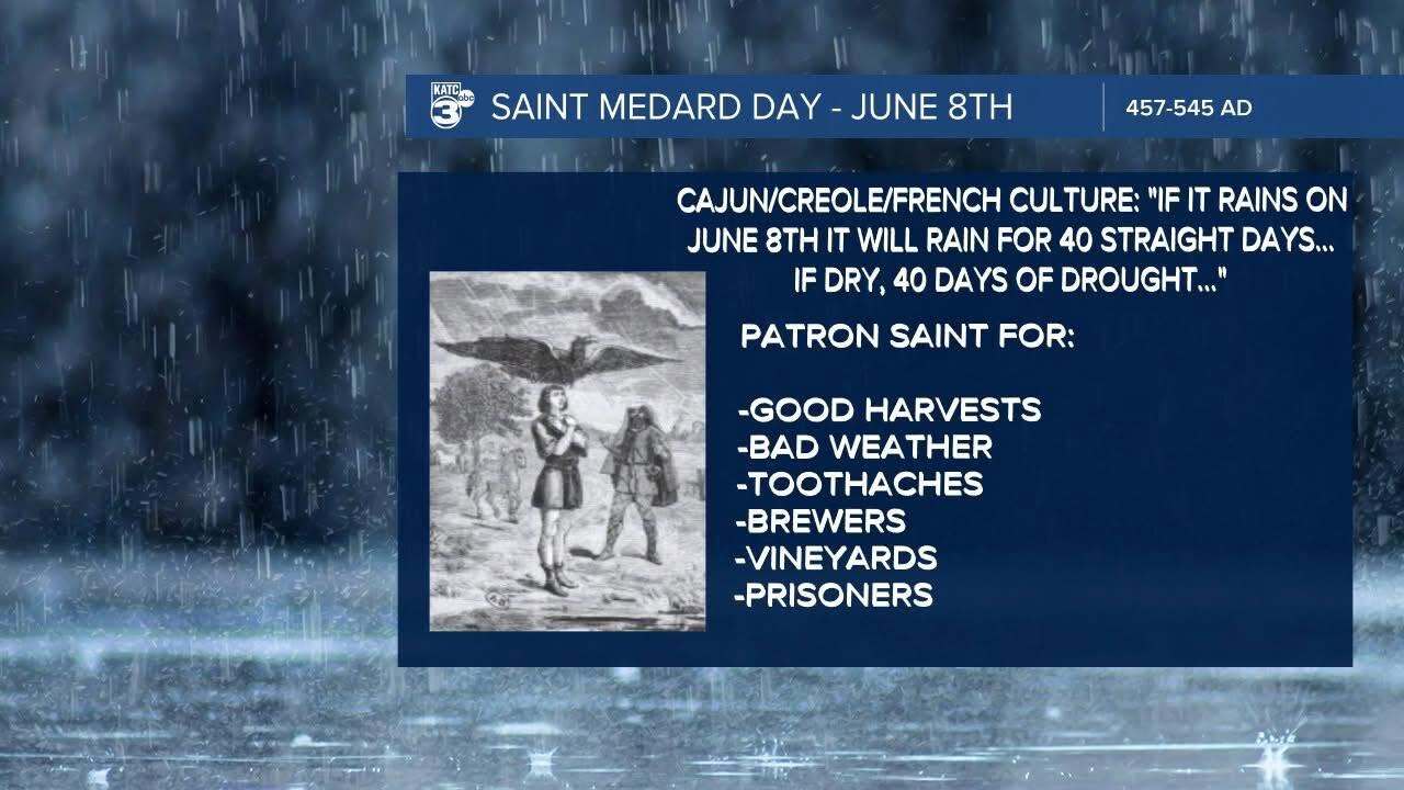
According to Cajun/Creole and French catholic culture, "If it rains on June 8th it will rain for 40 straight days...if dry, 40 days of drought..."
Most of us in Acadiana have not seen much in the way of shower activity through late Monday afternoon...
