


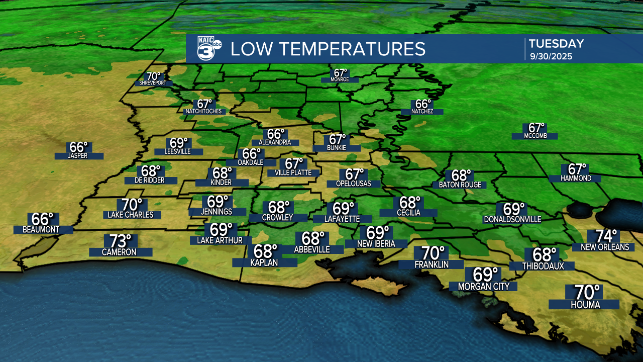
After some nice fall-like days for Acadiana, moderating temperatures with highs back near 90° are expected for the rest of the week, while we continue to track two Atlantic tropical systems.
In the near term, an upper disturbance in Texas is expected to cross the area tomorrow bringing plenty of mid and high level clouds, but with perhaps a few sprinkles but with no measurable precipitation at all.
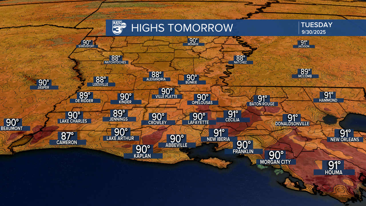
There should be enough intervals of sun in between the cloud cover Tuesday to help get our temperatures close to the lower 90s for afternoon highs.
More sun should return Wednesday with fair to partly cloudy skies expected for the rest of the week and into the weekend.
There are hints we could see a few showers Wednesday and then again toward the Sunday/Monday time frame.
What we don't see, is a significant cool front through the next one to two weeks...it will eventually arrive, bit more likely later into the month.
See the KATC 10 Day Forecast for the latest.
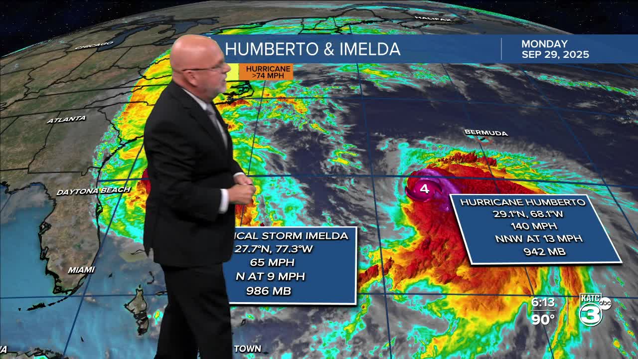
Meanwhile it's a busy period for the Western Atlantic between the East Coast and Bahamas to Bermuda.
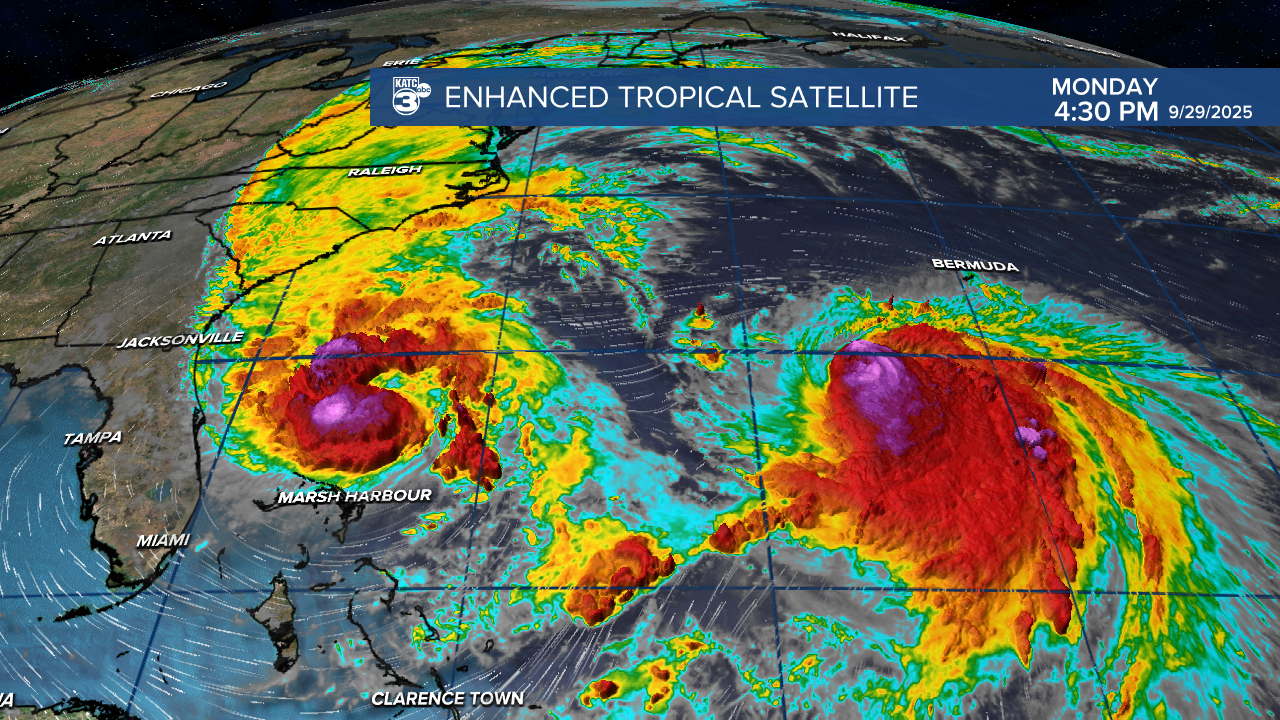
Major Hurricane Humberto is expected to skirt to the west of Bermuda with potential tropical storm conditions (or at least some strong rain squalls) for the island Tuesday...currently there's a tropical storm watch here for Humberto but a hurricane watch was also posted this afternoon for the island regarding Imelda.

Thereafter, the tiny island will be watching Imelda which could be a more substantial threat and is currently expected to be near category 2 status as it nears the area. A hurricane watch was issued for Bermuda at 4pm this afternoon.

Imelda's potential impacts on Bermuda look to occur late Wednesday and/or into early Thursday.
GRAF Model forecast regarding Humberto and Imelda below:
