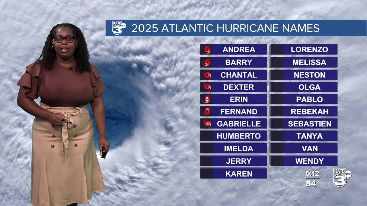

The tropics have been quite active over the past few days, with the formation of Tropical Storm Humberto, Invest 94L, and Post-Tropical Cyclone Gabrielle.
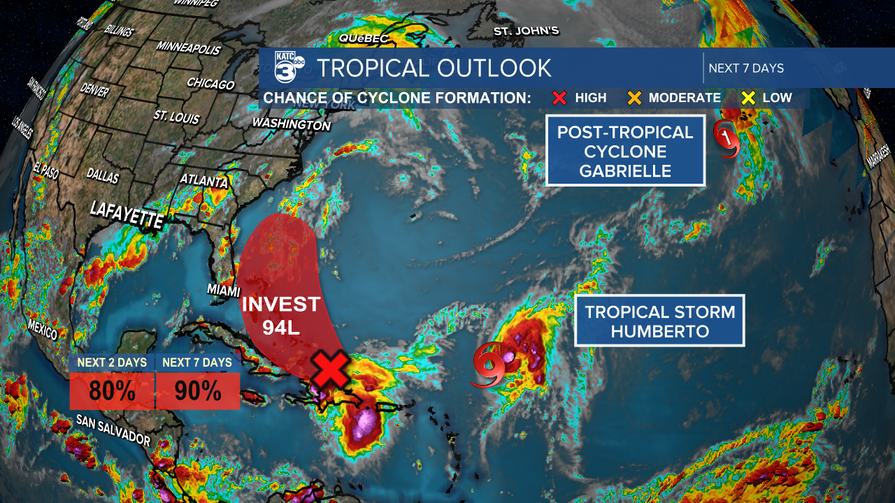
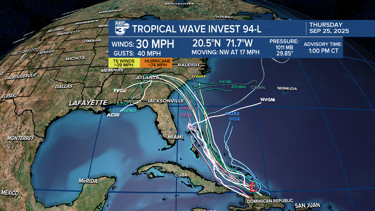
Let’s start with Invest 94L. This tropical wave is currently located near Hispaniola and the Turks and Caicos Islands. It is expected to develop into a tropical depression or storm either late tomorrow or this weekend.

We may soon see the emergence of Tropical Storm Imelda! Most of the spaghetti models show this system moving over the U.S. It's definitely something for the coast of Florida, Georgia and the Carolinas to watch out for.
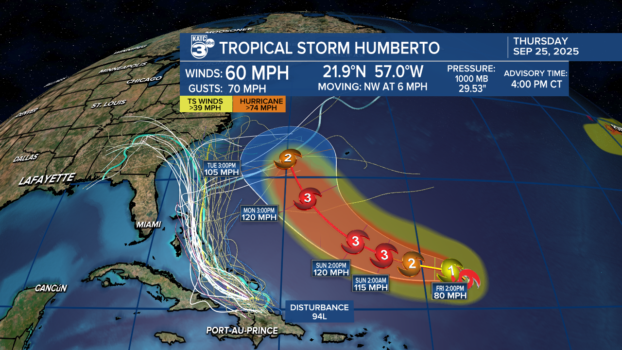
As for Tropical Storm Humberto, it is likely to strengthen into a hurricane tomorrow and may become a major hurricane over the weekend.
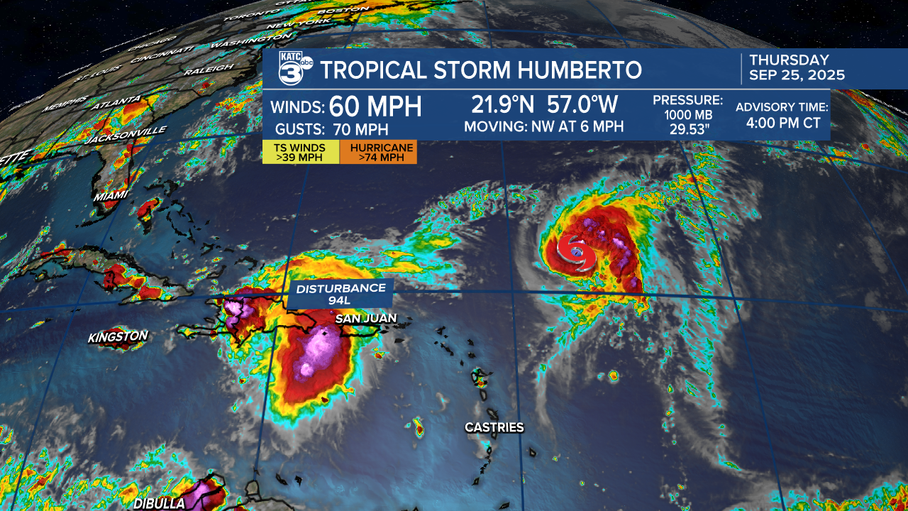
Humberto is projected to move northwest, passing just west of Bermuda. For now, it remains over the open waters of the Atlantic, but we can expect an increase in rough surf and rip current risks along the east coast.
Meanwhile, Post-Tropical Cyclone Gabrielle is moving east at 31 mph, with sustained winds of 70 mph. It is bringing hurricane conditions to the Azores Islands, potentially becoming the first hurricane to strike the island in more than a decade.
Cooler Fall mornings are in store this weekend!
See the KATC 10 Day Forecast for the latest.
Follow Meteorologist Breyanna Lewis for further updates.
