


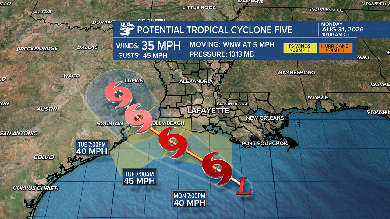
The National Hurricane Center has started issuing advisories on Potential Tropical Cyclone Five as tropical storm conditions have been recorded as a Gulf system has show signs of organizing.
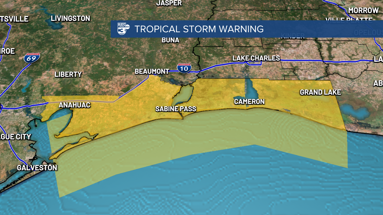
A tropical storm warning has been issued for Cameron Parish and the coastal waters from Galveston to south of Vermilion Bay, tropical storm conditions can be expected in these areas in the next 24 hours if they're not being felt already.
The worst of the weather is expected along the Cameron Parish coast in the early morning hours of Tuesday with landfall expected Tuesday afternoon just west of the Louisiana state border.
Impacts to the rest of Acadiana will be minimal with a few rain bands possible over the next couple of days, but as they're moving quickly flooding isn't expected to be an issue.
Storm surge and wind impacts look minimal even along the Cameron coast with most of the activity staying south of the storm center.
Rain totals around the center may push 6" but will be confine to a localized region near the storm center as it makes landfall which will likely be west of Sabine Pass.
We'll continue to monitor the system with some strengthening expected but rapid intensification looks unlikely.
