


The chance and coverage of scattered afternoon showers and typical summer thunderstorms should improve over the next couple of days for Acadiana, giving us some relief from the heat, but not so much the humidity.
High pressure aloft is expected to weaken a little through Thursday allowing for roughly a 40% chance of afternoon storms for Wednesday, and 40-50% Thursday.
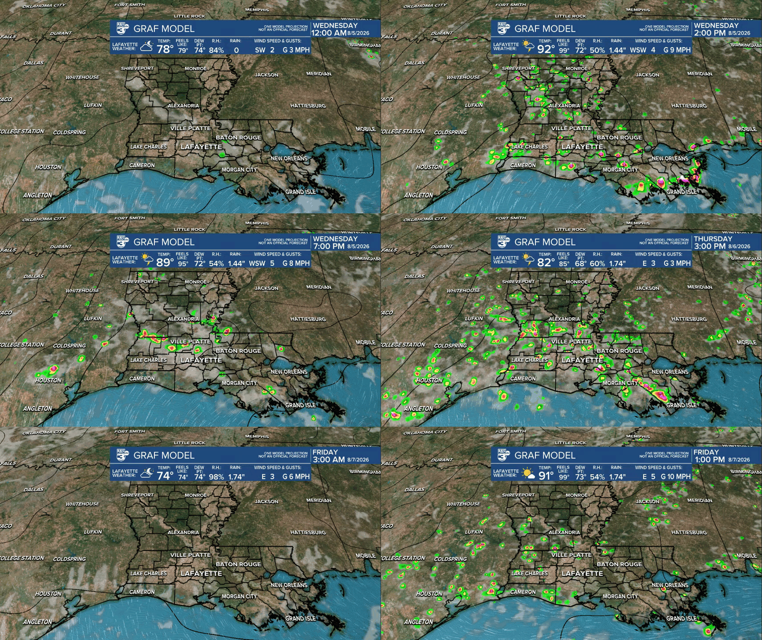
Most of us will not get meaningful rainfall, but at least we should see some of the edge taken off the heat and a little moisture for the ground in some areas.

Per usual, most areas may catch 1/4" or less, while there will be some spots that catch a couple of inches, as storms will be slow to move with very light winds aloft to push the activity along.
Thereafter, our rain chances into the weekend will start near 20-30% and finish near 40-50% Sunday as a little more of a weakness redevelops in the upper atmosphere.
This will leave us with our best chance of rain, currently estimated to be Monday at 60%.

Later next week it just continues to look like August being August with more hot and humid conditions accompanied by the chance of at least a few scattered afternoon storms.
Highs will stay mostly in the low-mid 90s unless storms are more prevalent, when we could slip in a day with highs closer to the upper 80s...Monday is the best chance for that.
See the KATC 10 Day Forecast for the latest.

Meanwhile, the tropics are quiet with no suspect areas per the National Hurricane Center.

A decent looking wave is coming off of the African Coast with a few more expected behind it in the next week ahead, but conditions are expected to remain rather hostile for any Atlantic development through at least mid-August...and for now, zero worries.
