

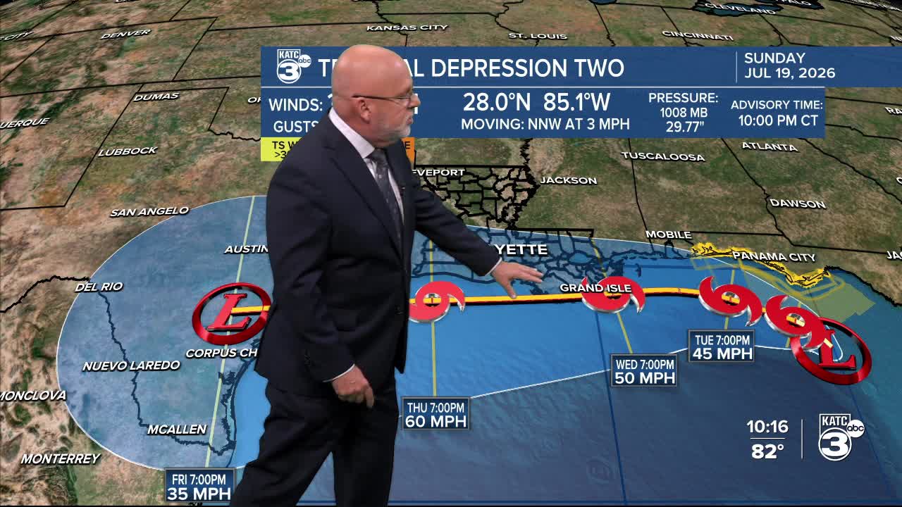


Tropical Depression #2 is expected to become Tropical Storm Bertha Tuesday and eventually slowly drift westward across the Louisiana/Acadiana Coast with mostly some wind impacts with the system possible for Acadiana later this week.
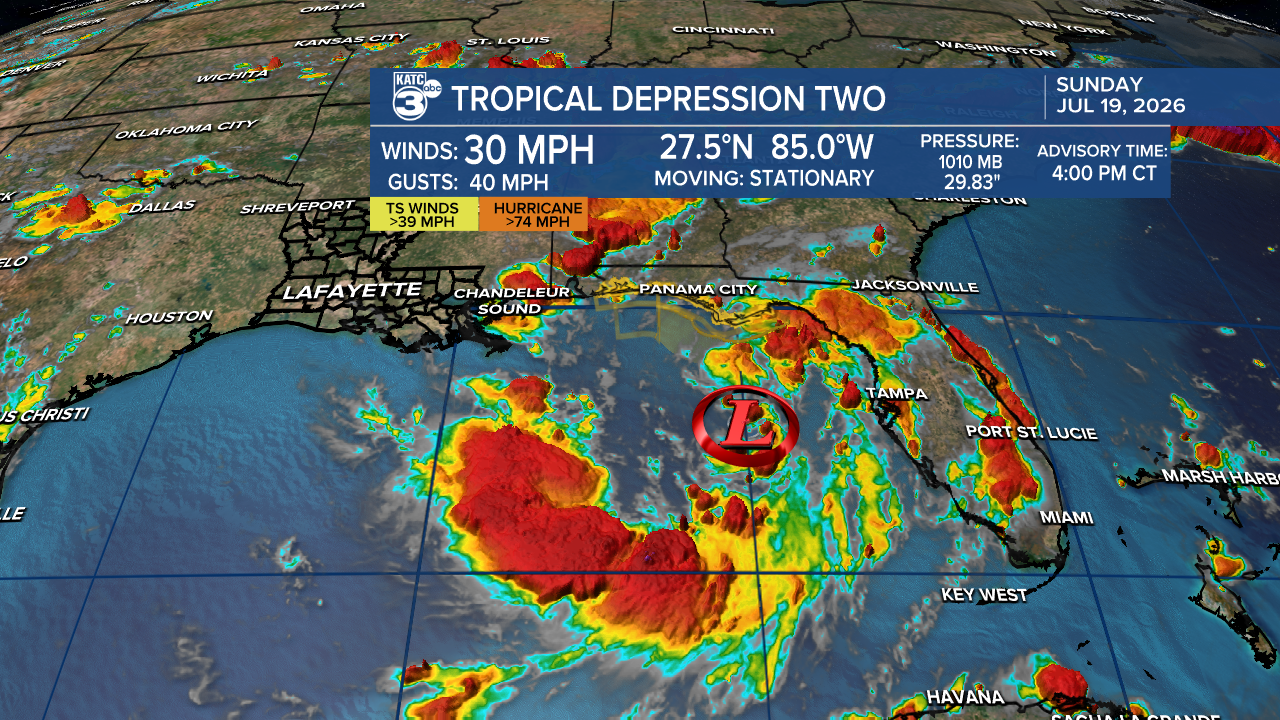
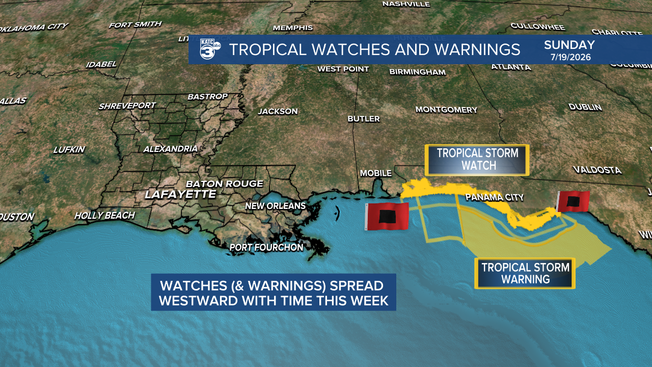
Tropical Storm Watches could be issued for potions of the Louisiana Coast by Tuesday, or later this even later this Sunday evening.
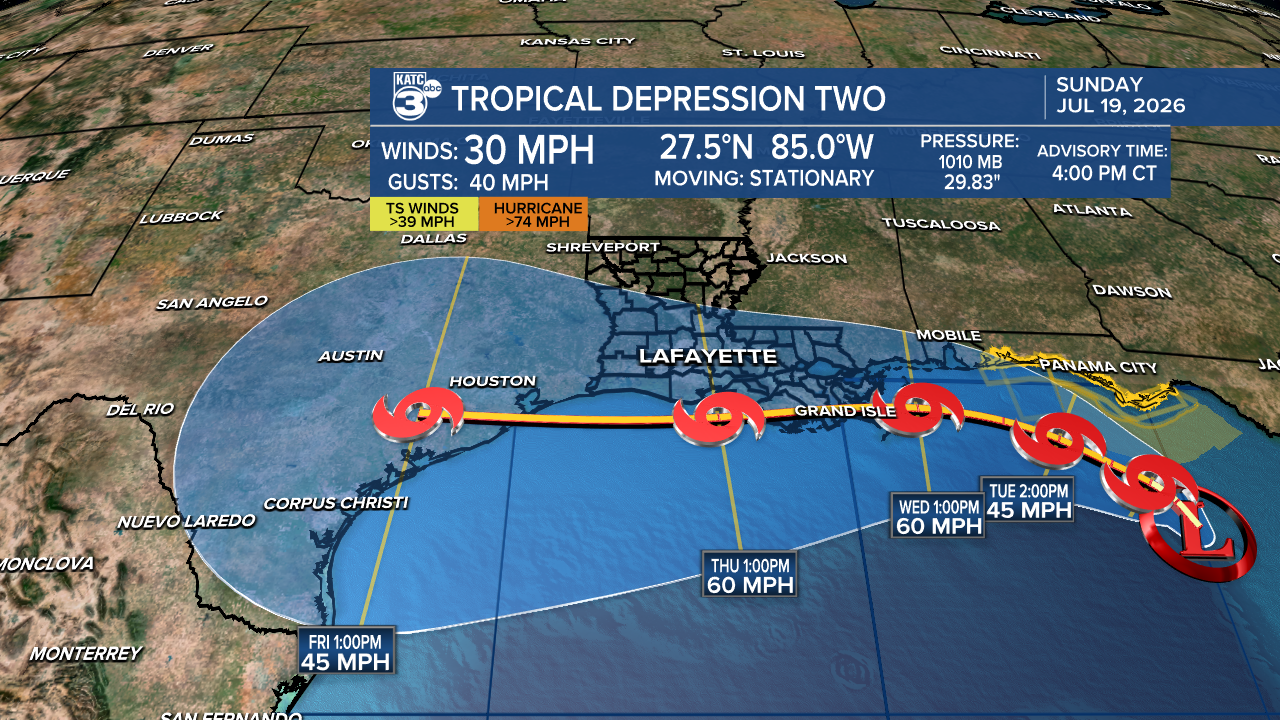
Those watches (and eventually some warnings) are expected to spread westward all the way to the Mid to Upper Texas Coast by Wednesday.
The latest National Hurricane Center forecast track as of 4pm Sunday has potential tropical storm Bertha traveling westward (and farther south than this morning's update near the Louisiana Coast primarily Wednesday through Friday, and for now, it should be a mostly wind event for Acadiana.
An upper level high pressure ridge should keep the storm traveling east to west later this week and toward the Texas Coast by Friday.
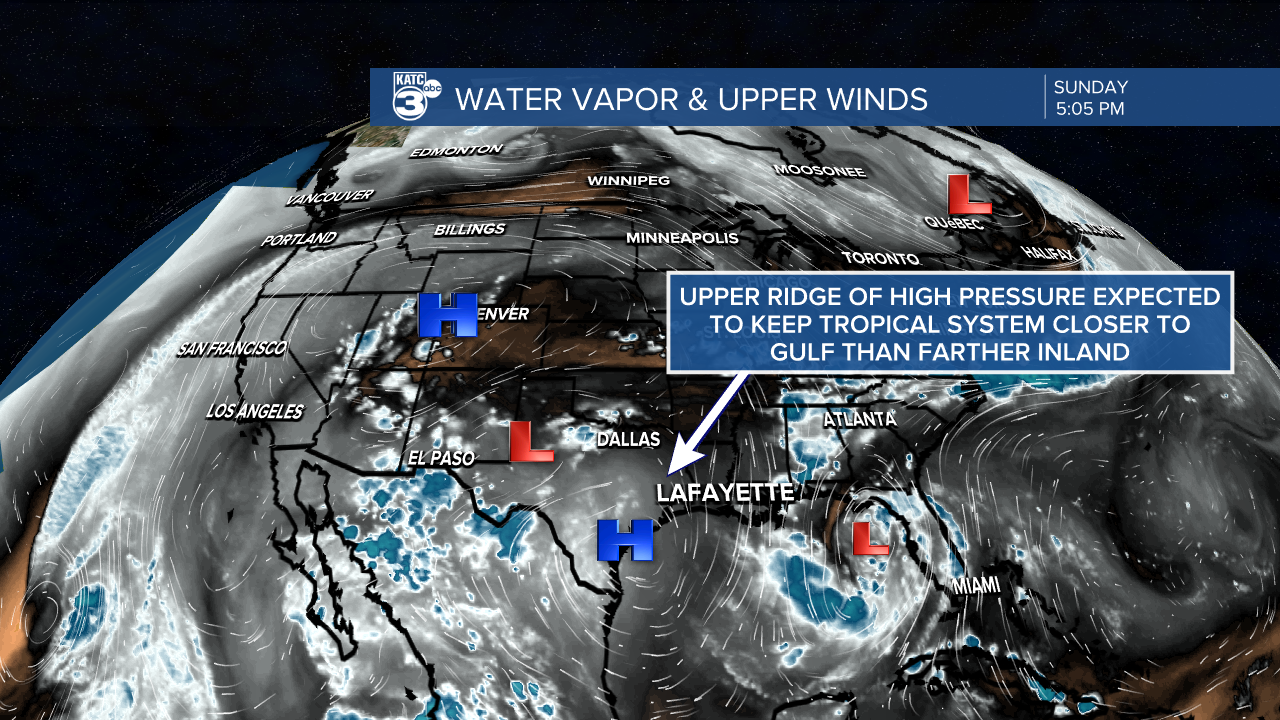
At the same time, when this system is by Acadiana, an upper level ridge is anticipated to build in from the north helping to insure the system and most of its weather stays offshore.
That upper shear is also expected to begin weakening any storm starting Wednesday and beyond...and it's not out of the realm of possibility that this system weakens even more prior to reaching the Texas Coast.
Nonetheless, Acadiana should be prepared for some breezy conditions, with the best chance of tropical storm force gusts, perhaps up to near 40-60 mph possible toward the immediate coast and all portions of the southern parishes of Louisiana this week.
For Acadiana, the inland wind threat could be minimal with just some breezy days Wednesday and Thursday...of course this will be quite subject to change in either direction in the days ahead.
It could just be a 15-25 mph with a few higher gusts event for inland Acadiana.
All offshore and marine interests should prepare for a tropical storm, and even a hurricane, with winds and seas beginning to increase in the offshore locations as early as late Tuesday, and certainly for Wednesday into Thursday.
The ridge to the north and its expected upper shear should help keep the system offshore and keep all the the more intense storms in the southern half of the tropical system and may help weaken any tropical depression, storm or even low end hurricane.
This will put most of it's heavy precipitation concentrated offshore, but with some more significant amounts toward Eastern and Southeastern Louisiana developing by mid-week.
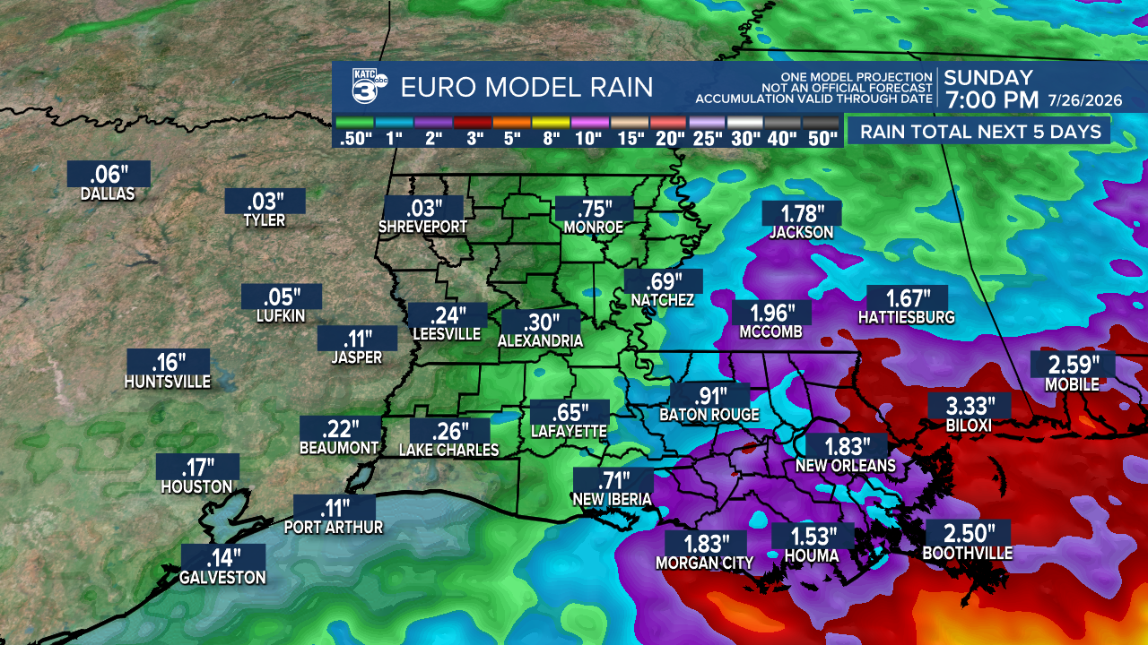
At this time minimal rain impacts are expected for the Acadiana area.
It should be noted that the latest Euro Ensemble Model spaghetti plots illustrate if potential Bertha is close to our coast or just inland across Southern Louisiana it may be near tropical storm strength or weaker...should it go farther offshore, there could be a small window for hurricane potential.
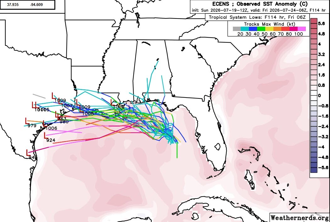
Extreme East and Southeast Louisiana could see significant tropical conditions either way by Wednesday.
For Acadiana, given the above scenario the inland wind threat could be minimal with just some breezy days Wednesday and Thursday,
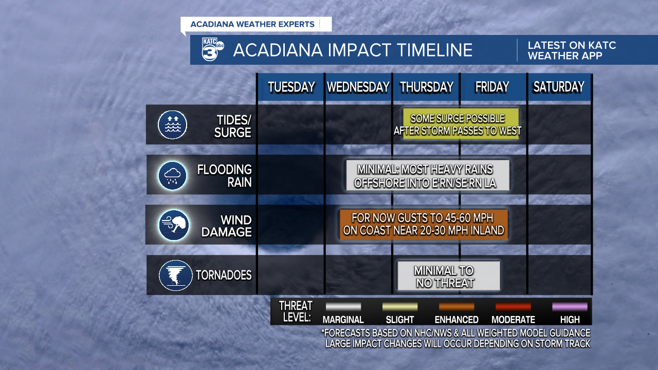
There could be a storm surge factor that may develop for our coast later Thursday into Friday after the storm passes to our west, but it's too soon, to even make a guess at this point.
And it's completely possible that this system weakens more significantly before reaching the Acadiana area, or be a stronger system if it treks farther offshore.
Whatever tropical action we see this week, we'll go back to a relatively benign forecast next weekend into the into the following week.
And in the near term, expect more high heat for Acadiana with temperatures pushing the mid-upper 90s through Wednesday while heat index values could reach 106°-114° each day.
See the KATC 10 Day Forecast for the latest.
