

After a morning start in the upper 60s to lower 70s Acadiana will see temperatures rise again to near 90° Wednesday afternoon.
Drier air continues to try to work into the region, but ahead of the drier air in the lower part of the atmosphere, there could be a few isolated showers and/or thundershowers that develop Wednesday afternoon into the early evening hours...rain chances remain on the low side however, near 20-30%.
Otherwise, it remains a mostly sunny forecast through the rest of the week with rain chances down to 2-5% at best.
Daytime highs will push a little closer to the mid 90s for Thursday and Friday.
By the latter part of the weekend another frontal trough approaches the area allowing for the possibility of a few afternoon showers/thundershowers Saturday and perhaps a better chance of thunderstorms into Sunday.
Once again a frontal boundary will be in the area into early next week keeping some rain chances in the forecast, but the fronts do not work their way far enough into the Gulf to give our area a significant cool down.
But overall, next week looks a little more like September (a few degrees cooler) than this week will...see the KATC 10 Day Forecast for the latest.
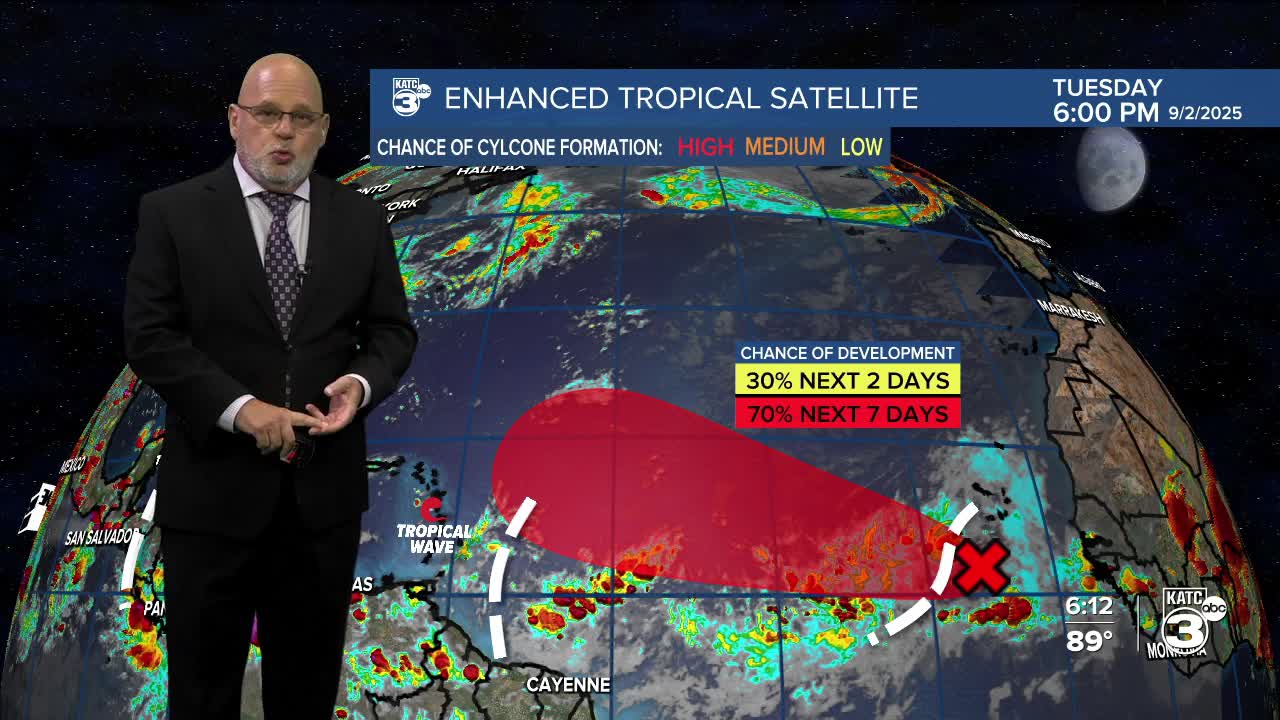
Meanwhile, the tropics are expected to remain quiet in the Gulf for at least the next week, but there could be some changes in that department later this month per the update below:
