The strong cold front that blasted through the area Sunday morning continues to head well into the Gulf of Mexico. High pressure is building in and will hold strong for the next several days.
After a chilly start to the day, sunshine will help to warm the temperatures this afternoon. Highs look to be in the upper 60s to near 70 degrees. Normal high this time of year is 72. The air mass is very dry, so even with mild temperatures today, overnight temperatures will cool into the 40s. Normal lows for mid November are in the lower 50s.
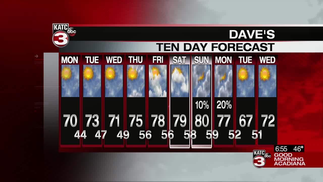
For the remainder of the week, skies will remain mostly sunny. The ridge of high pressure will edge eastward by the end of the week, allowing more of a southerly flow. Expect temperatures to climb back into the mid to upper 70s by the end of the week, with overnight lows creeping closer to 60. Another front is expected by the end of the weekend. A few showers will be possible Sunday into Monday, with another push of refreshing cool air!
Hurricane Iota is closing in on the Central American coast. This is a dangerous hurricane by any standards, but the locations Iota will affect will make it even more deadly. The system will weaken quickly by wind standards after landfall. A slower forward speed and heavy rainfall will persist over Nicaragua and Honduras for several days. This will cause widespread flooding and mudslides.
