


Scattered on and off showers and thunderstorms are in the forecast for Acadiana from early Thursday into Friday, and ending sometime Saturday.
It's mesoscale convective complex (MCC) season for Louisiana...which means a more unpredictable pattern and fitting with the weather (and forecasts) we've see locally over the last couple of weeks.

An upper level trough across the Western & Central U.S. will continue to eject upper level disturbances across the region allowing for showers and clusters of strong thunderstorms to develop primarily north of the Acadiana, with some activity slipping into our area starting late tonight and then again on Friday and Saturday.
The risk of showers and storms will be possible at any time, day or night.
In this is the type of pattern, a forecaster can go with a 20%-40% chance, or up to a 70% chance, and be right, as once storm complexes develop, they tend to have a mind of their own.
Latest HRRR model trending on taking the complex in Northeast Texas and sliding it southeastward through Louisiana tonight and reaching Acadiana during the Thursday morning hours.

Models suggest "weakening" dynamics as showers and storms enter Acadiana during the predawn hours...but we know how well (or not) the models have been performing of late...

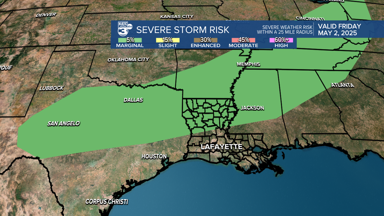
Per the Storm Prediction Center (SPC), the primary risk of severe storms should stay to Acadiana's northwest tonight, but edge into the "marginal" category tomorrow for the I-10 parishes on northward, with a "slight" risk into CenLA northward.

Strong, gusty potentially damaging winds will be the primary threat along with the possibility of hail.
And earlier this afternoon the SPS upgraded portions of Louisiana for a marginal risk of severe storms Friday, favoring closer to the northern parishes of Acadiana.
Severe or not, it looks like we'll have to monitor radar "trends" and perhaps at times, ignore the model data.
Scattered showers and storms may linger well into Saturday, but may end as early as Saturday morning...but that's not a done deal.
Sunday should be drier, and with a weak front pushing through Saturday look for more pleasant late night/early morning lows Sunday into early next week.
You can see the latest KATC 10 Day Forecast and Power Doppler 3 here.
