


After a weekend of tropical showers and thunderstorms, this weather pattern will continue through the week. An upper level low made its way across the Gulf of Mexico and is now moving over Texas. The persistent southerly flow will keep the moisture in place for the early part of the week. Expect partly sunny skies with occasional rain and thunderstorms each day. Some rains will be heavy, but brief. So some isolated street flooding is possible. Expect highs in the upper 80s with heat index values in the upper 90s. Expect the same forecast for Tuesday. Stay ahead of the rains by downloading the KATC Weather App or by heading the the Live Radar Page.
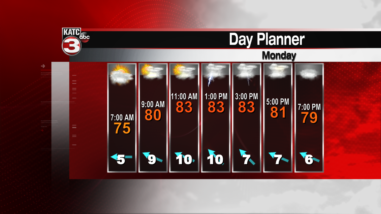
A bit of a ridge will build over the area for the mid week. Although we can't completely drop the chances for rain, those rains may be more confined to the afternoon hours. Moisture values will still be quite high, so some rains may be heavy at times. Highs Wednesday and Thursday will be near 90 with heat index values near 100.

Toward the end of the week, the persistent southerly flow returns, and rain chances are back up in the 50-60% range. Expect coastal showers and storms during the overnight/early morning period. I-10 corridor and inland areas can expect scattered showers mainly after noon. Highs will hold in the upper 80s to near 90.
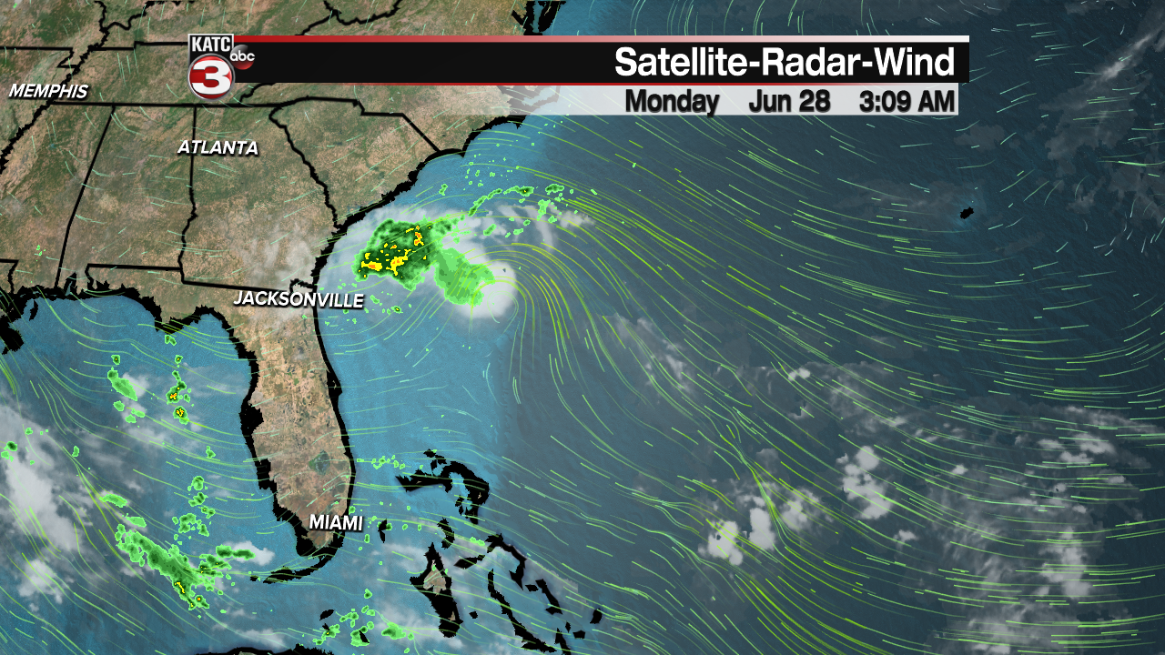
Tropical weather is quiet for our local area as the Gulf of Mexico should remain quiet. A disturbance off the east coast has a chance for development ahead of moving onshore near Georgia and the Carolinas. The National Hurricane Center thinks there's a 70% chance for development. It'll need to work fast because it'll be over land within the next day or so.
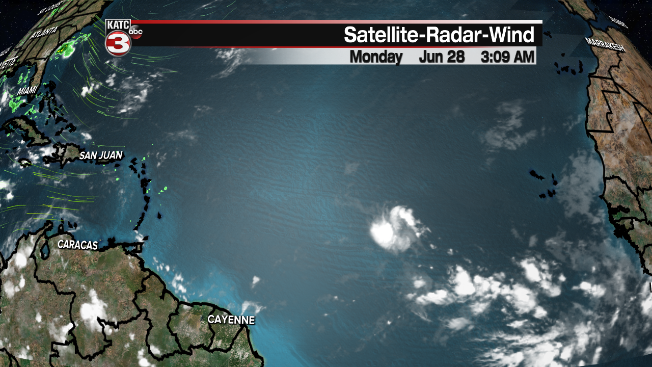
Another wave over the central Atlantic has a slight chance for development over the next week or so. This is expected to drag westward toward the northern Caribbean and eventually toward the southeastern coast of the U.S. The chances of development is around 40% for the next five days.
