

We're expecting a fine weekend here in Acadiana when it comes to the weather. A ridge of high pressure aloft should keep the chances for rain down today and tomorrow, but the ridge will start to weaken toward the end of the weekend and into early next week.
At this time, there are no areas of concern over the tropical areas, and the National Hurricane Center doesn't expect any tropical development over the next two days. But over five days, the NHC is putting a 20% chance for some development over the Bay of Campeche or the southwestern Gulf of Mexico.

First, to clear up any rumors. As of Friday morning, there is NO tropical weather happening in the Atlantic basin. We barely have a broad trough of low pressure that covers areas from the Yucatan to the western Caribbean. Some showers are over Belize and Guatemala.
Considering tropical weather "development" is more likely to happen in this region during the month of June, people get nervous this time of year, and so do the models. Computer solutions often spin up tropical systems from really nothing at all. Remember, this is in the "model world", not the "real world". If you saw all of the models, like we do in the Weather Lab, you'd think we were having hundreds of hurricanes each year.
Just in the past couple of days, both the EURO and the GFS have tried to get something going over the western Gulf for late next week. But each model has completely different solutions, and the same models have widely different outlooks from run to run. Meteorologists look for consistency from run to run as well as agreement between different models. So far we've seen none of this.


The overnight GFS model had a significant tropical storm moving onto the Texas coast, and when it ran again this morning, the low was considerably weaker moving onshore east of New Orleans. There is the problem. A huge difference in intensity, and a track that is over 500 miles different. That's not the consistency meteorologists look for and generally throw out the forecast.
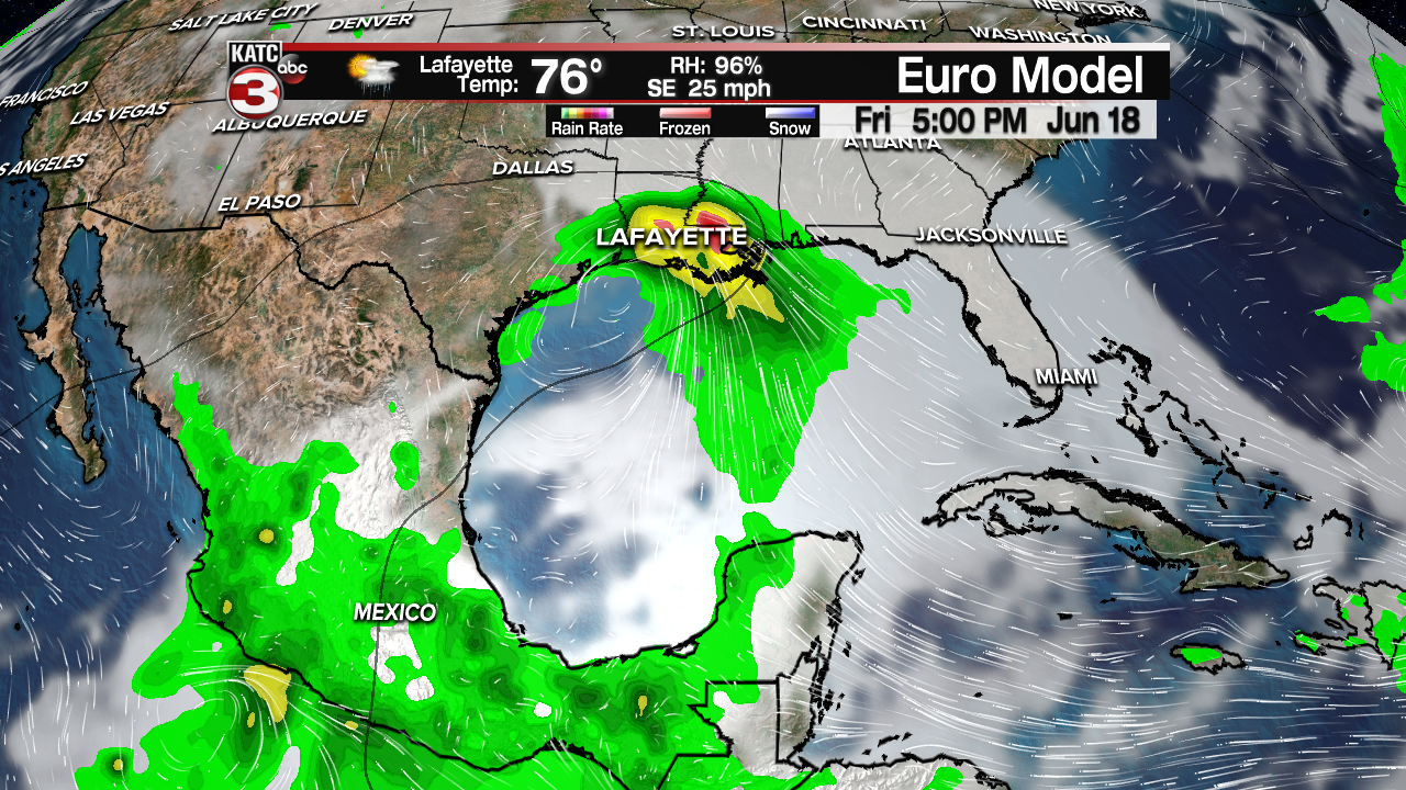
The EURO won't update again until later today, but the morning run showed a very weak low over the middle Gulf, lifting toward the upper Texas coast bringing just elevated rain chances for late next week.
So, as you can see, models from run to run don't agree, and model against model is also in disagreement. Therefore, as a meteorologist, I'll tell you to enjoy your weekend. Make sure you have hurricane plans in place because it is hurricane season after all. And check in with KATC over the weekend and especially early next week. Also, I would generally expect rain chances to increase late next week.
