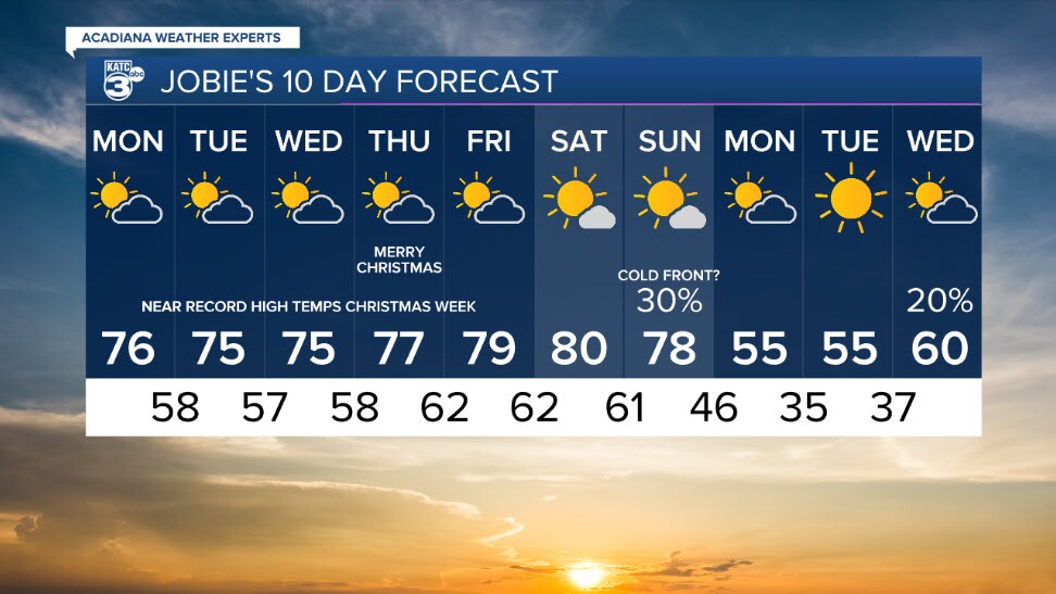
Today will be much like yesterday, and tomorrow, will be nearly like today, minus the rain chances, so let's talk about it.
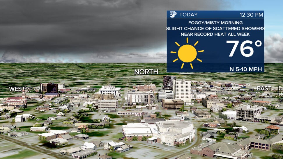
This Monday morning we have areas of Dense Fog with a Dense Fog Advisory issued through mid-morning. This fog is particularly impacting coastal parishes where visibility is incredibly low. So leave extra time for your travel, and go ahead and grab your umbrella. Most of you won't need it, but some of us will. There is a roughly 20% chance of rain today, with the potential for some pop up thunderstorms due to the high temperatures and moisture in the air.
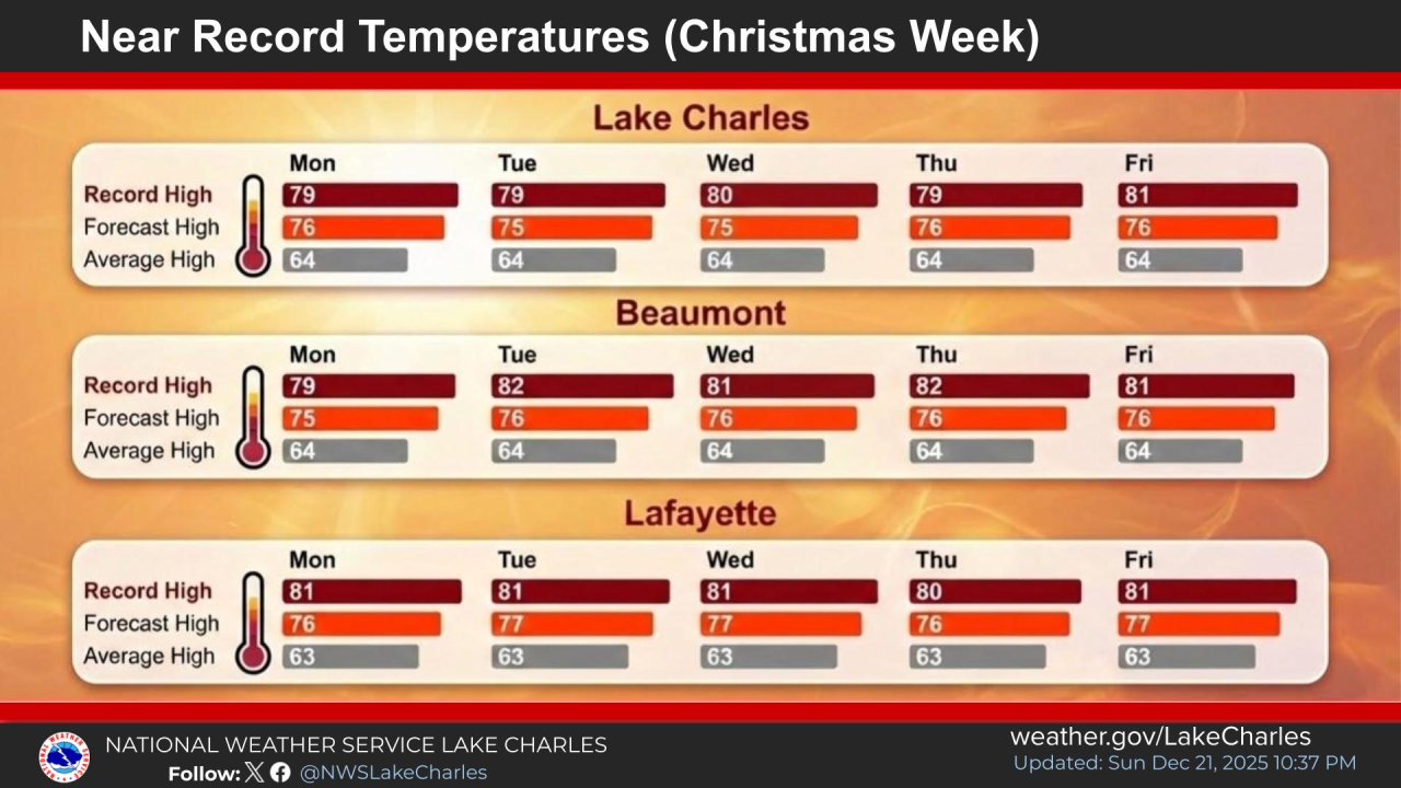
Speaking of high temperatures, for the remainder of our Christmas week, Santa wants to send us records instead of presents. There are daily chances that we beat record temperatures throughout the week leading into Christmas. Really the only change is that rain chances decrease to near 0% on Tuesday. Nightly fog will likely develop near the coast again, so repeat dense fog advisories are likely. We won't get coal, but we will surely get the heat.

The National Weather Service in Lake Charles did a great breakdown on Christmas week climatology, where you can see this week's record temperatures, along with projected highs for the corresponding day.

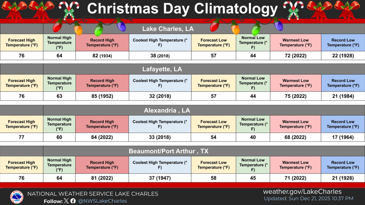
For Christmas Day itself, the record will be hard to beat, but it won't be far behind.
The next cold front still needs to have the timing more worked out, but it looks to arrive this weekend, bringing a return to the rain chances, and cooler temperatures.